
[Map showing the Brooklyn Heights Reformed Church]: surveyed by Ludlam & Stuchfield, city surveyors June 30, 1890
Map No. B A-1890a.Fl
Cadastral map showing Monroe Place and Pierrepont St. (modern-day Brooklyn Heights). Shows property (including dimensions). Title devised by cataloger. Oriented with north to the upper left. Watermarked.
Map area shown
Relation
Full catalog recordSize
32 × 20 cmDownload
Low Resolution Image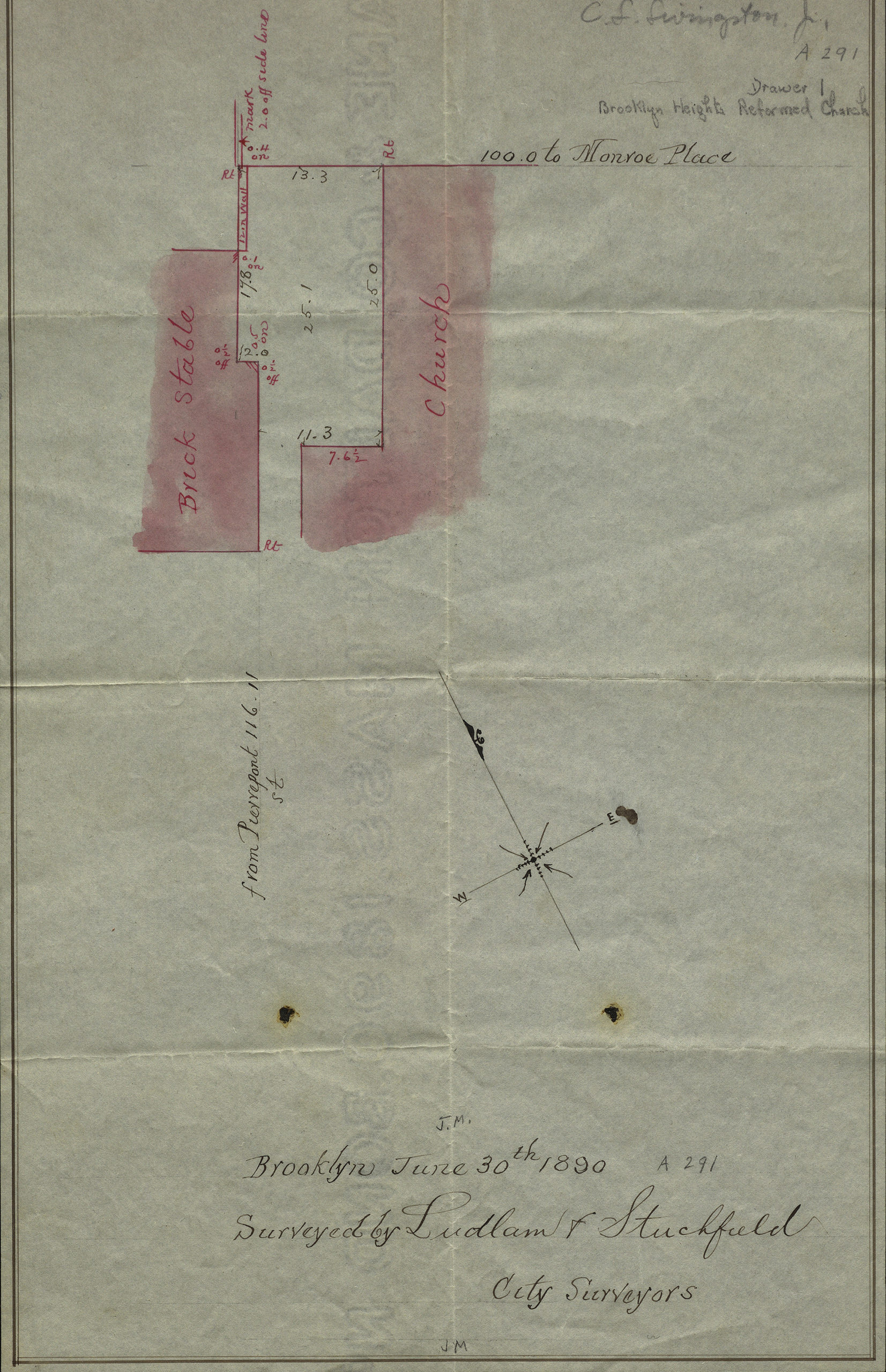
Creator
Ludlam, Silas,Publisher
Brooklyn Historical SocietyCitation
[Map showing the Brooklyn Heights Reformed Church]: surveyed by Ludlam & Stuchfield, city surveyors; June 30, 1890, Map Collection, B A-1890a.Fl; Brooklyn Historical Society.Scale
Scale not givenLoading zoom image... 