Map showing the Brooklyn Rapid Transit system [1917]
Map No. NYC-[1917?].Fl
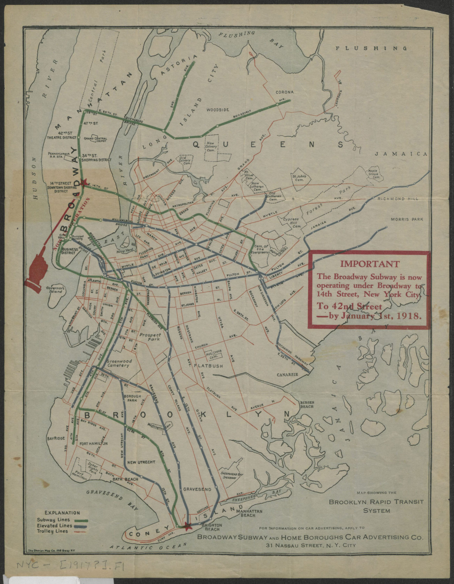
Shows planned subway line, elevated and trolley lines for Brooklyn Rapid Transit system in Brooklyn, Manhattan, and Queens. “The Broadway Subway is now operating under Broadway to 14th Street, New York City. To 42nd Street–by January 1st, 1918.”
Map area shown
Genre
Transportation mapsRelation
Full catalog recordSize
26 × 20 cmDownload
Low Resolution Image
Creator
Ohman Map Co.,Publisher
Brooklyn Historical SocietyCitation
Map showing the Brooklyn Rapid Transit system; [1917], Map Collection, NYC-[1917?].Fl; Brooklyn Historical Society.Scale
Scale not givenLoading zoom image... 