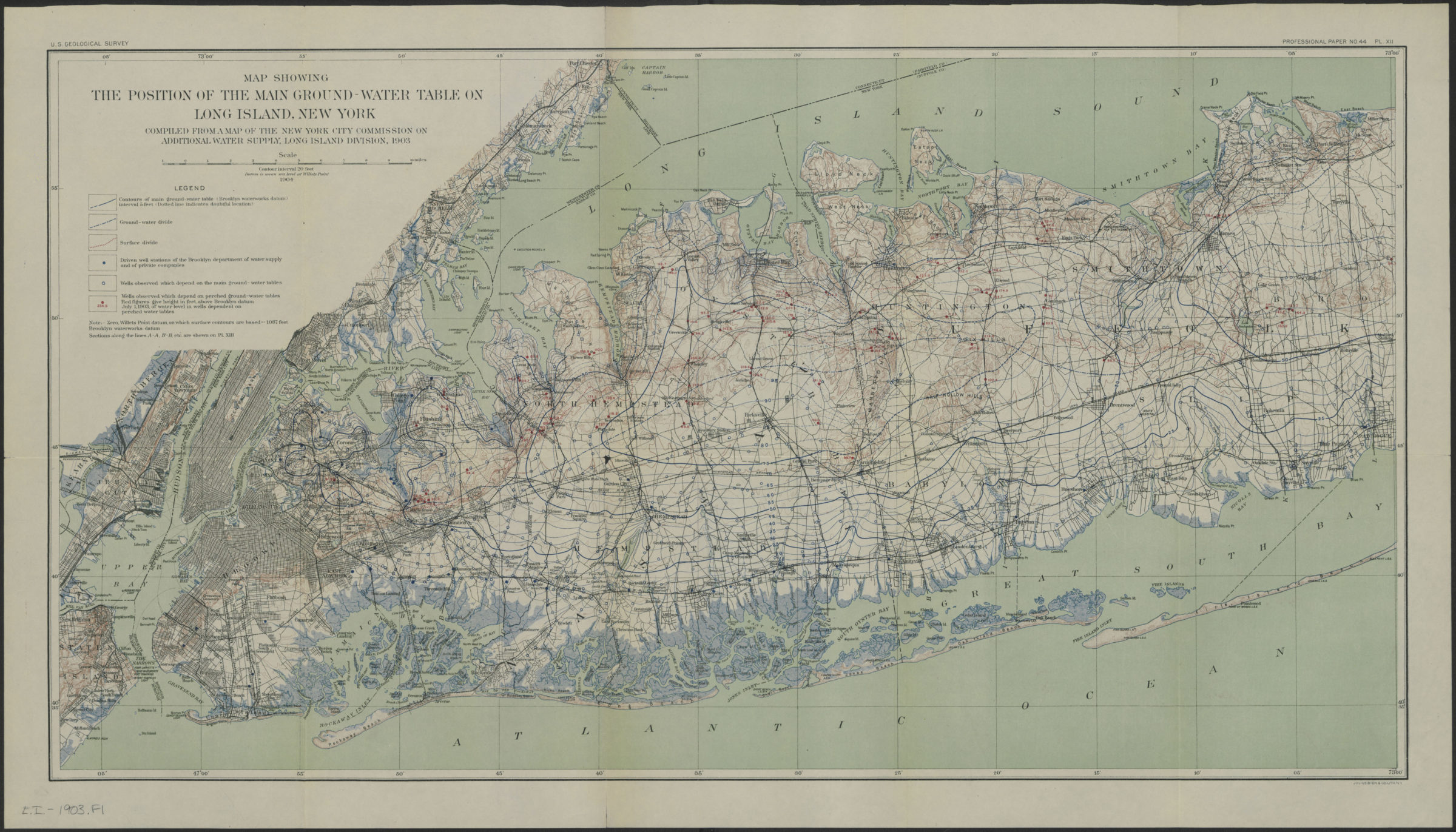
Map showing the position of the main ground-water table on Long Island, New York: compiled from a map of the New York City Commission on Additional Water Supply, Long Island Division, 1903 1904
Map No. L.I.-1903.Fl
Relief shown by contours and spot heights. “Pl. XII.” Also shows locations of wells.
Subjects
Map area shown
Genre
Public utility mapsRelation
Full catalog recordSize
42 × 78 cmDownload
Low Resolution Image
Creator
Geological Survey (U.S.),Publisher
Brooklyn Historical SocietyCitation
Map showing the position of the main ground-water table on Long Island, New York: compiled from a map of the New York City Commission on Additional Water Supply, Long Island Division, 1903; 1904, Map Collection, L.I.-1903.Fl; Brooklyn Historical Society.Scale
Scale [ca. 1:130,000]Loading zoom image... 