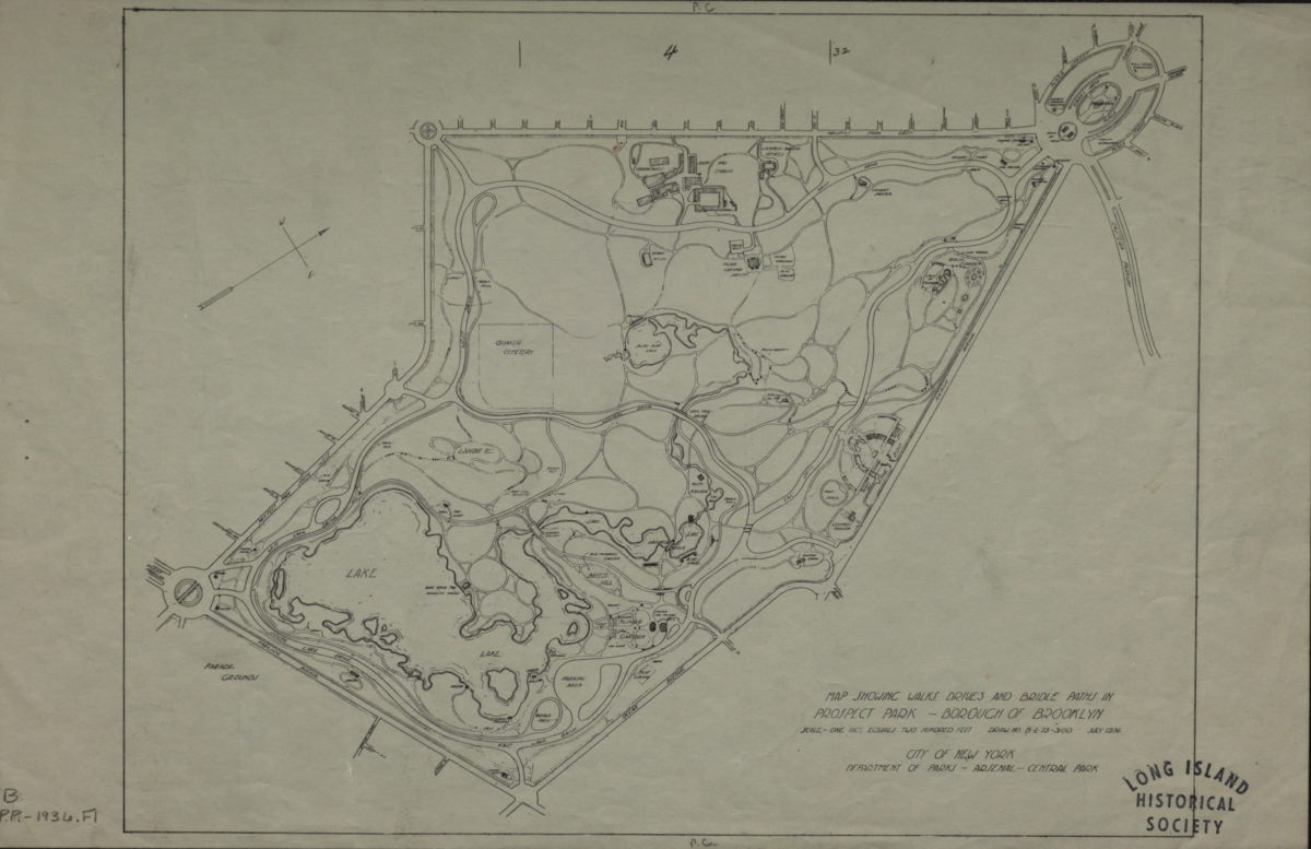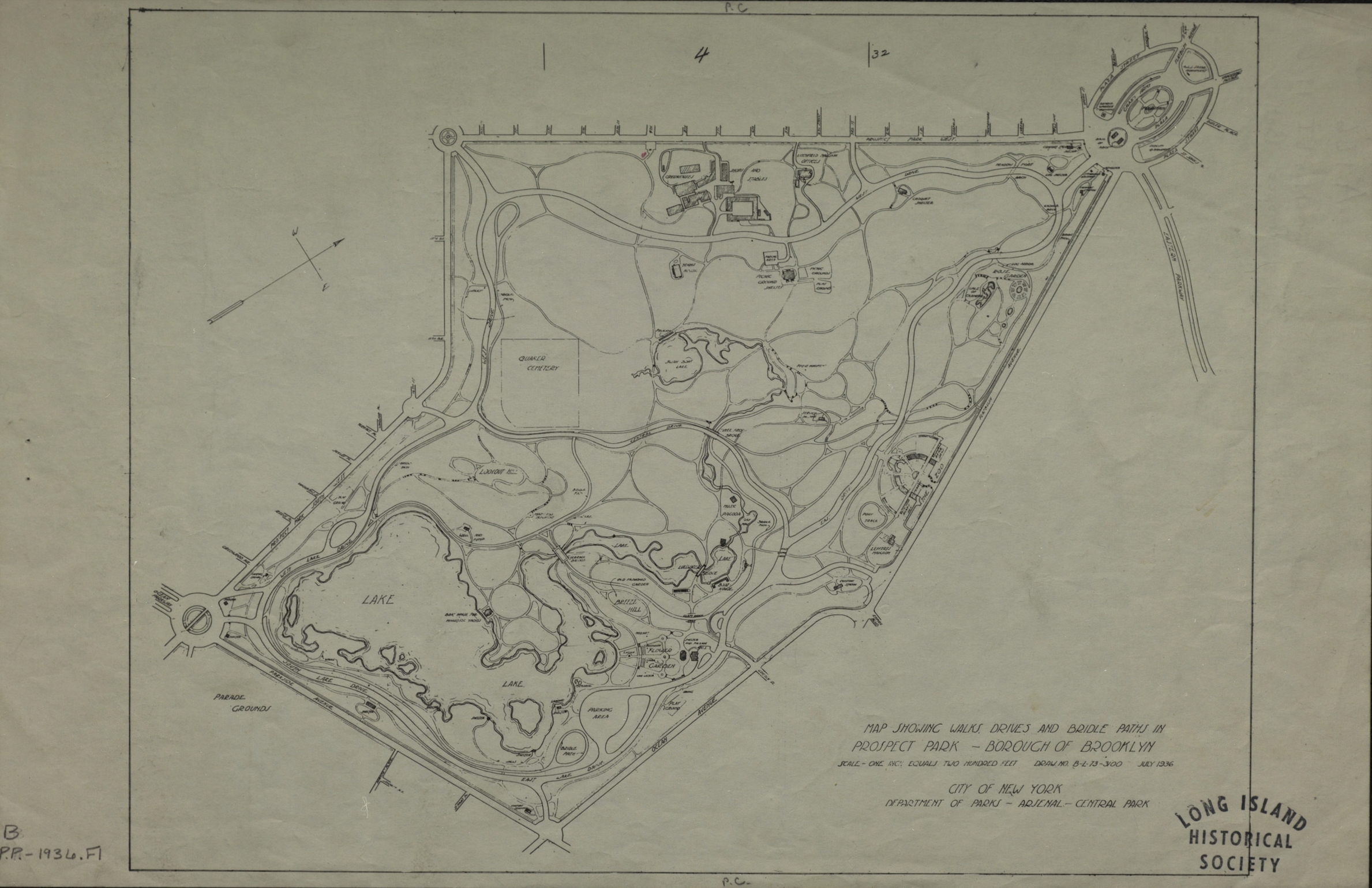
Map showing walks, drives and bridle paths in Prospect Park, Borough of Brooklyn 1936
Map No. B PP-1936.Fl
Shows roads and paths, public buildings, landscape features including hills, lakes, and the Quaker cemetery (Friend’s Cemetery) in Prospect Park. Oriented with north to the upper right.
Map area shown
Genre
MapRelation
Full catalog recordSize
28 × 44 cmDownload
Low Resolution ImageCreator
New York (N.Y.).; Department of Parks,Publisher
Brooklyn Historical SocietyCitation
Map showing walks, drives and bridle paths in Prospect Park, Borough of Brooklyn; 1936, Map Collection, B PP-1936.Fl; Brooklyn Historical Society.Scale
Scale 1:2400. 1 in to 200Loading zoom image...