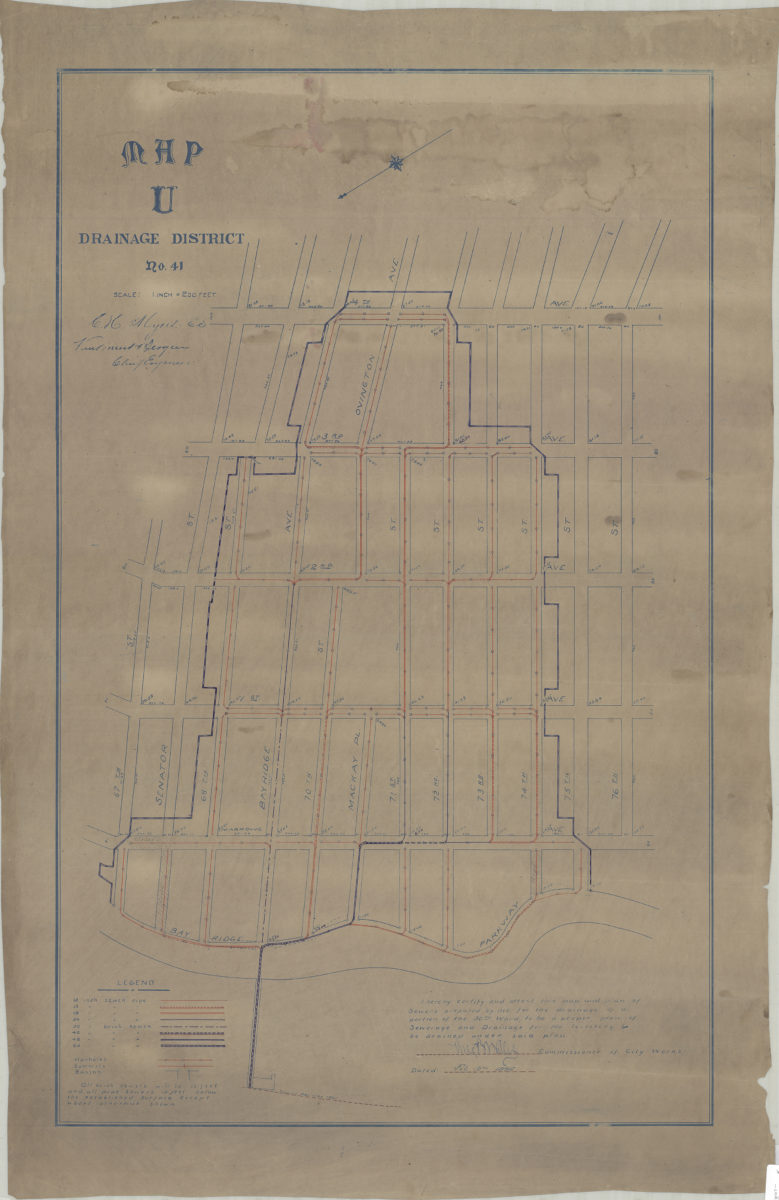
Map U, Drainage District No. 41: [by] C.H. Myers, E.S. [and] Van Brunt Bergen, chief engineer [1896]
Map No. Bergen-[1896].Fl
Covers area bounded by Bay Ridge Pkwy, 76th St., 4th Ave., and 67th St. (modern-day Bay Ridge). Shows sewers by pipe material and size, manholes, summits, and basins. Oriented with north to the lower left. Certified, signed, and dated by the Comissioner of City Works, Feb. 12, 1896. Includes key. BHS copy stamped: Emil Coester, Solar Printing, 320 Hancock St., Brooklyn, N.Y.
Map area shown
Genre
Public utility mapsRelation
Full catalog recordSize
79 × 49 cmDownload
Low Resolution Image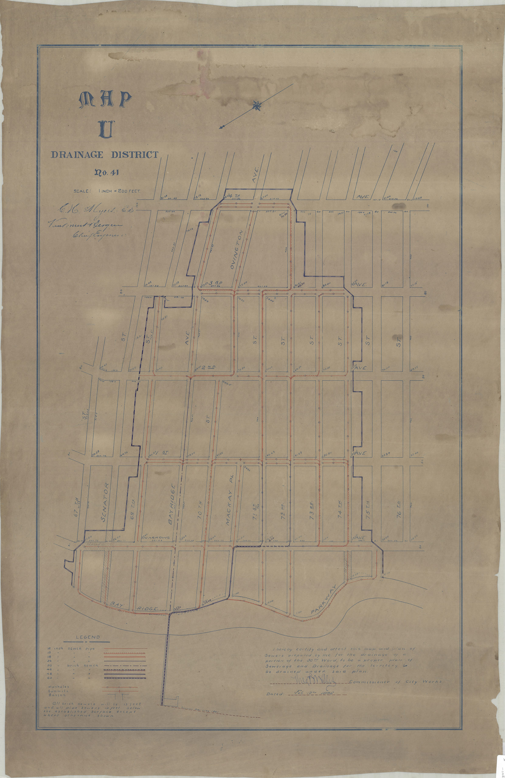
Creator
Myers, Chas. H.,Publisher
Brooklyn Historical SocietyCitation
Map U, Drainage District No. 41: [by] C.H. Myers, E.S. [and] Van Brunt Bergen, chief engineer; [1896], Map Collection, Bergen-[1896].Fl; Brooklyn Historical Society.Scale
Scale [1:2,400] 1 in to 2Loading zoom image...