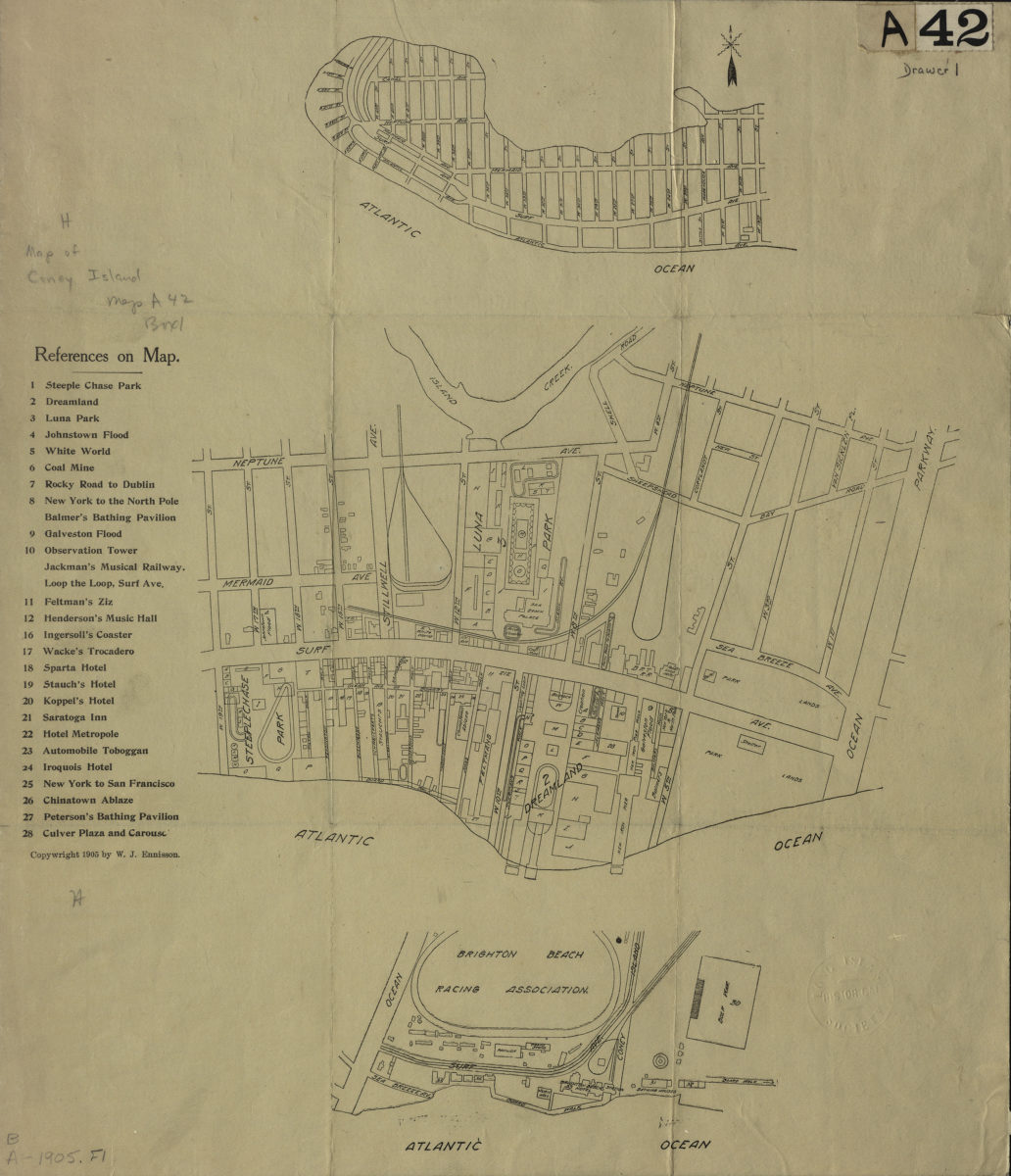
[Maps of Coney Island, 1905] [1905; 1905]
Map No. B A-1905.Fl
Maps cover area from the western tip of Coney Island to 19th Street, from 19th Street to Ocean Parkway, and from Ocean Parkway past Coney Island Avenue. Maps show streets, amusement parks, and the Brighton Beach Racing Association racetrack. Title devised by cataloger. Includes index to hotels, amusement parks, bathing pavilions, music halls, and other tourist attractions.
Subjects
Places
Map area shown
Genre
Tourist mapsRelation
Full catalog recordSize
41 × 36 cmDownload
Low Resolution Image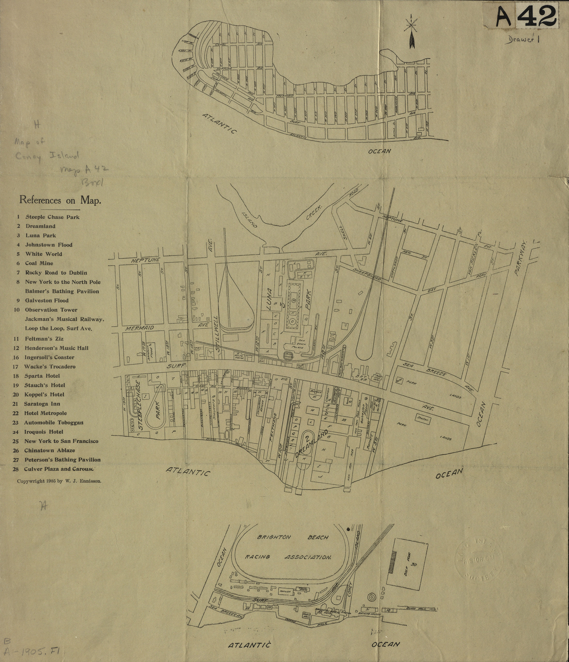
Creator
Ennisson, W.J,Publisher
Brooklyn Historical SocietyCitation
[Maps of Coney Island, 1905]; [1905; 1905], Map Collection, B A-1905.Fl; Brooklyn Historical Society.Scale
Scales differLoading zoom image...