[Maps of Cowenhoven Lane and profile map of the grade of 2nd Avenue] [ca. 1903]
Map No. Bergen-1903.Fl
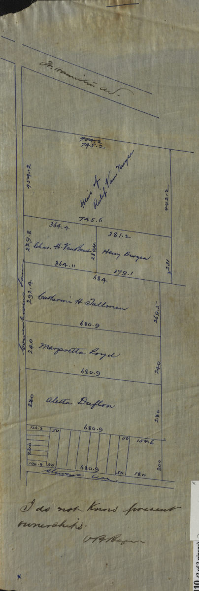
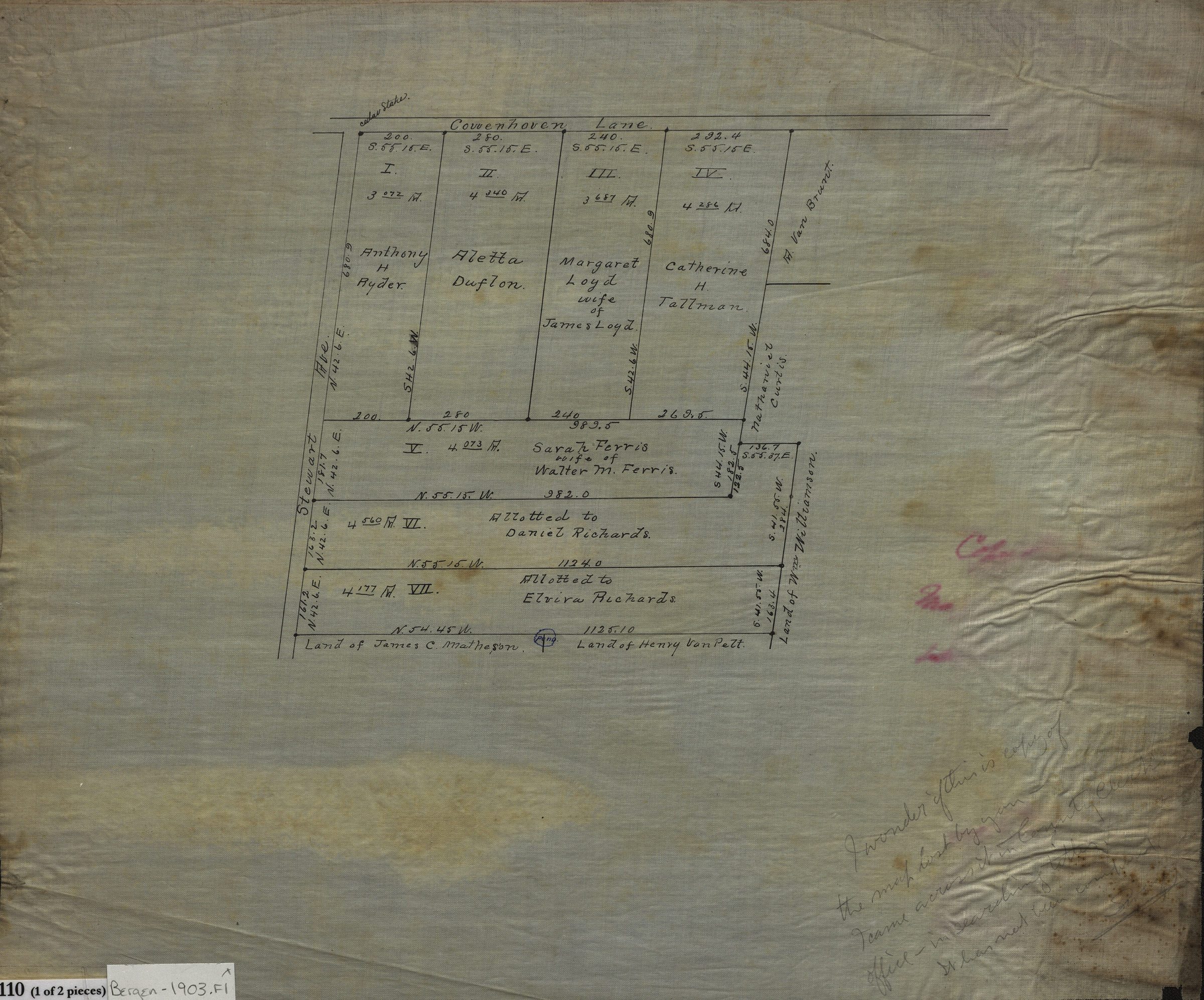
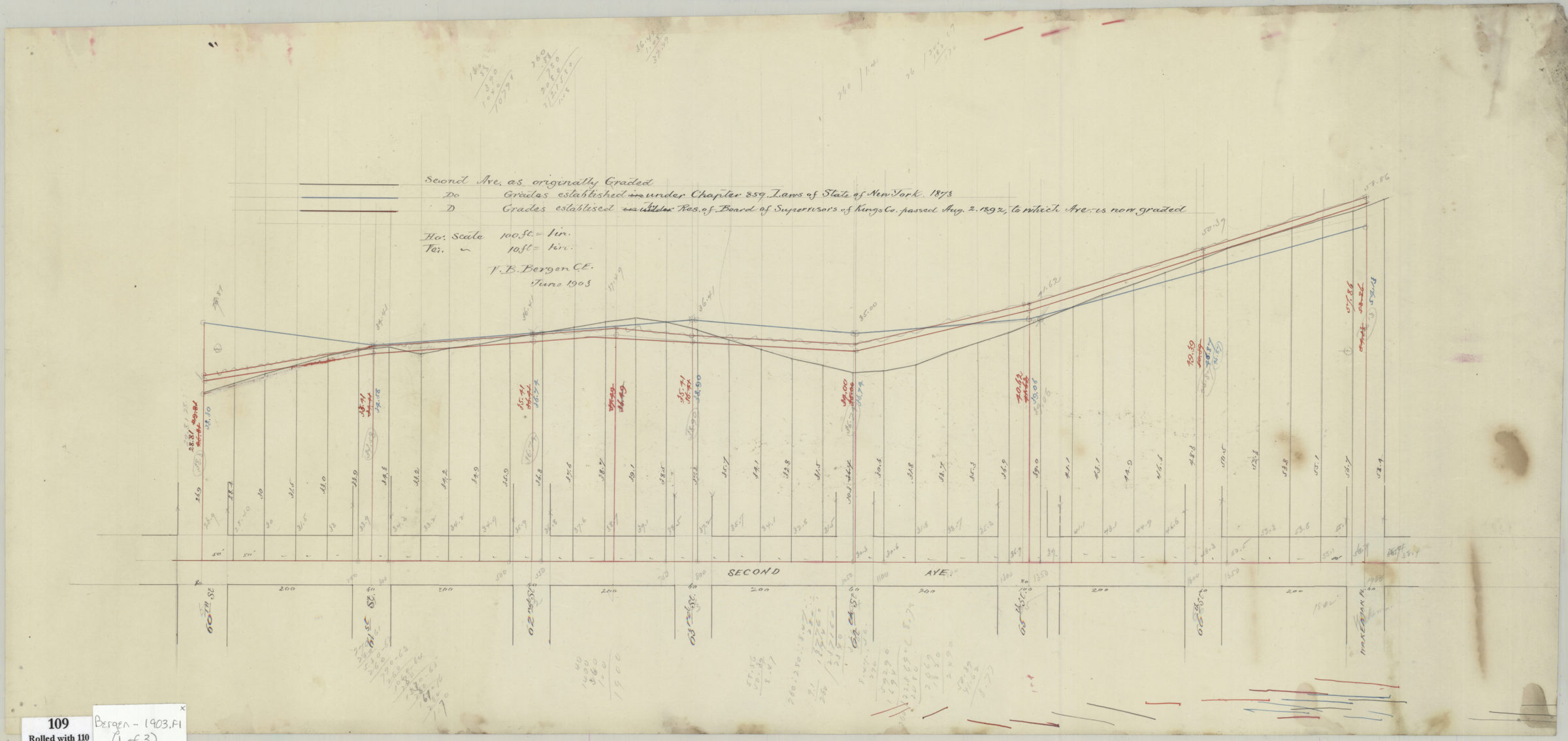
Cadastral maps covering area near the intersection of Cowenhoven Lane and Stewart Avenue in modern-day Bay Ridge. Show property (including dimensions), lots, and names of landowners. Grade profile of 2nd Avenue from 60th Street to Wakeman Place. Shows original and proposed grades. Title devised by cataloger. Map 2 attributed to Van Brunt Bergen, based on handwriting on piece. Maps 1 and 2 on linen. Maps found rolled together in BHS archives and cataloged as a unit to preserve context. [Cadastral map of Cowenhoven Lane between Stewart Avenue and Fort Hamilton Avenue]. [Cadastral map of Cowenhoven Lane east of Stewart Avenue]. [Profile map of the grade of 2nd Avenue from 60th Street to Wakeman Place] / V. B. Bergen, June 1903.
Subjects
Places
Map area shown
Relation
Full catalog recordSize
29 × 63 cmDownload
Low Resolution Image
Creator
Bergen, Van Brunt,Publisher
Brooklyn Historical SocietyCitation
[Maps of Cowenhoven Lane and profile map of the grade of 2nd Avenue]; [ca. 1903], Map Collection, Bergen-1903.Fl; Brooklyn Historical Society.Scale
Scales differLoading zoom image...