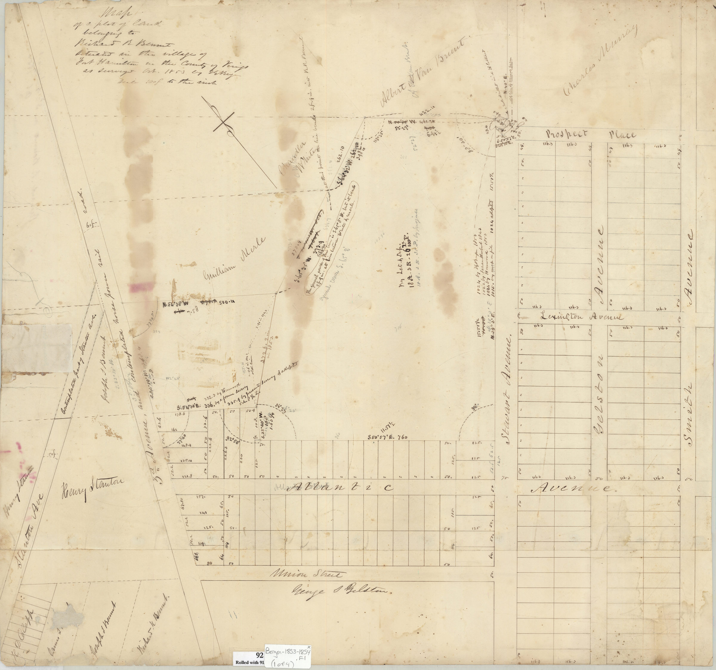
[Maps of land in Fort Hamilton bought and sold by Richard R. Bennet] 1853-1854
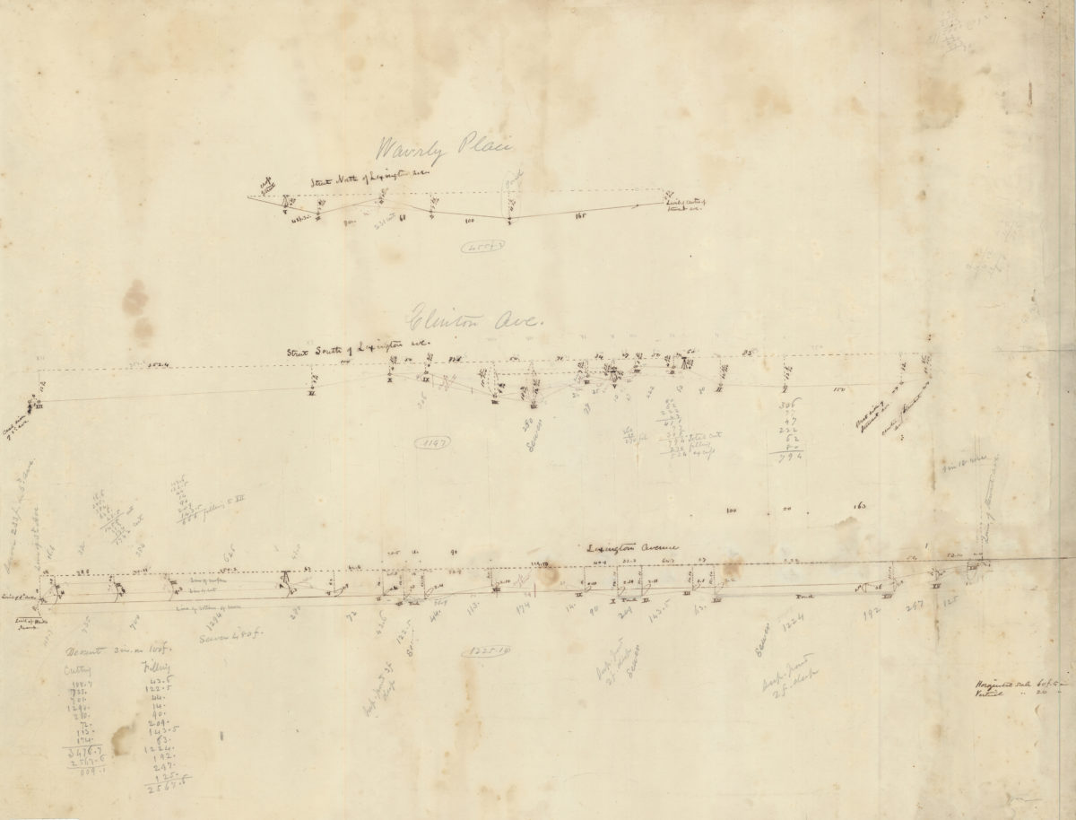
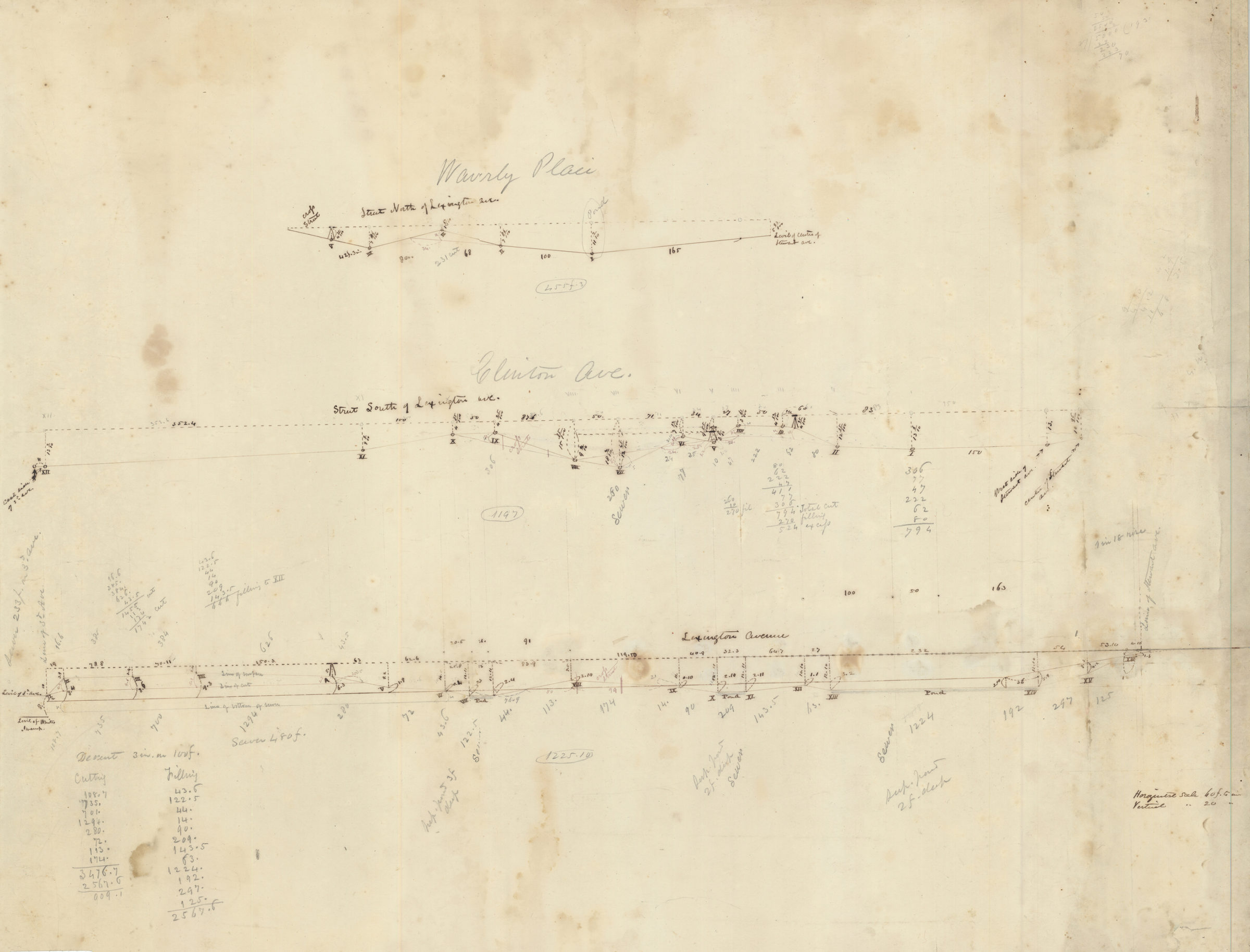
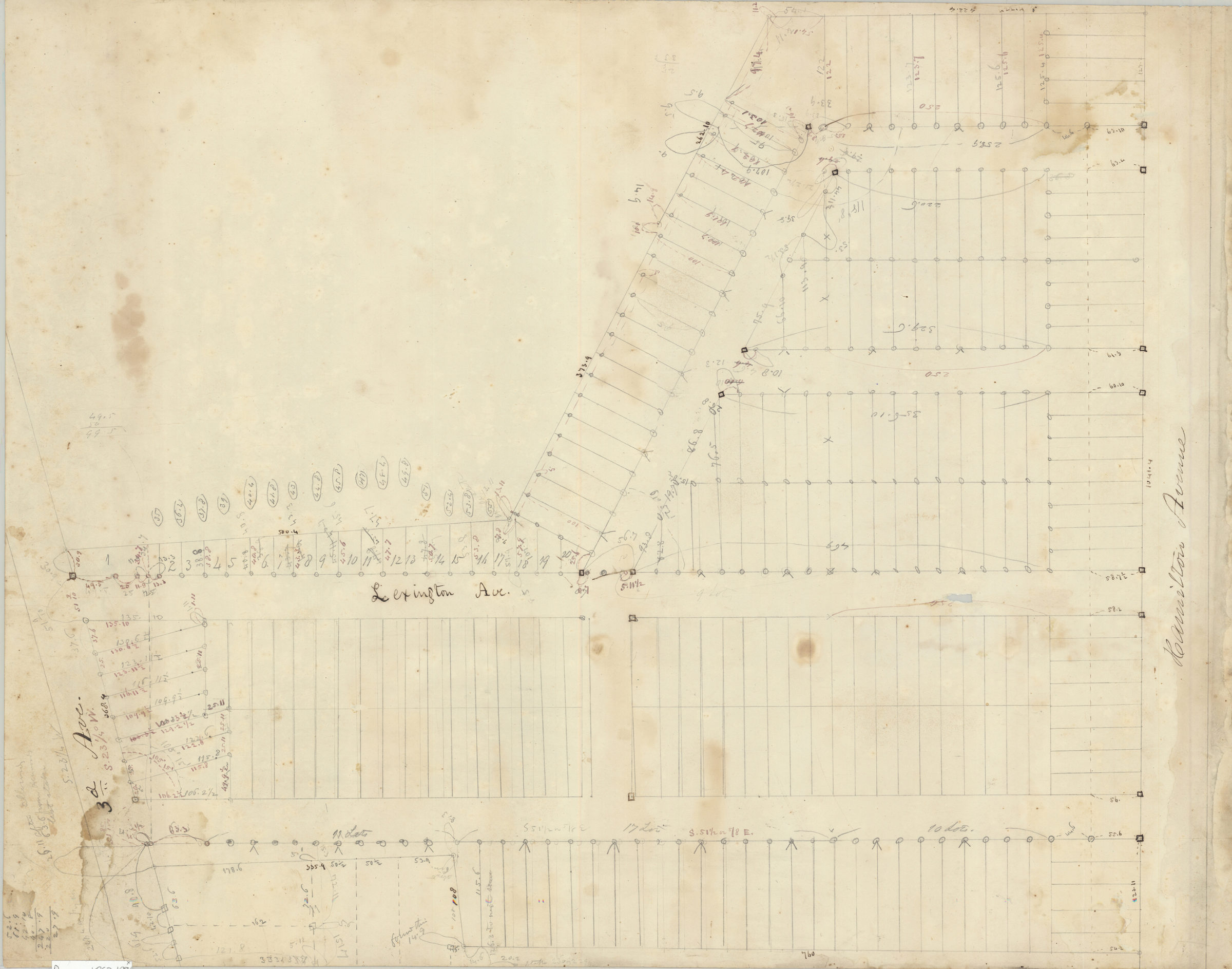
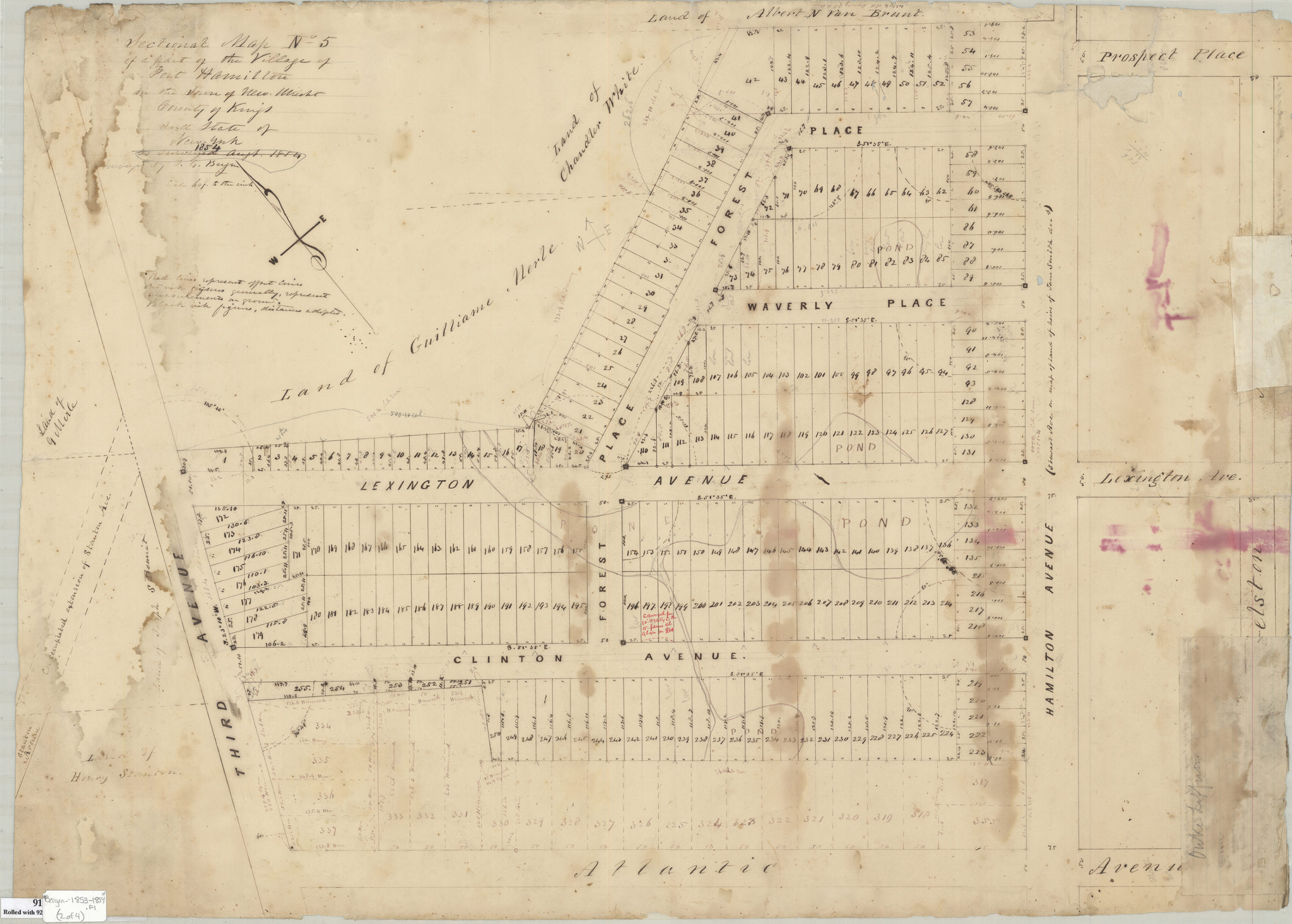
Cadastral map of area bounded by Park Place, Smith Avenue, Union Street and 3rd Avenue in modern-day Fort Hamilton section of Bay Ridge. Shows property, lots, and names of landowners. 2 cadastral maps of area between Hamilton Avenue and 3rd Avenue from Atlantic Avenue to Prospect Place in modern-day Fort Hamilton section of Bay Ridge. Shows property divided into lots and outline of a pond. 1 sheet showing grade profiles of sections of Lexington Avenue, Clinton Avenue, and Waverly Place. Title devised by cataloger. Attributed to Teunis G. Bergen, based on handwriting. Maps found rolled together in BHS archives and cataloged as a unit to preserve context. Map of a plot of land belonging to Richard R. Bennet situated in the village of Fort Hamilton in the County of Kings / as surveyed Oct. 1853 by T.G. Bergen. Sectional map no. 5 of a part of the village of Fort Hamilton in the town of New Utrecht, County of Kings, and State of New York, 1854 / surveyed by T.G. Bergen. [Survey drawing covering area identical to Sectional map no. 5 of a part of the village of Fort Hamilton in the town of New Utrecht, County of Kings, and State of New York, 1854]. Grades of land bought by banker of R. R. Bennet.
Subjects
Places
Map area shown
Relation
Full catalog recordSize
54 × 77 cmDownload
Low Resolution Image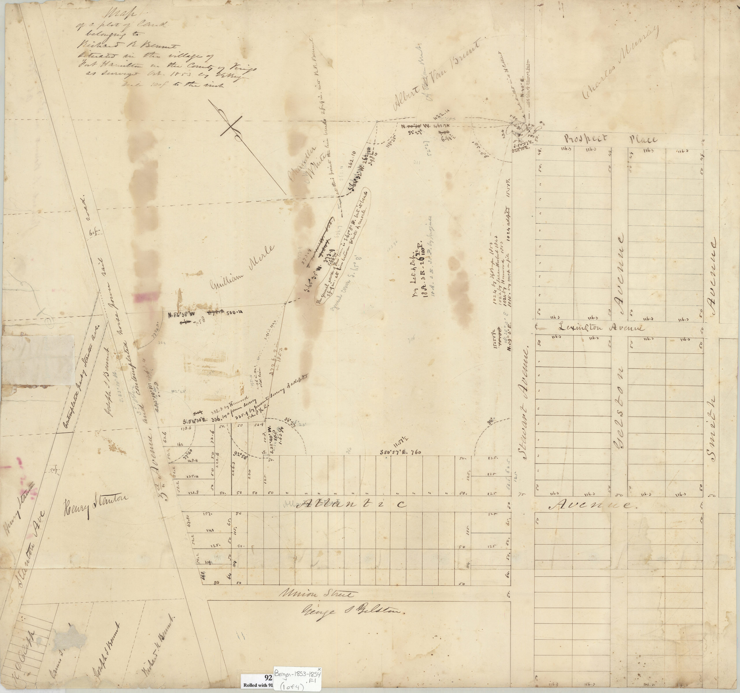
Creator
Bergen, Teunis G.,Publisher
Brooklyn Historical SocietyCitation
[Maps of land in Fort Hamilton bought and sold by Richard R. Bennet]; 1853-1854, Map Collection, Bergen-1853-1854.Fl; Brooklyn Historical Society.Scale
Scales differ