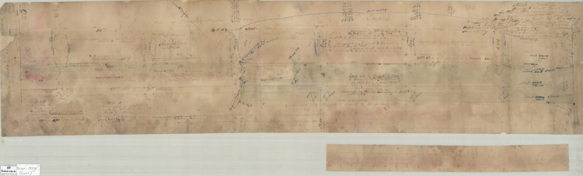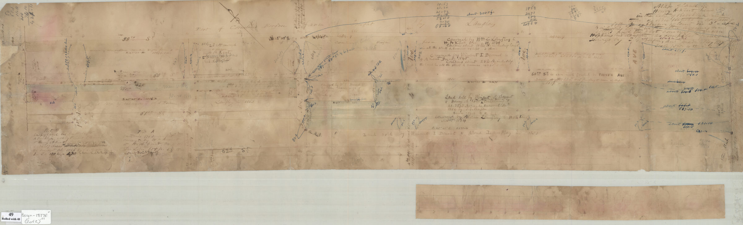

[Maps of land of Henry A. Kent, situated in the city of Brooklyn & town of New Utrecht, containing 61 4/10 acres exclusive of land in 3rd Avenue and including land in the other avenues & streets, and the plot conveyed to Susan Hopkins May 1877
Map No. Bergen-1877f.Fl
Cadastral maps covering area bounded by New York Bay, 59th Street, Seventh Avenue, and 62nd Street. Shows property (including dimensions), and names of landowners in modern-day Sunset Park. Title taken from finished version of the map, with modifications by cataloger. Oriented with north to the upper left. Includes notes on conveyances. Maps found rolled together in BHS archives and cataloged as a unit to preserve context. Map of land of Henry A. Kent, situated in the city of Brooklyn & town of New Utrecht. Land of H [text illegible] Brooklyn & New Utrecht, made May 1877.
Map area shown
Relation
Full catalog recordSize
28 × 106 cmDownload
Low Resolution Image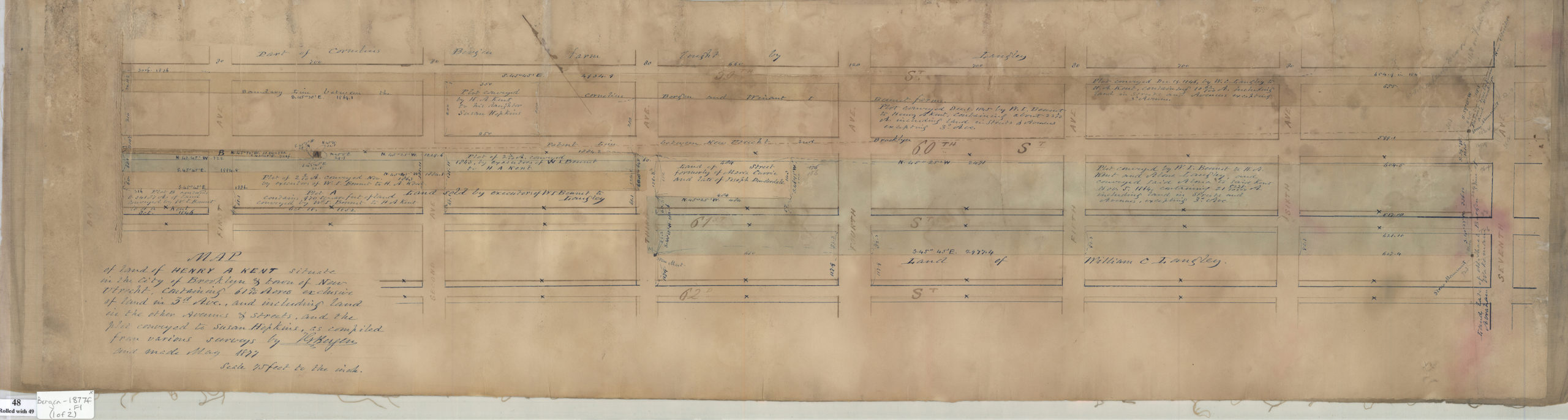
Creator
Bergen, Teunis G.,Publisher
Brooklyn Historical SocietyCitation
[Maps of land of Henry A. Kent, situated in the city of Brooklyn & town of New Utrecht, containing 61 4/10 acres exclusive of land in 3rd Avenue and including land in the other avenues & streets, and the plot conveyed to Susan Hopkins; May 1877, Map Collection, Bergen-1877f.Fl; Brooklyn Historical Society.Scale
Scale [1:900] 1 in to 75Loading zoom image...