[Maps of land of John Cowenhoven, formerly of Garret Cowenhoven, and of William G. Kouwenhoven] 1890-[1892]
Map No. Bergen-1890-[1892].Fl
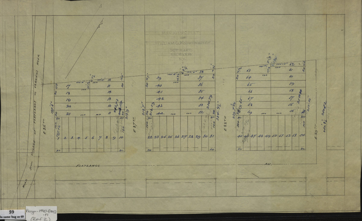
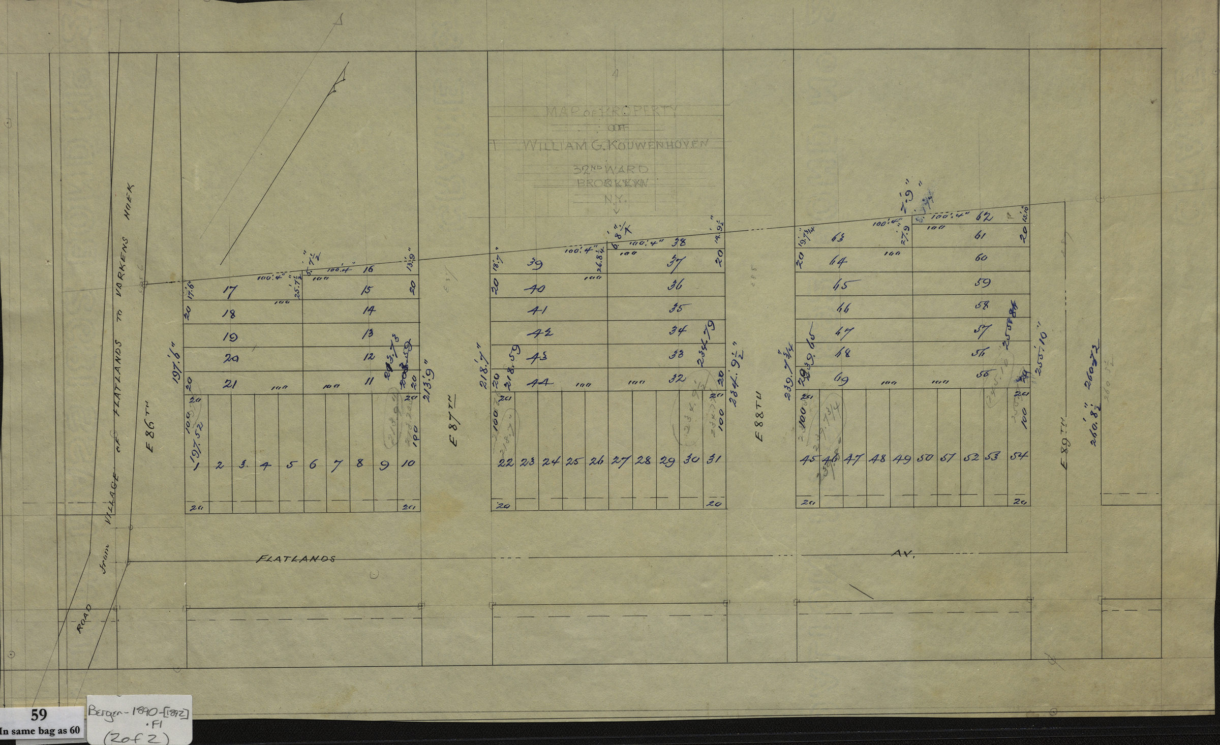
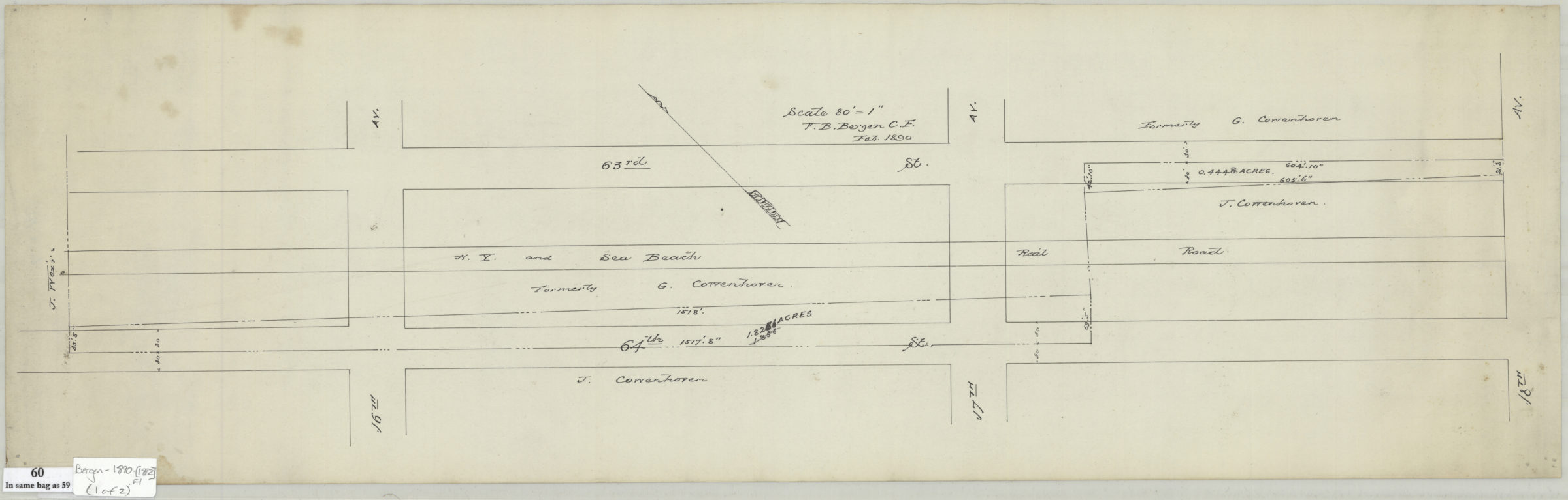
Cadastral map covering 63rd and 64th Streets between 15th and 18th Avenues showing streets, property, track of New York and Sea Beach Rail Road, and names of landowners in modern-day Bensonhurst. Cadastral map covering the area along Flatlands Avenue between East 86th Street and East 89th Street showing streets and lots (including lot numbers and dimensions) in modern-day Canarsie. Title devised by cataloger. Maps found rolled together in BHS archives and cataloged as a unit to preserve context. Watermark: Crane & Co., Dalton, Mass., 1892. Line for John Cowenhoven [text illegible] of land formerly of Garret Cowenhoven, Feb. 1890 (Scale 80 ft. to the in.). Map of property of William G. Kouwenhoven, 32nd Ward, Brooklyn, N.Y.
Subjects
Places
Map area shown
Relation
Full catalog recordSize
22 × 71 cmDownload
Low Resolution Image
Creator
Bergen, Van Brunt,Publisher
Brooklyn Historical SocietyCitation
[Maps of land of John Cowenhoven, formerly of Garret Cowenhoven, and of William G. Kouwenhoven]; 1890-[1892], Map Collection, Bergen-1890-[1892].Fl; Brooklyn Historical Society.Scale
Scales differLoading zoom image...