[Maps of properties in areas of Sunset Park and Williamsburg] [ca. 1869]
Map No. Bergen-[1869?].Fl
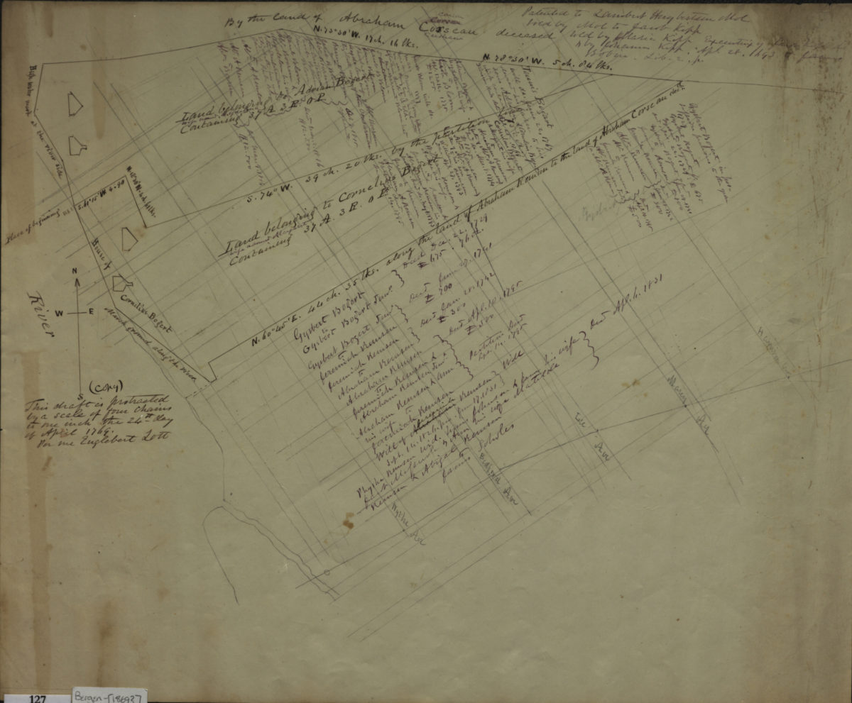
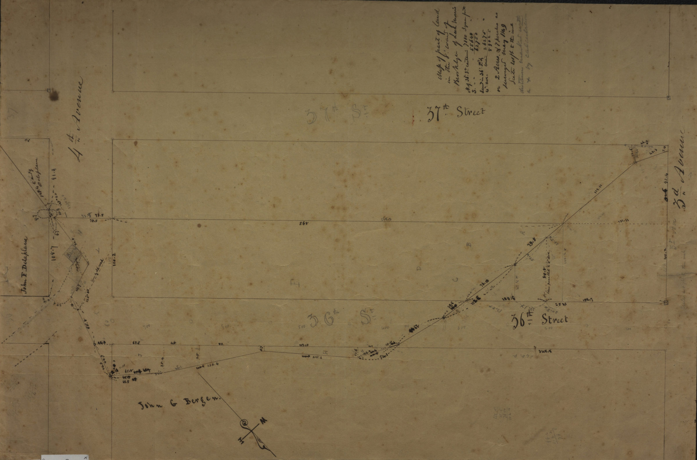
Cadastral survey map of property line running from 37th Street and 4th Avenue to 37th Street and 3rd Avenue in modern-day Sunset Park. Shows streets and names of some landowners. Cadastral map showing farm properties of 1769 drawn over street grid in modern-day Williamsburg. Shows property and names of landowners, includes extensive notes on conveyances. Title devised by cataloger. Attributed to Teunis G. Bergen, based on handwriting. Maps found rolled together in BHS archives and cataloged as a unit to preserve context. Map of part of land in the 8[th] ward of Brooklyn of Leah Morris. surveyed 1869. [Copy of map made by Englebert Lott in 1769 of area in Williamsburg].
Subjects
Places
Map area shown
Relation
Full catalog recordSize
37 × 56 cmDownload
Low Resolution Image
Creator
Bergen, Teunis G.,Publisher
Brooklyn Historical SocietyCitation
[Maps of properties in areas of Sunset Park and Williamsburg]; [ca. 1869], Map Collection, Bergen-[1869?].Fl; Brooklyn Historical Society.Scale
Scales differLoading zoom image...