[Maps of properties of John Ditmas and John Lott, Flatbush, County of Kings] [ca. 1868]
Map No. Bergen-[1868?]a.Fl
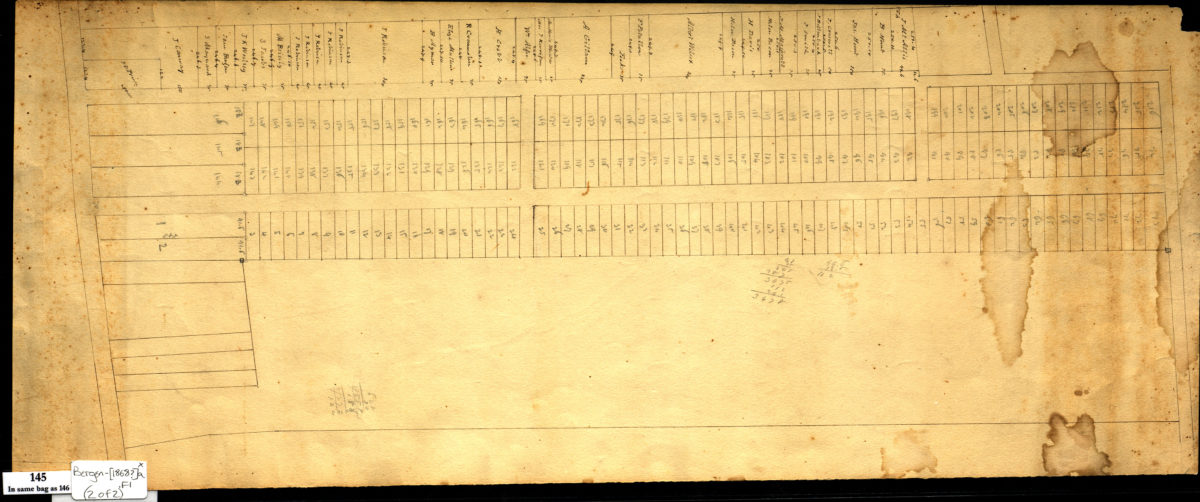
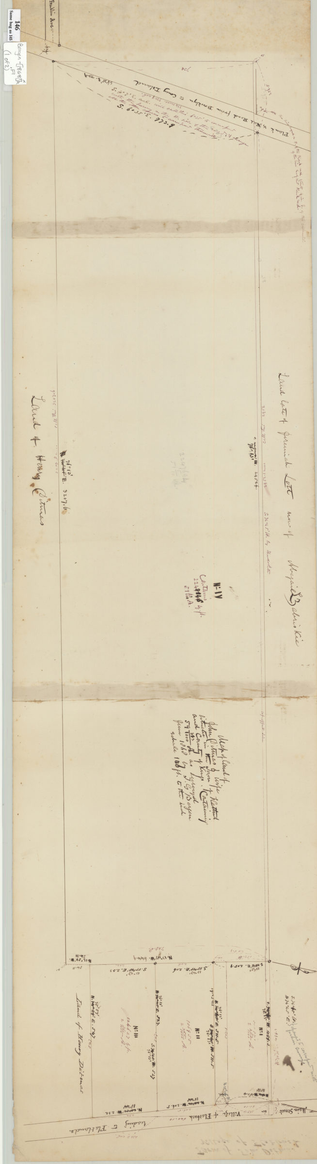
Cadastral map on 3 assembled sheets showing property (including dimensions) and names of landowners in modern-day Flatbush. Cadastral map showing property, lots (including numbers) and names of landowners. Title devised by cataloger. Attributed to Teunis G. Bergen, based on handwriting. Maps found rolled together in BHS archives and cataloged as a unit to preserve context. Map of land of John Ditmas & wife situate[d] in the town of Flatbush, County of Kings containing 59 373/1000 acres / surveyed June 1868 by T. G. Bergen. Heirs of John Lott, Flatbush, in city lots.
Map area shown
Relation
Full catalog recordSize
28 × 107 cmDownload
Low Resolution Image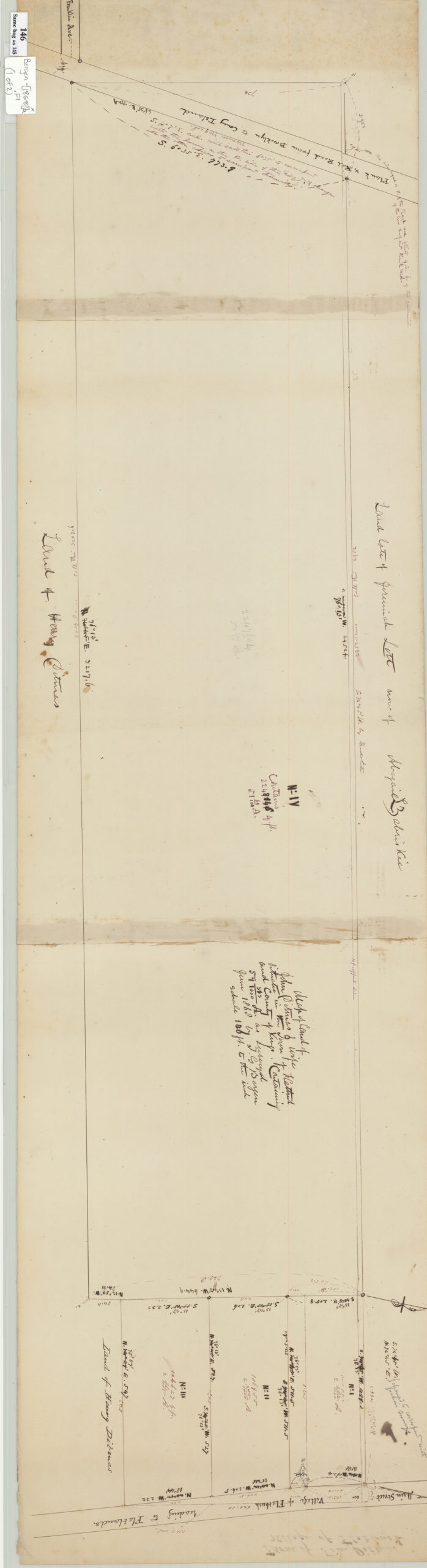
Creator
Bergen, Teunis G.,Publisher
Brooklyn Historical SocietyCitation
[Maps of properties of John Ditmas and John Lott, Flatbush, County of Kings]; [ca. 1868], Map Collection, Bergen-[1868?]a.Fl; Brooklyn Historical Society.Scale
Scales differLoading zoom image...