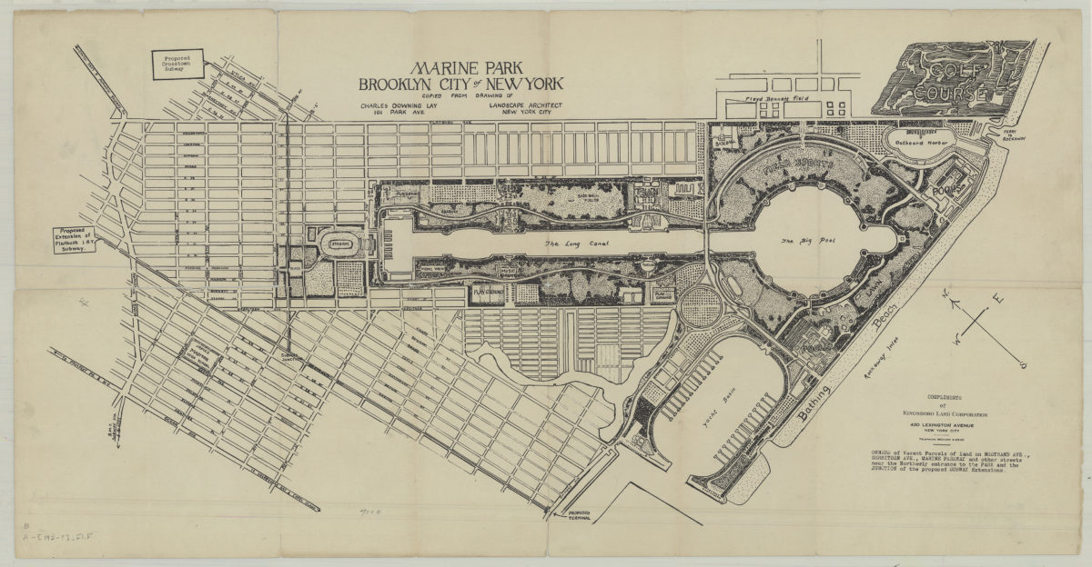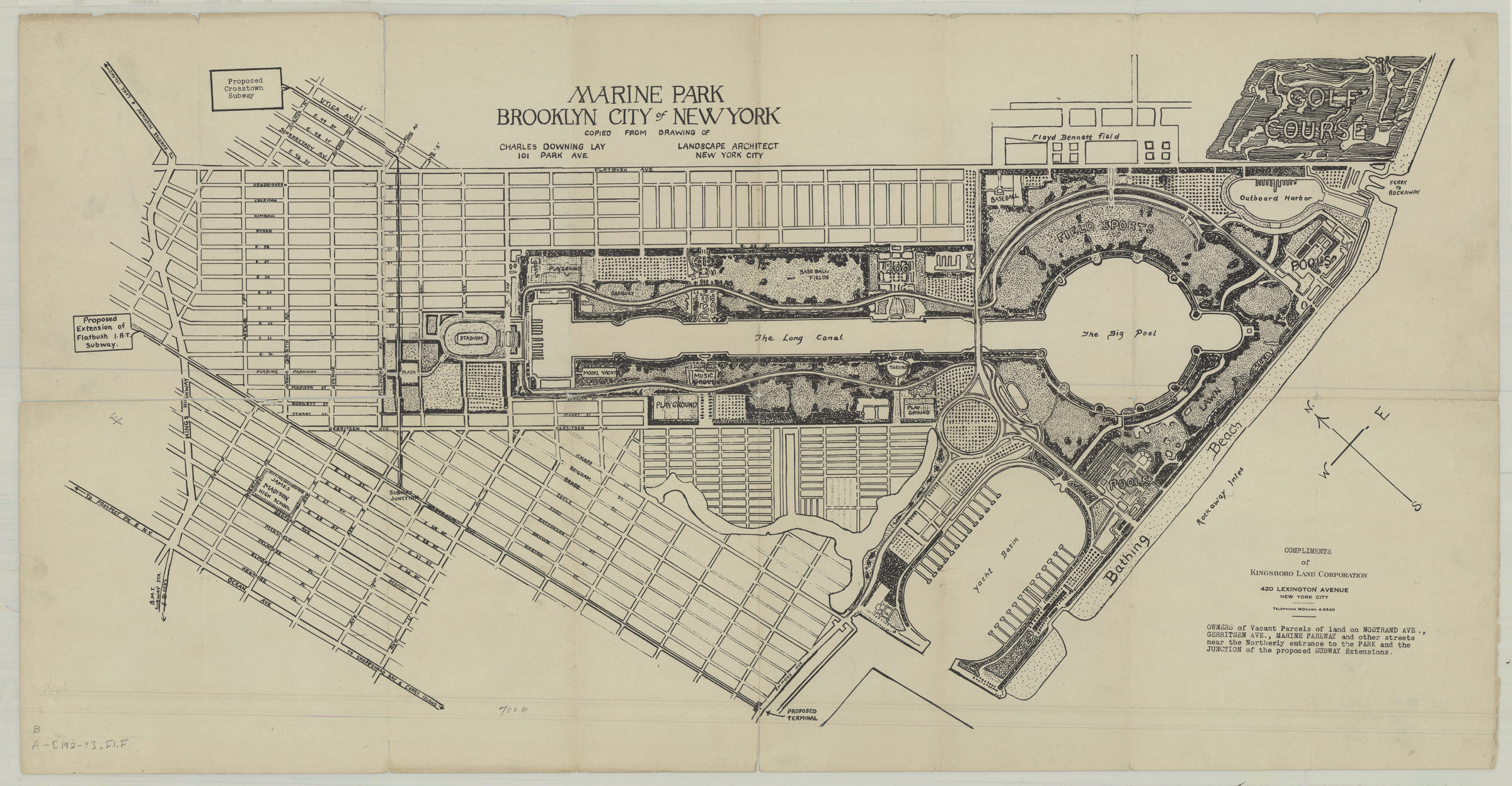
Marine Park, Brooklyn, New York City: copied from drawing of Charles Downing Lay, landscape architect, 101 Park Ave., New York City [1932]
Map No. B A-[1932?].Fl.Folio
Covers Marine Park and surrounding blocks from Kings Highway to the shore and from Ocean Avenue to Flatbush Avenue. Shows 1932 Charles Downing Lay site plan proposal for Marine Park, including landscape and water features, and stops for proposed subway extensions. “Compliments of Kingsboro Land Corporation, 420 Lexington Avenue … owners of vacant parcels of land on Nostrand Ave., Gerritsen Ave., Marine Parkway and other streets near the northerly entrance to the park and junction of the proposed subway extensions.” Oriented with north to the upper left.
Map area shown
Genre
Cadastral mapsRelation
Full catalog recordSize
45 X 86 cmDownload
Low Resolution Image
Creator
Lay, Charles Downing,Publisher
Brooklyn Historical SocietyCitation
Marine Park, Brooklyn, New York City: copied from drawing of Charles Downing Lay, landscape architect, 101 Park Ave., New York City; [1932], Map Collection, B A-[1932?].Fl.Folio; Brooklyn Historical Society.Scale
Scale not givenLoading zoom image...