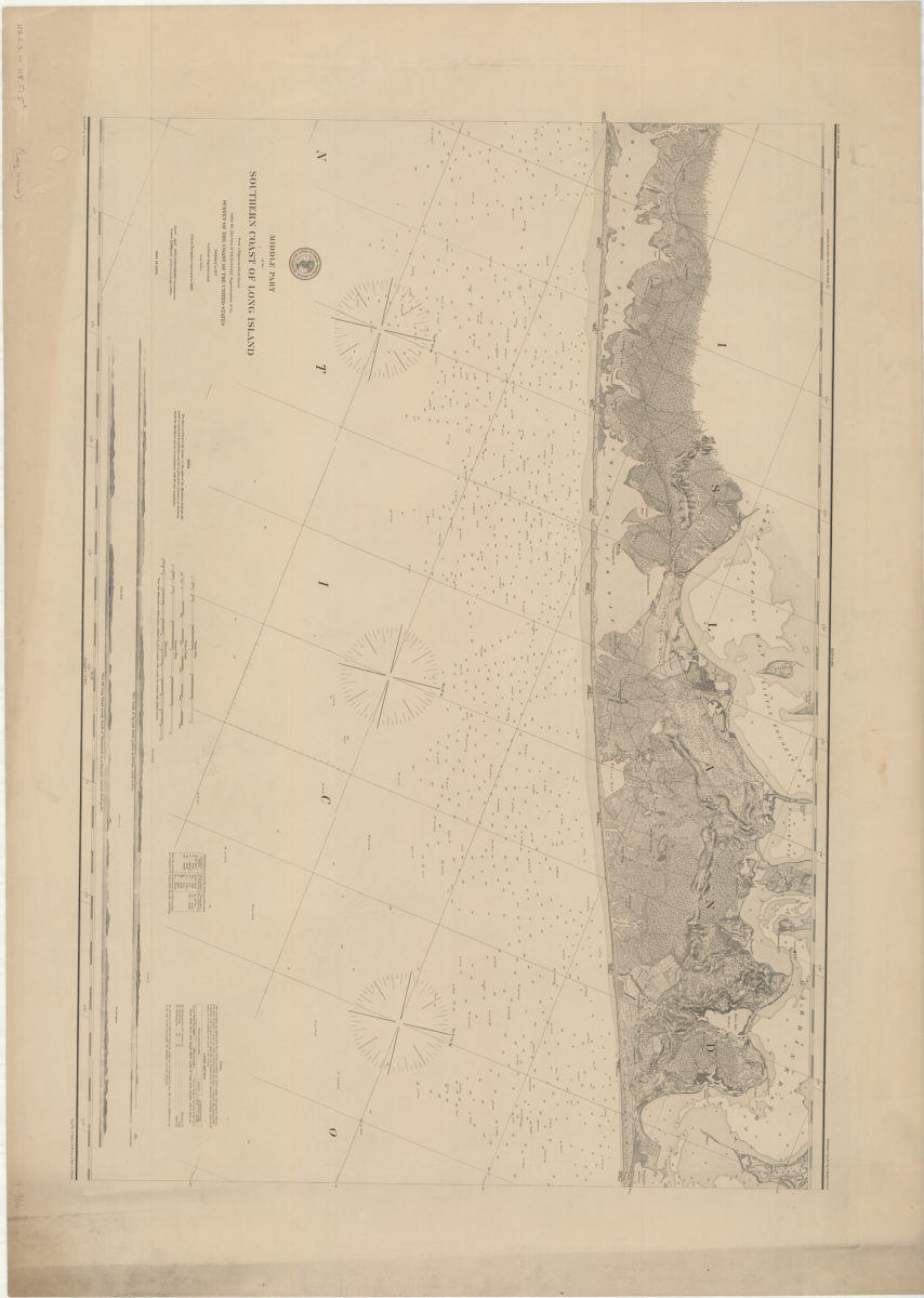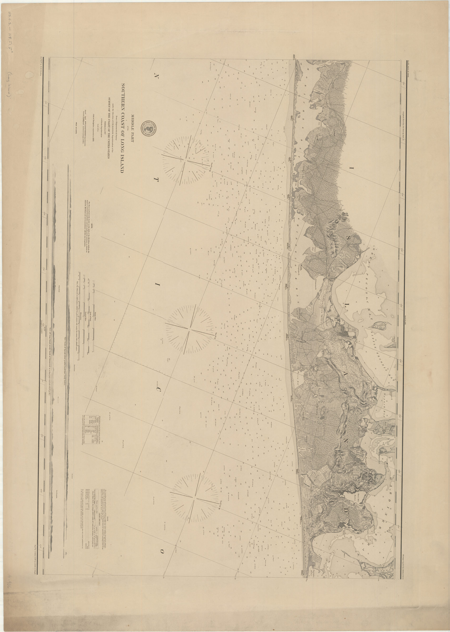
Middle part of the southern coast of Long Island: from a trigonometrical survey: under the direction of F.R. Hassler superintendent of the Survey of the Coast of the United States [1857]
Map No. U.S.C.S.-118.Fl.F
Relief shown by hachures. Depths shown by soundings. Oriented with north to the upper right. Includes notes, charts and 2 coastal panoramas. “Redd. drng by W.M.C. Fairfax.” Engd, by S. Siebert, A. Rollé, G. McCoy & J. Knight,.” “Verified, M.L. Smith, capt. topl. engrs. asst. in charge of office.”
Map area shown
Genre
Nautical chartsRelation
Full catalog recordSize
73 × 97 cmDownload
Low Resolution Image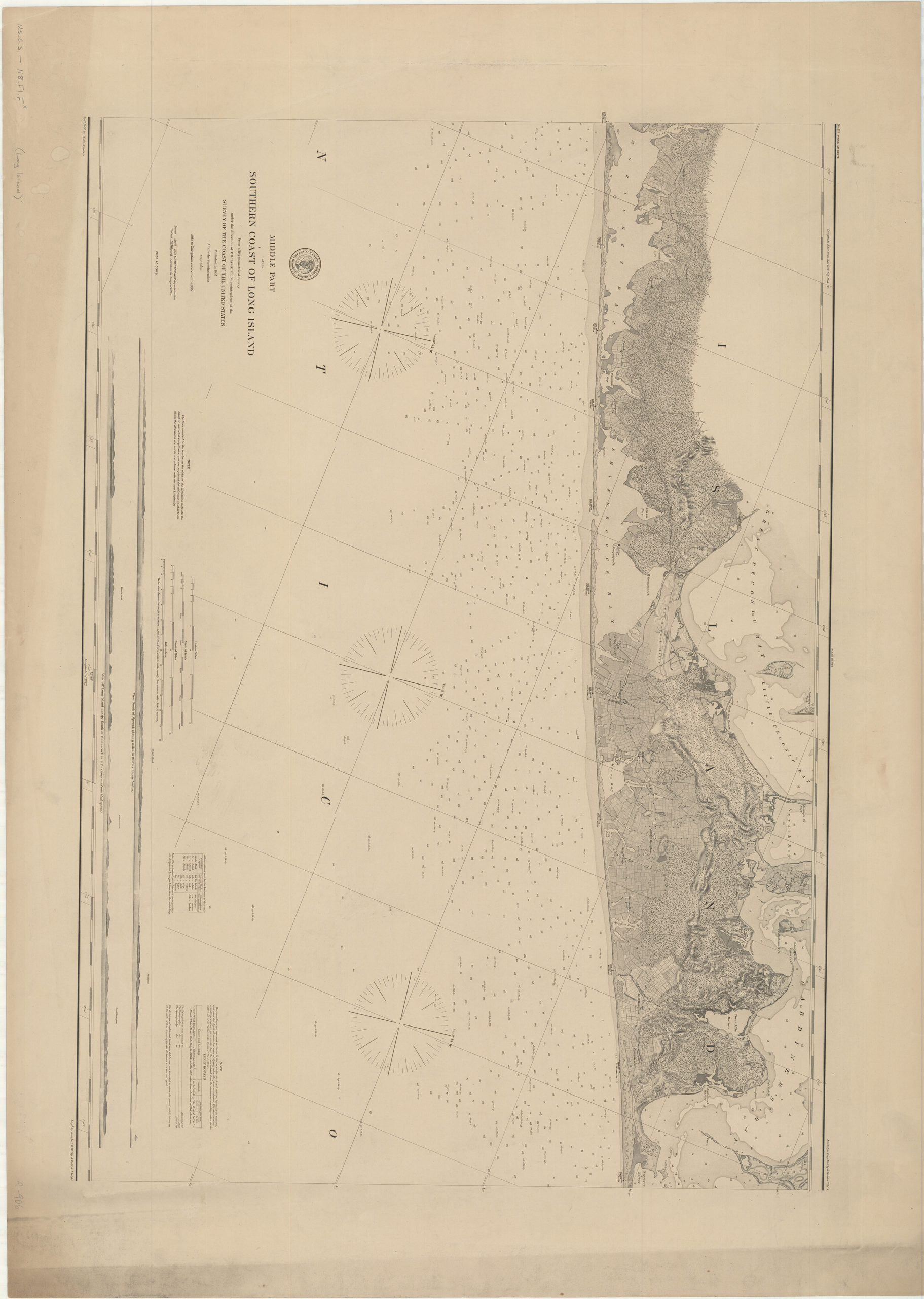
Creator
United States Coast Survey,Publisher
Brooklyn Historical SocietyCitation
Middle part of the southern coast of Long Island: from a trigonometrical survey: under the direction of F.R. Hassler superintendent of the Survey of the Coast of the United States; [1857], Map Collection, U.S.C.S.-118.Fl.F; Brooklyn Historical Society.Scale
Scale 1:80,000Loading zoom image...