Montague Business Improvement District [2003; 2003]
Map No. B A-2003.Fl
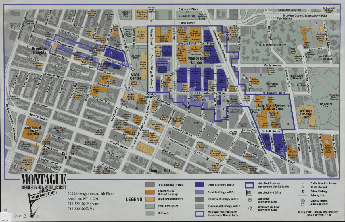
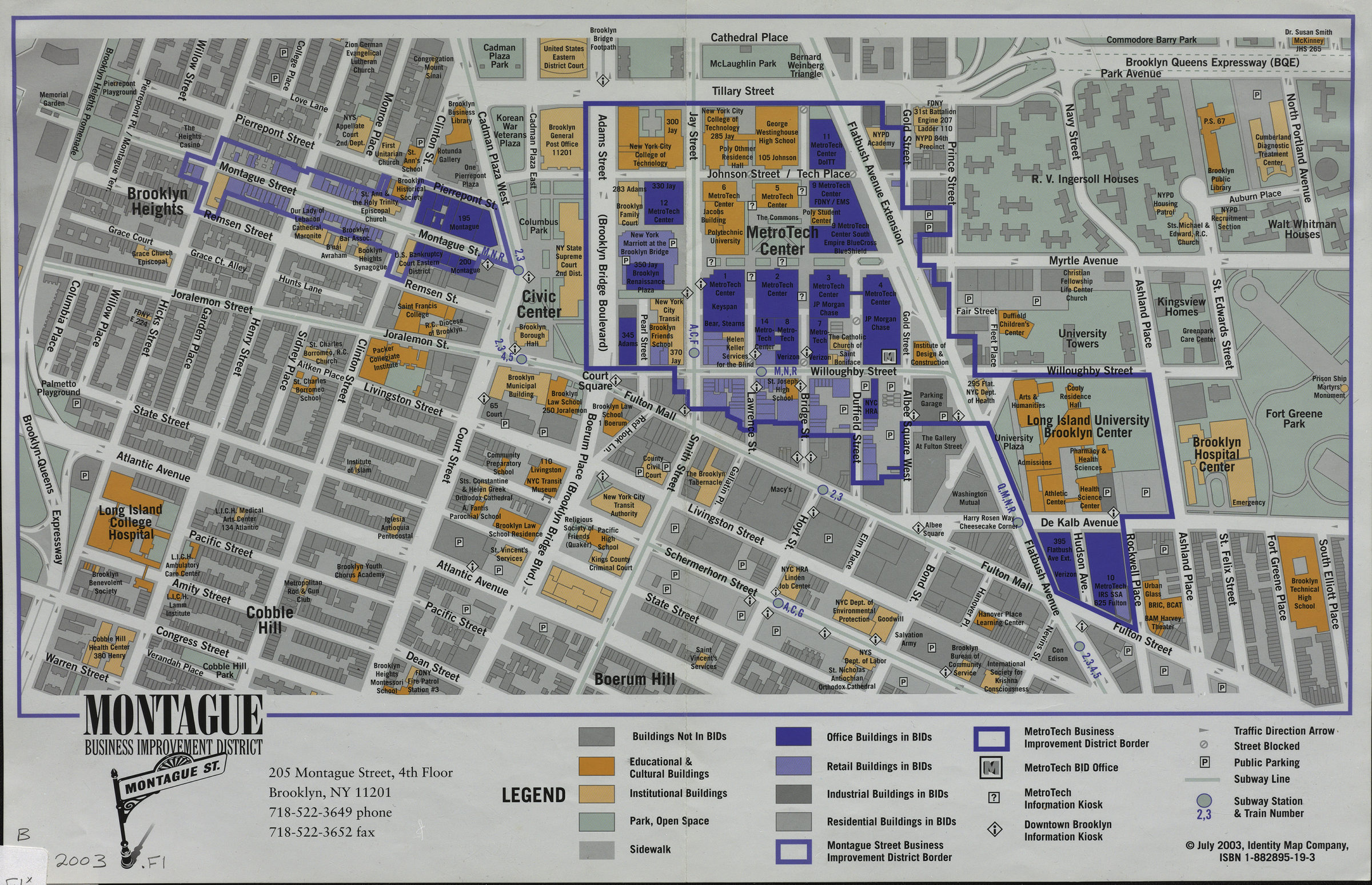
Covers the Montague Street and MetroTech Business Improvement Districts, and parts of the immediate surrounding Brooklyn neighborhoods of Brooklyn Heights, Cobble Hill, Boerum Hill and Civic Center. Shows streets and avenues, hospitals, schools and identifies various types of commercial buildings.
Map area shown
Genre
MapRelation
Full catalog recordSize
28 × 42 cmDownload
Low Resolution Image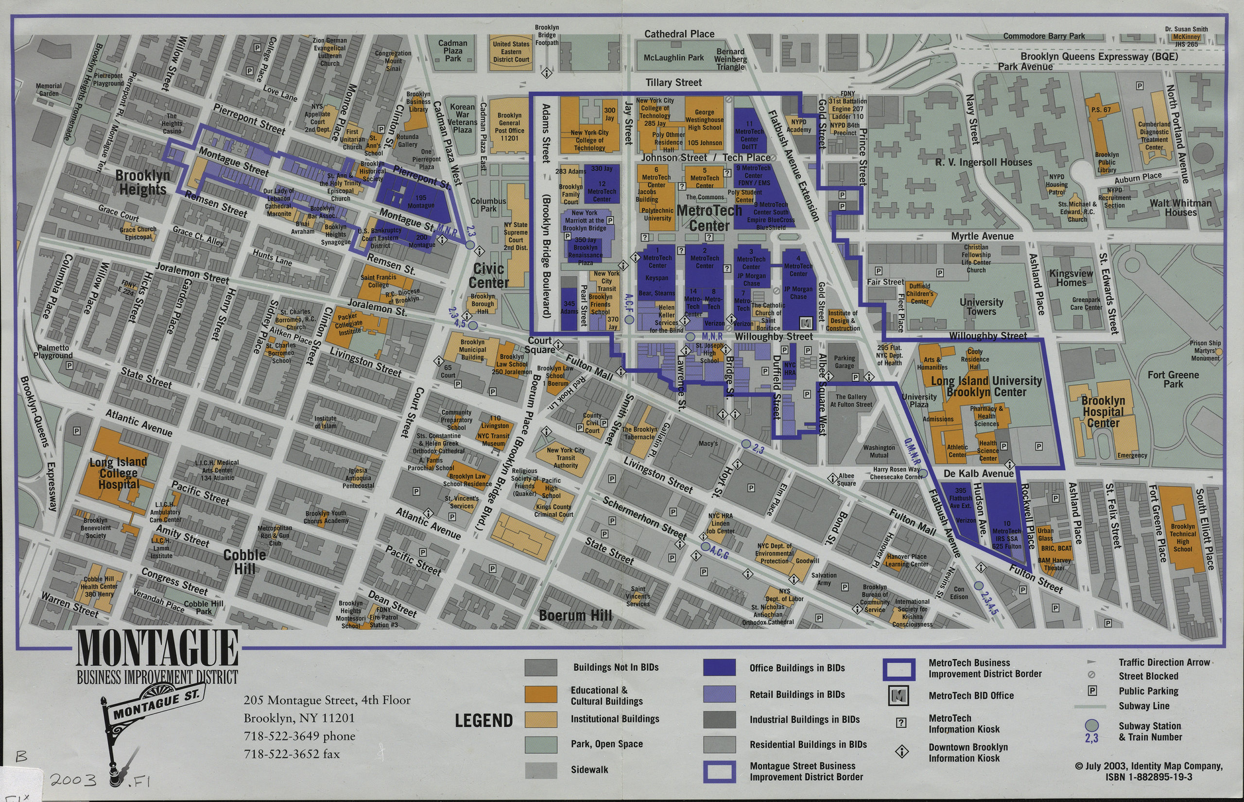
Creator
Identity Map Company,Publisher
Brooklyn Historical SocietyCitation
Montague Business Improvement District; [2003; 2003], Map Collection, B A-2003.Fl; Brooklyn Historical Society.Scale
Scale not givenLoading zoom image...