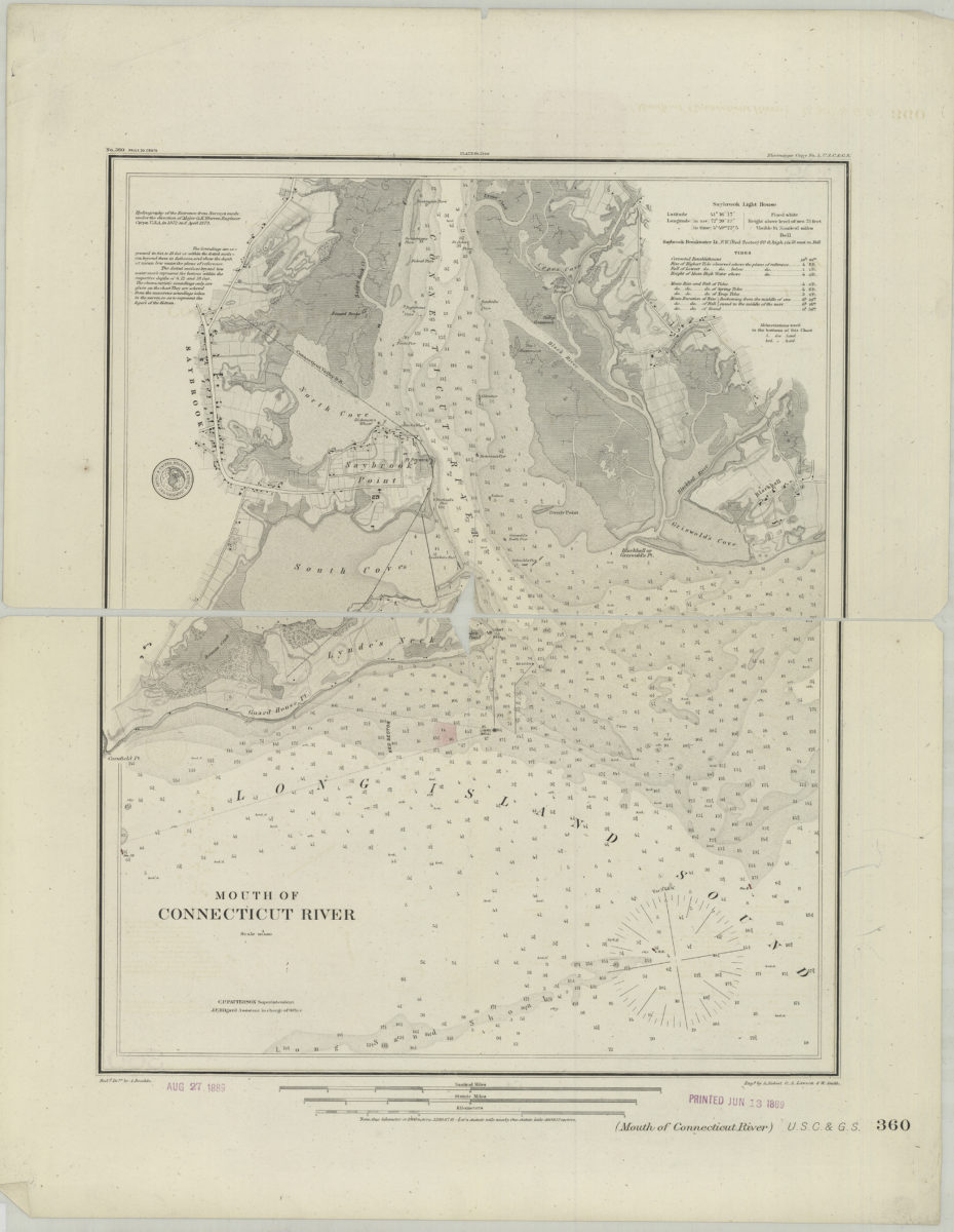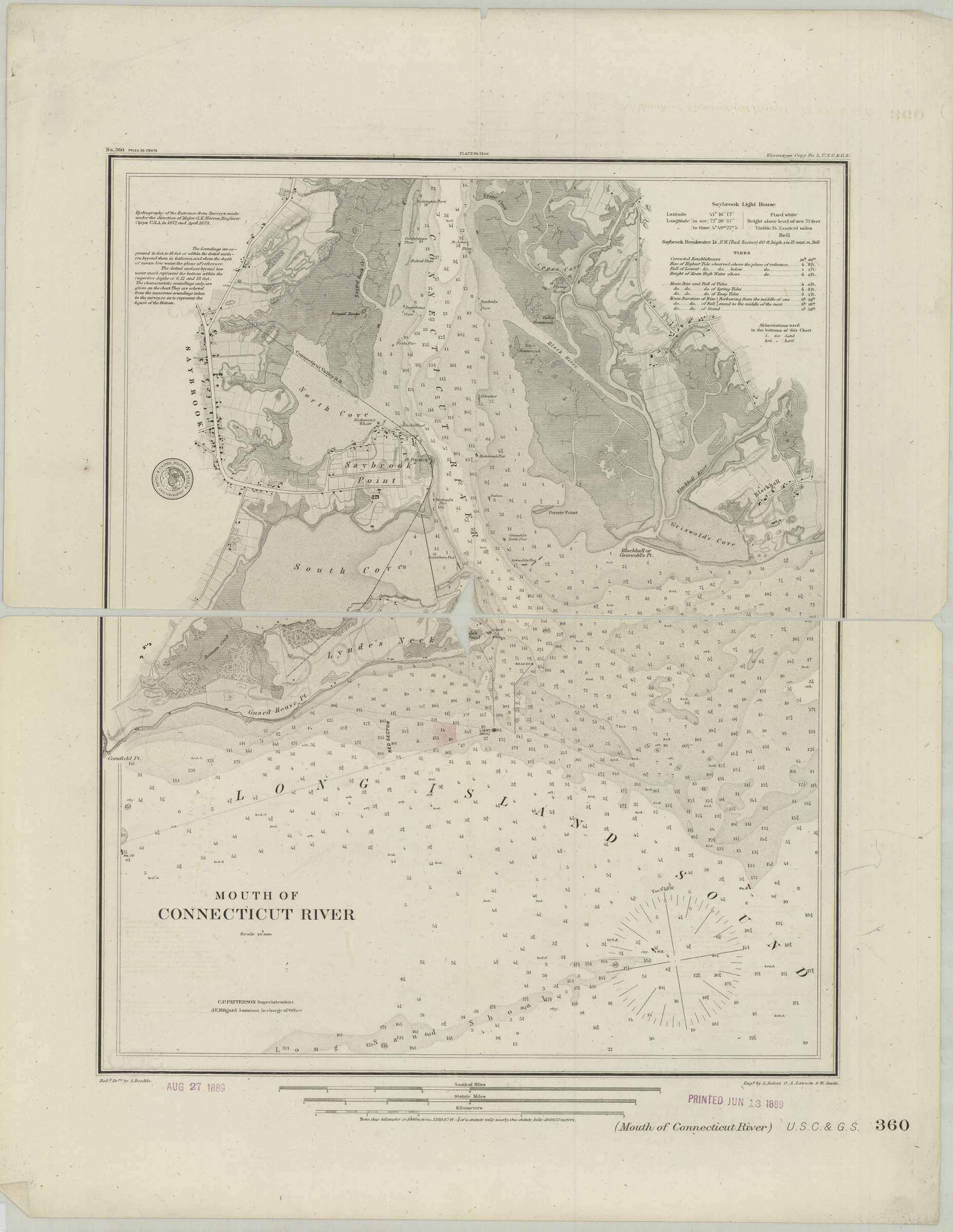
Mouth of Connecticut River [1889]
Nautical chart covering area east from Cornfield Pt. to Griswold’s Cove and north from Long Island Sound to Lyne Creek. Relief shown by shading and hachures. Depths shown by bathymetric tints and soundings (in feet and fathoms). “C.P. Patterson Superintendent.” “J.E. Hilgard Assistant in charge of Office.” “Redd. drng. by A. Boschke”–Lower left margin. Publication date inferred from stamp on BHS copy. BHS copy stamped: Aug 27, 1889. Printed Jun 13, 1889. “Engd. by S. Siebert, O.A. Lawson & W. Smith”–Lower right margin. “Hydrography of the Entrance from Surveys made under the direction of Major G.K. Warren, Engineer Corps., U.S.A., in 1872 and April 1879.” Some buoys colored red. Includes notes, key, tidal table, and seal. “Electrotype Copy No. 5, U.S.C.&G.S.”–Upper right margin. “Plate no. 1544”–Upper center margin. “No. 360”–Upper left margin. Watermark: John C. Clark Phil’a.
Map area shown
Genre
Nautical chartsRelation
Full catalog recordSize
44 × 36 cmDownload
Low Resolution Image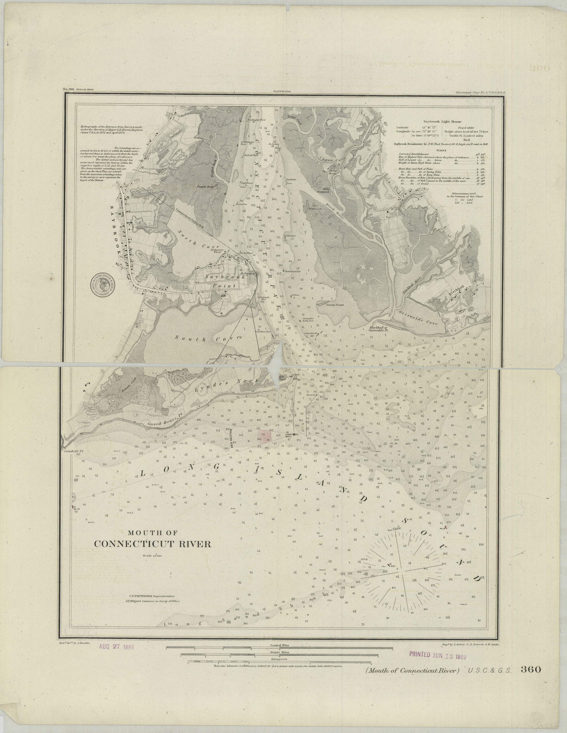
Creator
U.S. Coast and Geodetic Survey,Publisher
Brooklyn Historical SocietyCitation
Mouth of Connecticut River; [1889], Map Collection, U.S.C.S.-360.Fl; Brooklyn Historical Society.Scale
Scale 1:20,000