
Nester’s Brooklyn maps: cartography by Dante Di Matteo [1955; 1955]
Map No. B A-1955.Fl
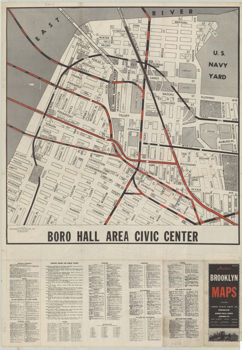
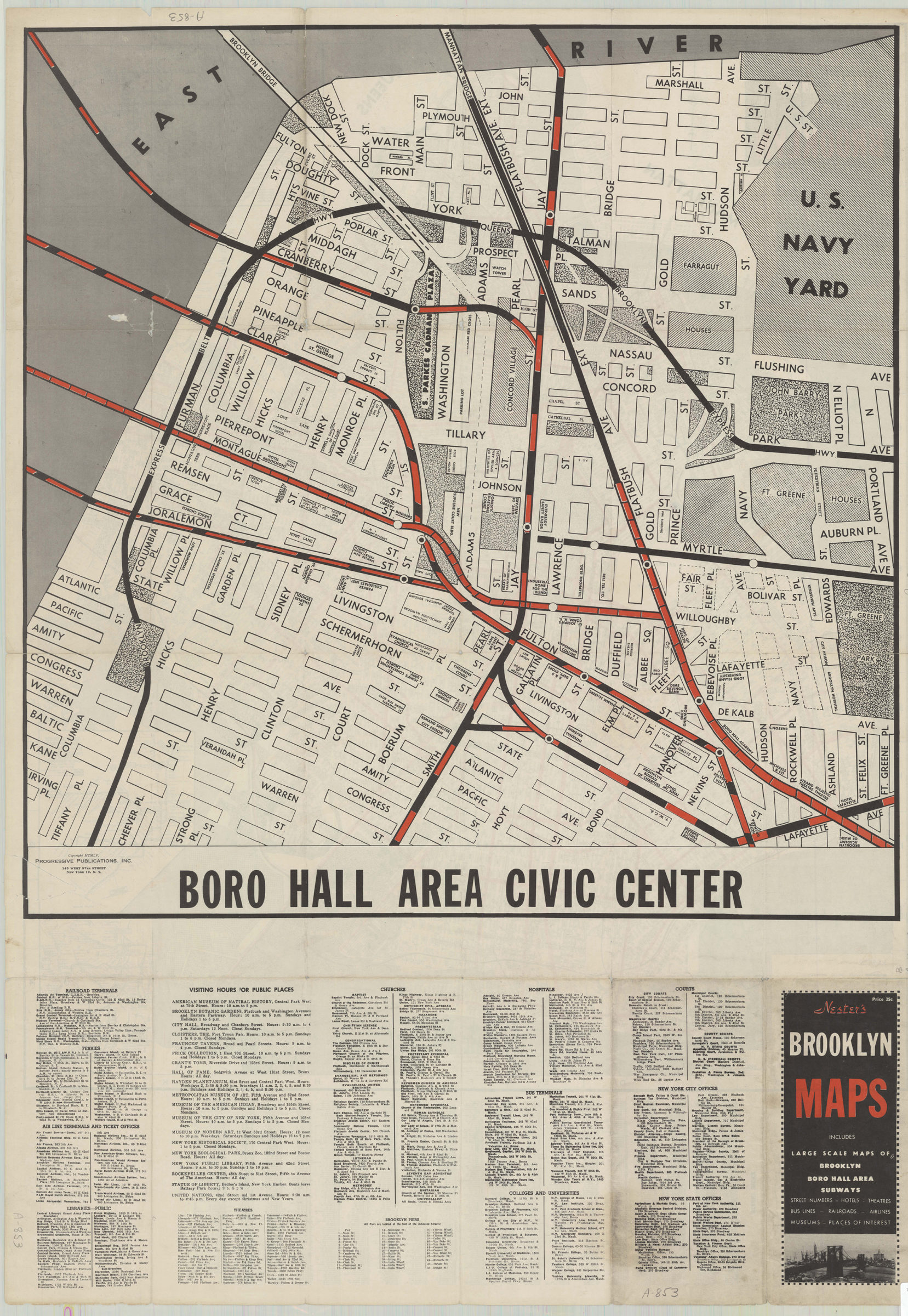
Panel title. Includes index, inset maps of New York City Transit Systems, directory of civic institutions and points of interest for Borough Hall area. Main routes shown in red. Nester’s new map of Brooklyn. Boro Hall Area Civic Center.
Map area shown
Genre
Transportation mapsRelation
Full catalog recordSize
97 × 68 cmDownload
Low Resolution Image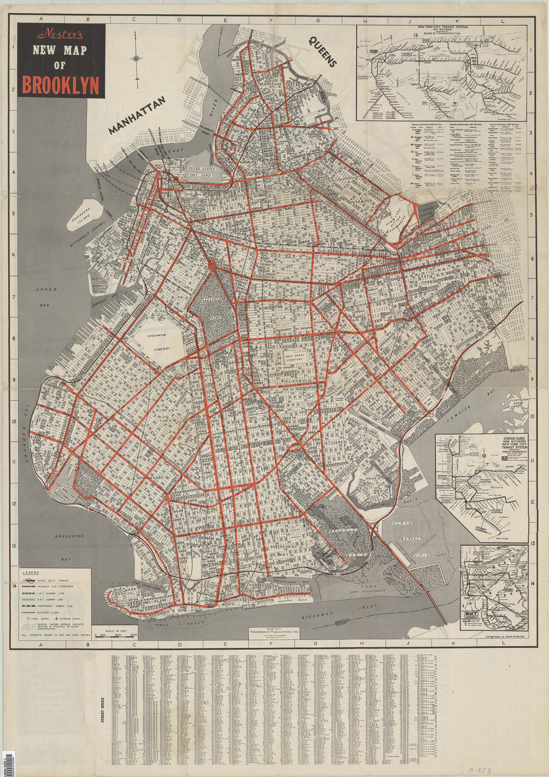
Creator
Matteo, Dante Di,Publisher
Brooklyn Historical SocietyCitation
Nester’s Brooklyn maps: cartography by Dante Di Matteo; [1955; 1955], Map Collection, B A-1955.Fl; Brooklyn Historical Society.Scale
Scales differLoading zoom image...