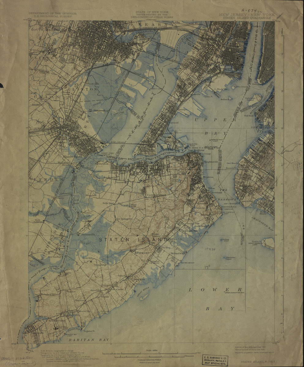
New Jersey- New York: Staten Island Quadrangle 1900
Map No. USGS-1:62,500 (Staten Island).Fl
United States. Geological Survey. U.S.G.S. Alternate title: Staten Island, N.J.-N.Y. Relief shown by 20 feet contour intervals. Triangulation by U.S. Coast and Geodetic Survey. Topography by U.S. Coast and Geodetic Survey. Surveyed in 1888-89. Partial revision of shore line 1925. Verso: legend and explanatory notes, “The topographic maps of the United States.”
Map area shown
Genre
MapRelation
Full catalog recordDownload
Low Resolution Image
Creator
Wheat, J. H.; Sutton, Frank; Thom, J. W.; Bodfish, Summer H.,Publisher
Brooklyn Historical SocietyCitation
New Jersey- New York: Staten Island Quadrangle; 1900, Map Collection, USGS-1:62,500 (Staten Island).Fl; Brooklyn Historical Society.Scale
Scale 1:62,500Loading zoom image...