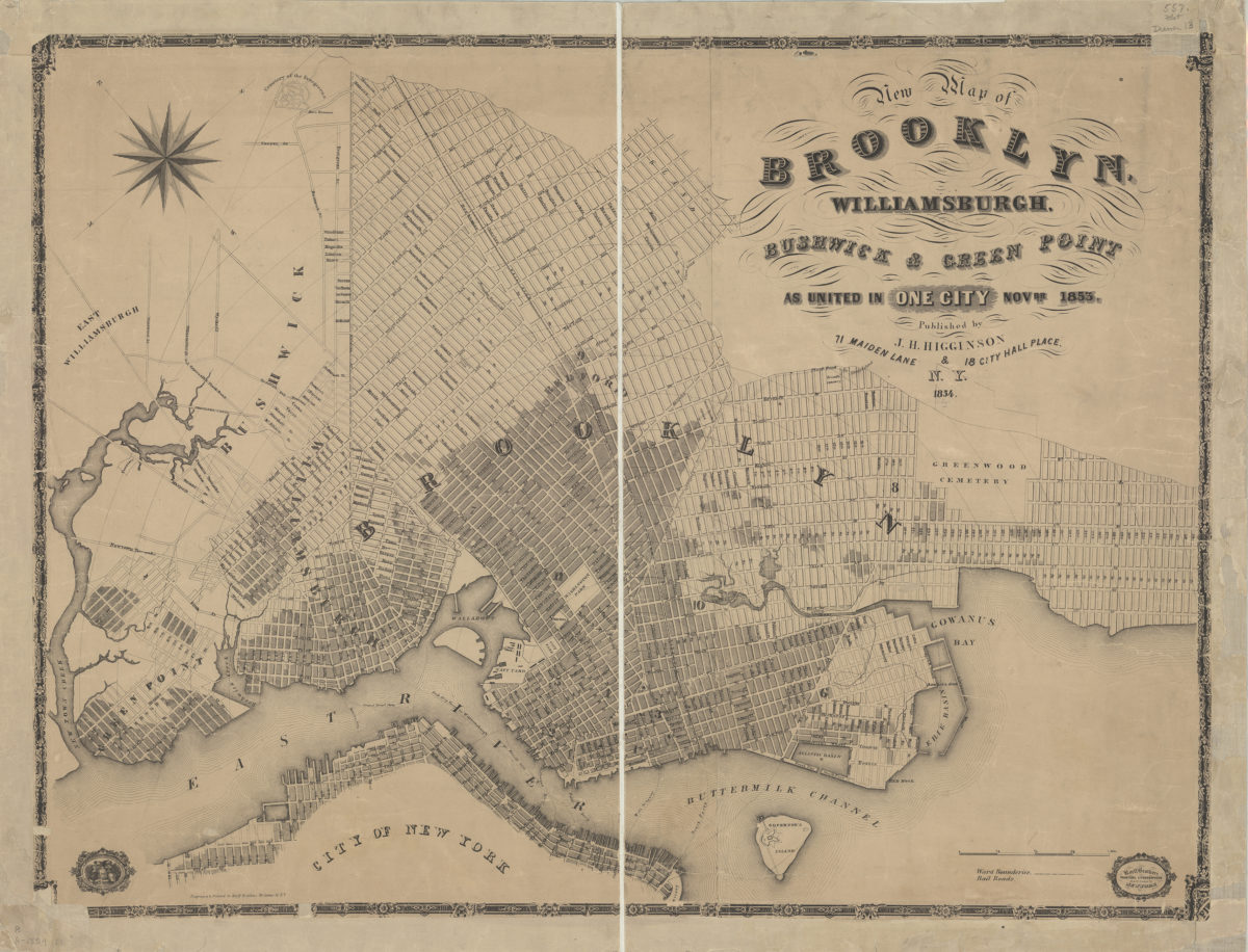
New map of Brooklyn, Williamsburgh, Bushwick & Green Point as united in one city, Novbr. 1853 1854
Map No. B A-1854.Fl.Folio
Covers the city of Brooklyn north from 59th St. to Green Point and east to Evergreen Cemetery. Also covers Governor’s Island and portions of East Williamsburgh and Lower Manhattan. Shows wards, railroads, ferry lines, and distances from City Hall (modernly known as Borough Hall). Oriented with north to the lower left. “Entered according to Act of Congress in the year 1864. J.H. Higginson in the Clerk’s Office of the District Court of the Southern District of New York.” Includes ill., key, and decorative border.
Map area shown
Genre
Zoning mapsRelation
Full catalog recordSize
67 × 88 cmDownload
Low Resolution Image
Creator
Higginson, J. H.,Publisher
Brooklyn Historical SocietyCitation
New map of Brooklyn, Williamsburgh, Bushwick & Green Point as united in one city, Novbr. 1853; 1854, Map Collection, B A-1854.Fl.Folio; Brooklyn Historical Society.Scale
Scale [ca. 1:14,908]Loading zoom image...