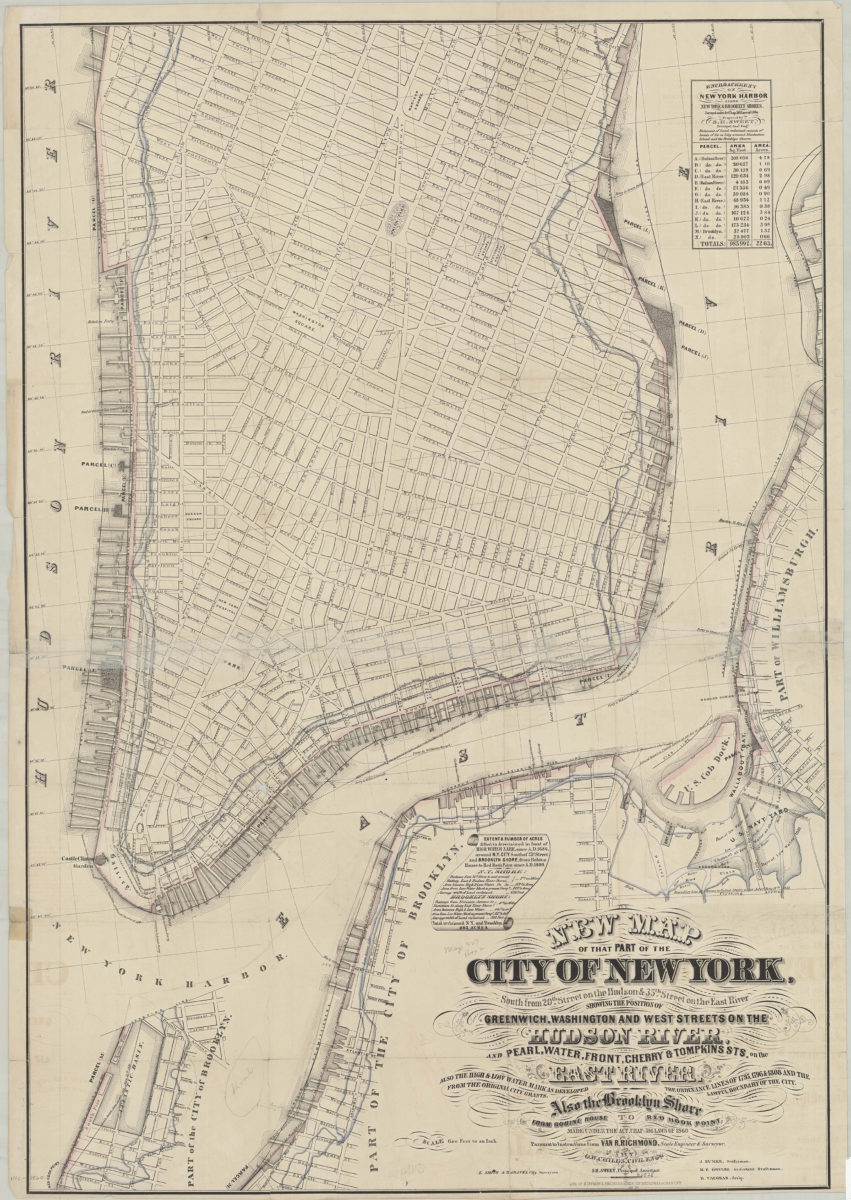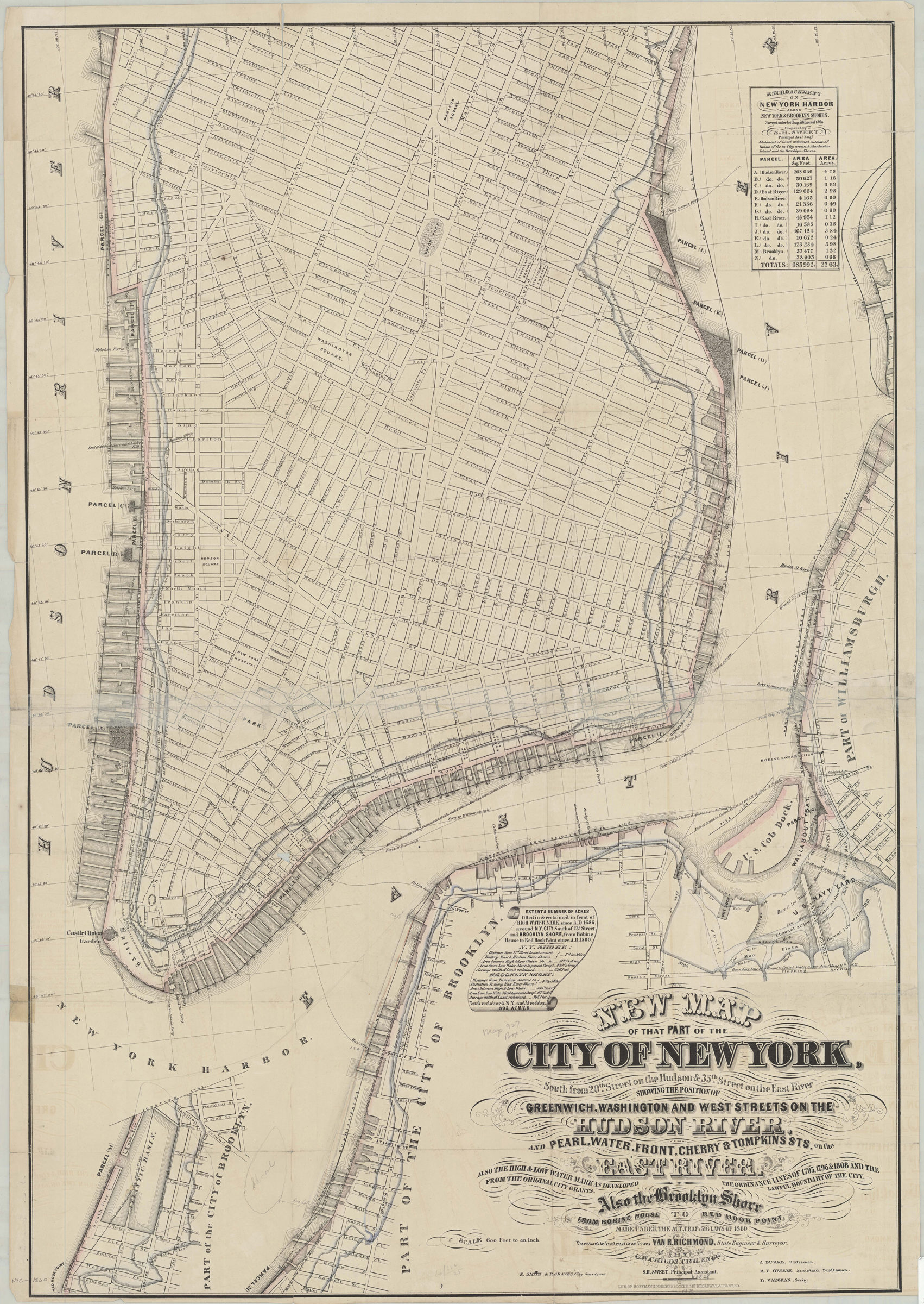
New map of that part of the city of New York south from 20th Street on the Hudson & 35th Street on the East River: showing the position of Greenwich, Washington and West Streets on the Hudson River, and Pearl, Water, Front, Cherry & Tompkins Sts [1862]
Map No. NYC-[1862?].Fl.F
Also shows original shore and ferry lines. “Made under the act, Chap. 516 Laws of 1860, pursuant to instructions from Van R. Richmond, state engineer & surveyor.” Includes tables of statistics regarding reclaimed land.
Map area shown
Genre
MapRelation
Full catalog recordSize
95 × 65 cmDownload
Low Resolution Image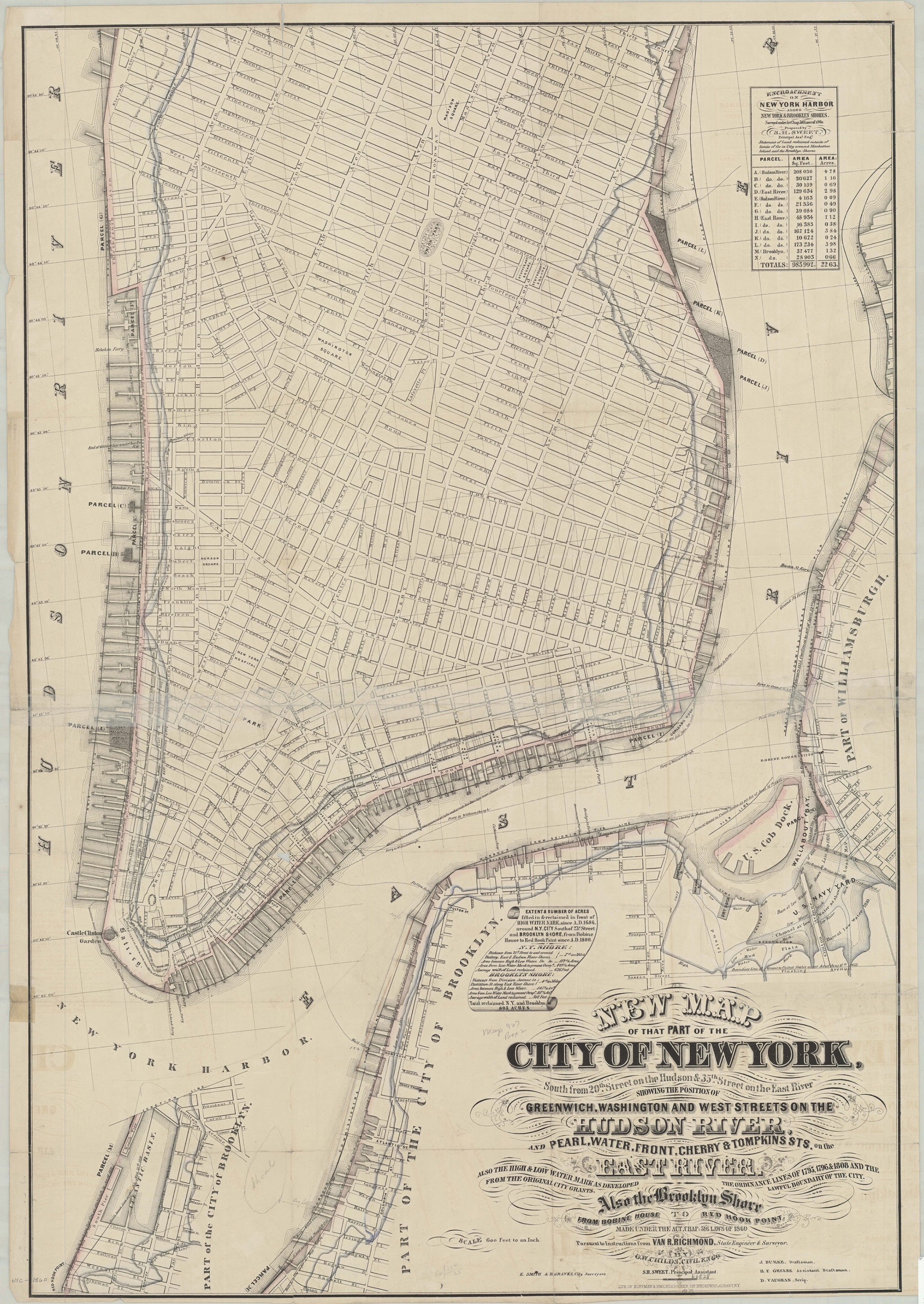
Creator
Childs, O. W.,Publisher
Brooklyn Historical SocietyCitation
New map of that part of the city of New York south from 20th Street on the Hudson & 35th Street on the East River: showing the position of Greenwich, Washington and West Streets on the Hudson River, and Pearl, Water, Front, Cherry & Tompkins Sts; [1862], Map Collection, NYC-[1862?].Fl.F; Brooklyn Historical Society.Scale
Scale [1:7,200] 1 in to 6Loading zoom image...