New York [1809]
Map No. NYC-[18-?]a.Fl
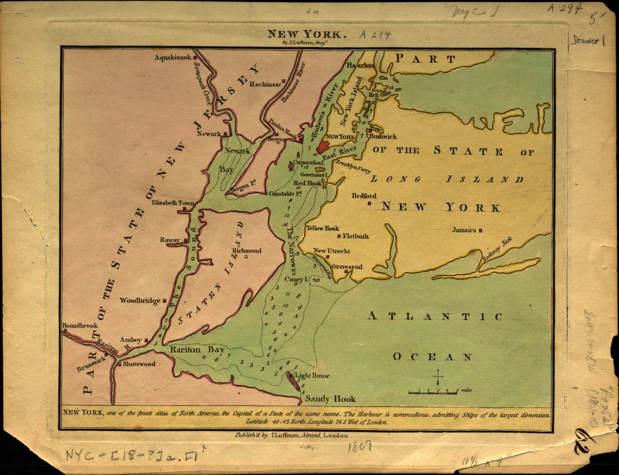
Text at bottom of sheet: “New York, one of the finest cities of North America, the capital of a state of the same name. The harbour is commodious, admitting ships of the largest dimension. Latitude 40.43 North. longitude 74.5 West of London.” Map covers Manhattan, Staten Island, and portions of New Jersey and Long Island. Depths shown by soundings.
Map area shown
Relation
Full catalog recordSize
18 × 24 cmDownload
Low Resolution Image
Creator
Luffman, John,Publisher
Brooklyn Historical SocietyCitation
New York; [1809], Map Collection, NYC-[18-?]a.Fl; Brooklyn Historical Society.Scale
Scale 1:321869Loading zoom image... 