New York and Brooklyn [186?]
Map No. NYC-[186-?]b.Fl
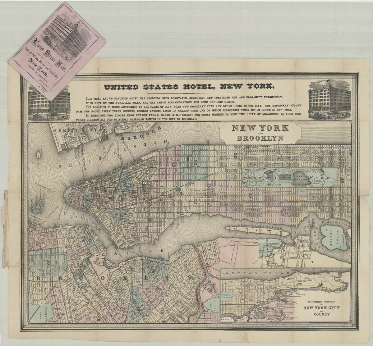
Covers the entirety of Manhattan also covers Governor’s Island, Wards Island, Blackwells Island, and Ellis Island as well as portions of southern Queens, the South Bronx, Jersey City, and Hoboken. Covers Brooklyn north from the Atlantic Basin to Greenpoint and east to Prospect Park. Shows wards, ferry lines, piers, slips, and elevated railroads. On pink cover: Ill. and text. “United States Hotel … Geo. N. Terry, Proprietor”–Cover. Includes decorative border, ill., text concerning the United States Hotel, and inset continuation map. Inset continuation map: Northern portion of New York City and County.
Map area shown
Genre
MapRelation
Full catalog recordSize
37 × 48 cmDownload
Low Resolution Image
Creator
Terry, Geo. N.; United States Hotel (New York, N.Y.),Publisher
Brooklyn Historical SocietyCitation
New York and Brooklyn; [186?], Map Collection, NYC-[186-?]b.Fl; Brooklyn Historical Society.Scale
Scale not givenLoading zoom image...