New York and Brooklyn [188?]
Map No. NYC-[188-?].Fl
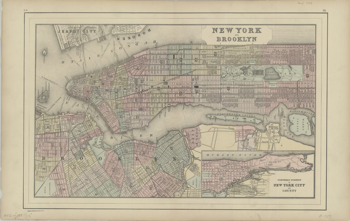
Covers the entirety of Manhattan also covers Wards Island, Blackwells Island, Ellis Island and Governor’s Island as well as portions of southern Queens, the South Bronx, Jersey City, and Hoboken. Also covers Brooklyn north from the Atlantic Basin to Greenpoint and east to Prospect Park. Shows wards and ferry lines. Extracted from unknown atlas. “Copyright 188[last number in date illegible] by Wm. M. Bradley & Bros.” Includes inset. Inset: Northern portions of New York City and County. “34”–Upper left margin. “35”–Upper right margin.
Map area shown
Genre
Zoning mapsRelation
Full catalog recordSize
31 × 49 cmDownload
Low Resolution Image
Creator
Wm. M. Bradley & Bros,Publisher
Brooklyn Historical SocietyCitation
New York and Brooklyn; [188?], Map Collection, NYC-[188-?].Fl; Brooklyn Historical Society.Scale
Scale not givenLoading zoom image...