New York and Brooklyn [ca. 1881]
Map No. NYC-1881.Fl
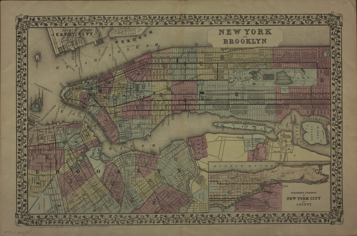
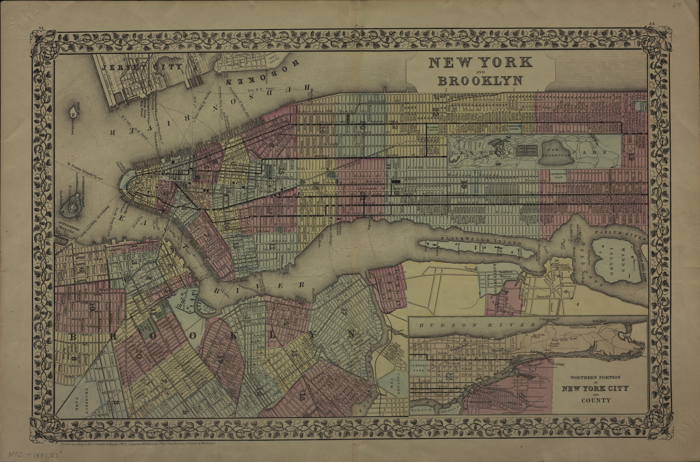
Covers the entirety of Manhattan also covers Wards Island, Blackwells Island, Ellis Island and Governor’s Island as well as portions of southern Queens, the South Bronx, Jersey City, and Hoboken. Also covers Brooklyn north from the Atlantic Basin to Greenpoint and east to Prospect Park. Shows wards, ferry lines, and elevated trains. Extracted from unknown atlas. “Entered according to Act of Congress in the year 1881 by S. Augustus Mitchell in the Office of the Librarian of Congress at Washington.” Includes decorative border and inset continuation map. Inset continuation maps: Northern portion of New York City and County. “34”–Upper left margin. “35”–Upper right margin.
Map area shown
Genre
MapRelation
Full catalog recordSize
31 × 49 cmDownload
Low Resolution Image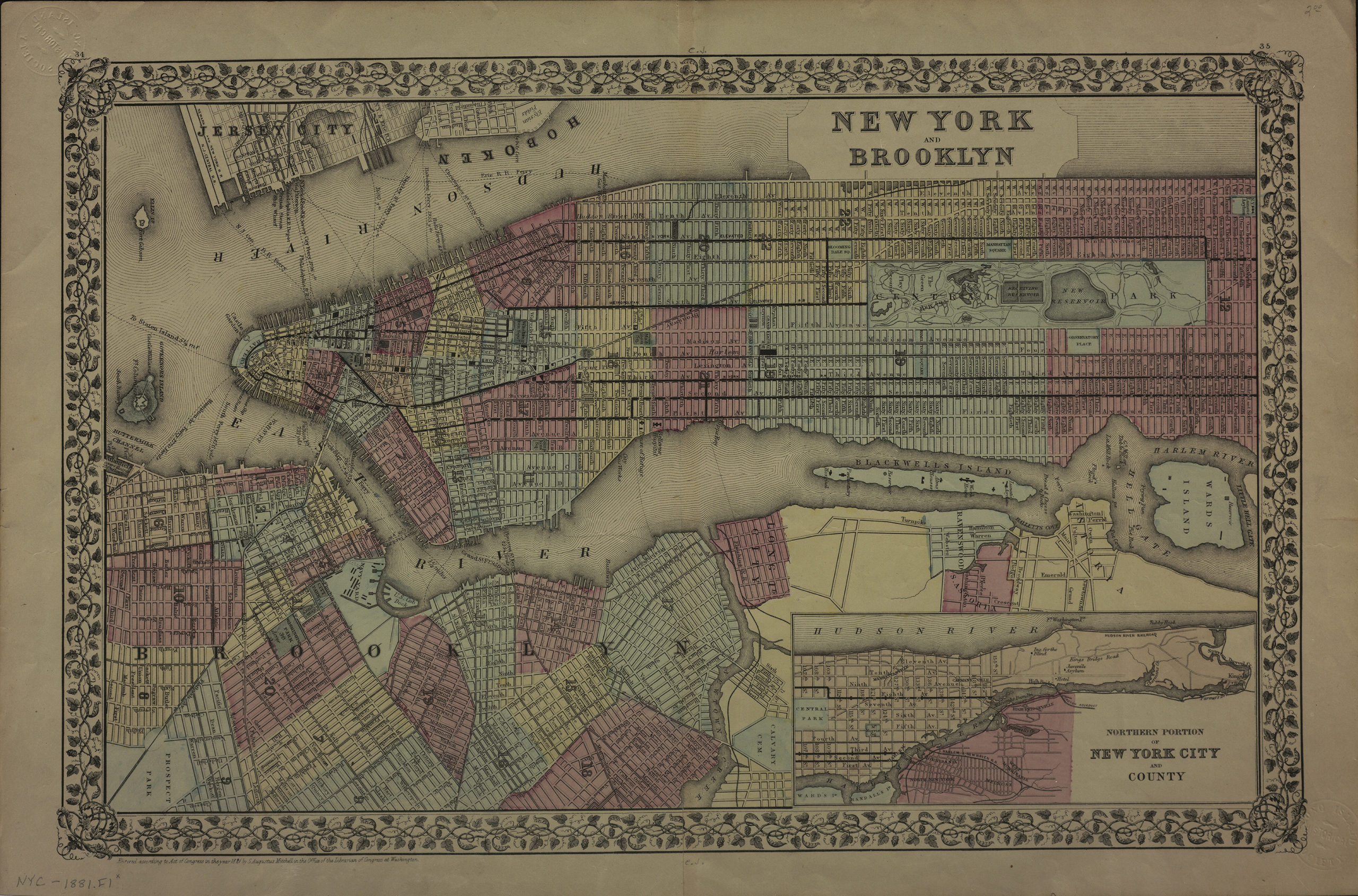
Creator
Mitchell, S. Augustus,Publisher
Brooklyn Historical SocietyCitation
New York and Brooklyn; [ca. 1881], Map Collection, NYC-1881.Fl; Brooklyn Historical Society.Scale
Scale not givenLoading zoom image...