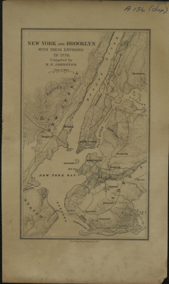
New York and Brooklyn with their environs in 1776: compiled by H.P. Johnston [18??]
Map No. NYC-1776 (18--?).Fl
Covers the entirety of Manhattan and Brooklyn also covers portions of the Bronx, eastern New Jersey, and Staten Island. Shows Brooklyn towns, the line of Denyse’s Ferry, and the site of the British landing at Gravesend Bay. Relief shown by shading and hachures. Accompanied by note from H.P. Johnston to the College of the City of New York’s Dept. of History.
Map area shown
Genre
Historical mapsRelation
Full catalog recordSize
17 × 11 cmDownload
Low Resolution ImageCreator
Johnston, Henry Phelps,Publisher
Brooklyn Historical SocietyCitation
New York and Brooklyn with their environs in 1776: compiled by H.P. Johnston; [18??], Map Collection, NYC-1776 (18--?).Fl; Brooklyn Historical Society.Scale
Scale [ca. 1:243,302]Loading zoom image...