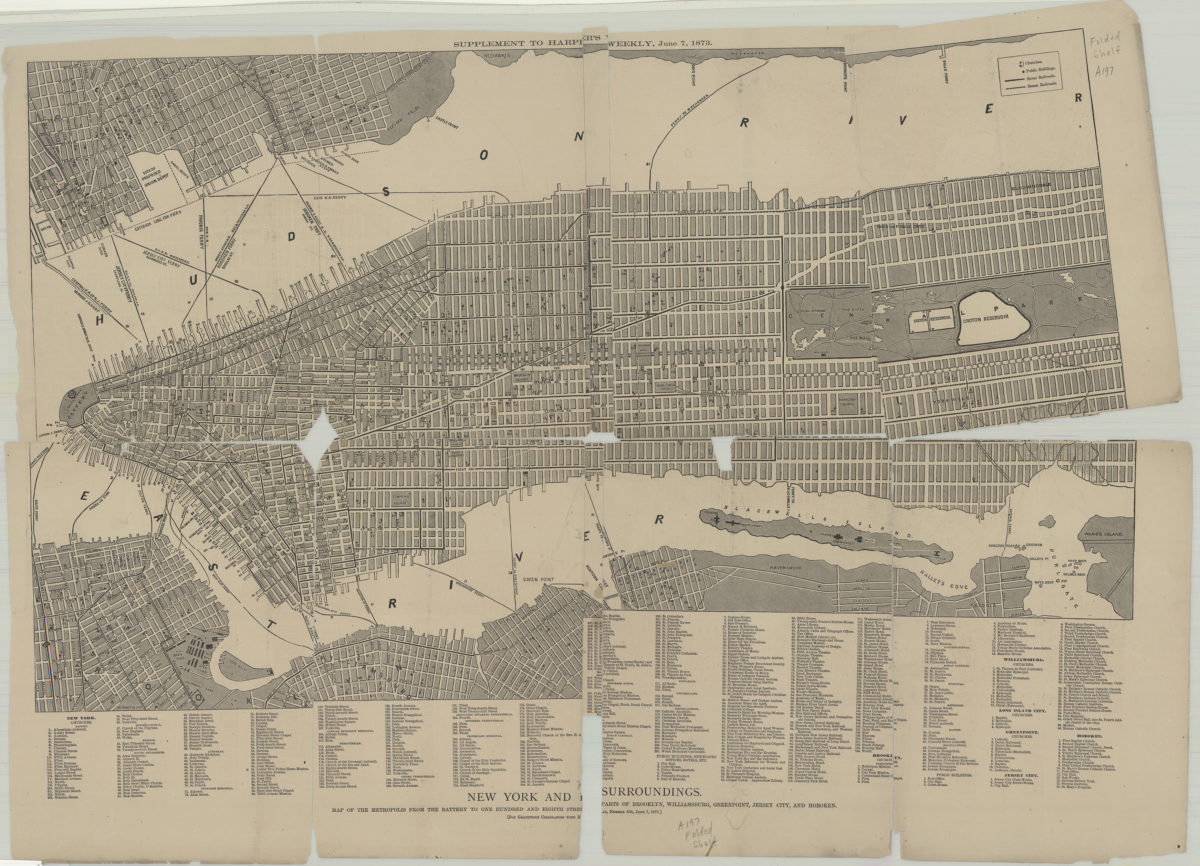
New York and its surroundings: map of the metropolis from the Battery to One Hundred and Eighth Street, and parts of Brooklyn, Williamsburg, Greenpoint, Jersey City, and Hoboken 1873
Map No. NYC-1873.Fl
Shows churches, public buildings, railroads, ferry lines, and piers. Includes key and index of churches and buildings. “Supplement to Harper’s Weekly, June 7, 1873”–Upper center margin.
Map area shown
Genre
MapRelation
Full catalog recordSize
45 × 76 cmDownload
Low Resolution Image
Creator
Publisher
Brooklyn Historical SocietyCitation
New York and its surroundings: map of the metropolis from the Battery to One Hundred and Eighth Street, and parts of Brooklyn, Williamsburg, Greenpoint, Jersey City, and Hoboken; 1873, Map Collection, NYC-1873.Fl; Brooklyn Historical Society.Scale
Scale [ca. 1:15,840]Loading zoom image...