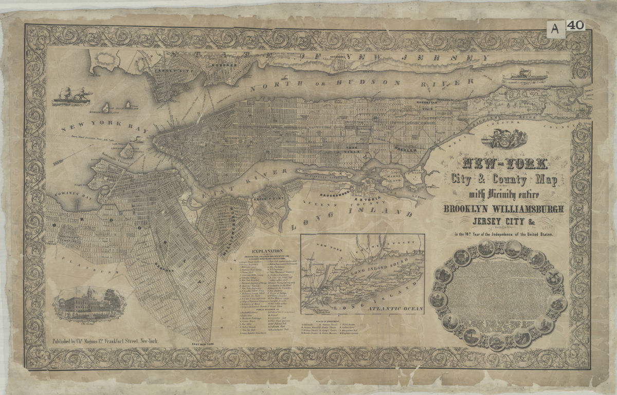
New-York City & County map: with vicinity entire, Brooklyn, Williamsburgh, Jersey City &c. in the 79th year of the independence of the United States [1855]
Map No. NYC-[1855].Fl
Covers the entirety of Manhattan also covers Brooklyn from approximately 42nd St. north to Green Point and east to East New York. Covers Blackwells Island, Wards Island, Randell’s Island, Sunken Meadow, Ellis’s Island, Bedlow’s Island, and Governors Island as well as portions of Queens, Long Island, and Hoboken. Shows ferry lines, places of amusement, universities, colleges, hospitals, benevolent institutions, and public buildings. Relief shown by hachures. Oriented with north to the upper right. Includes indexes, text, ill., decorative border, and inset of Long Island.
Map area shown
Genre
Historical mapsRelation
Full catalog recordSize
43 × 83 cmDownload
Low Resolution Image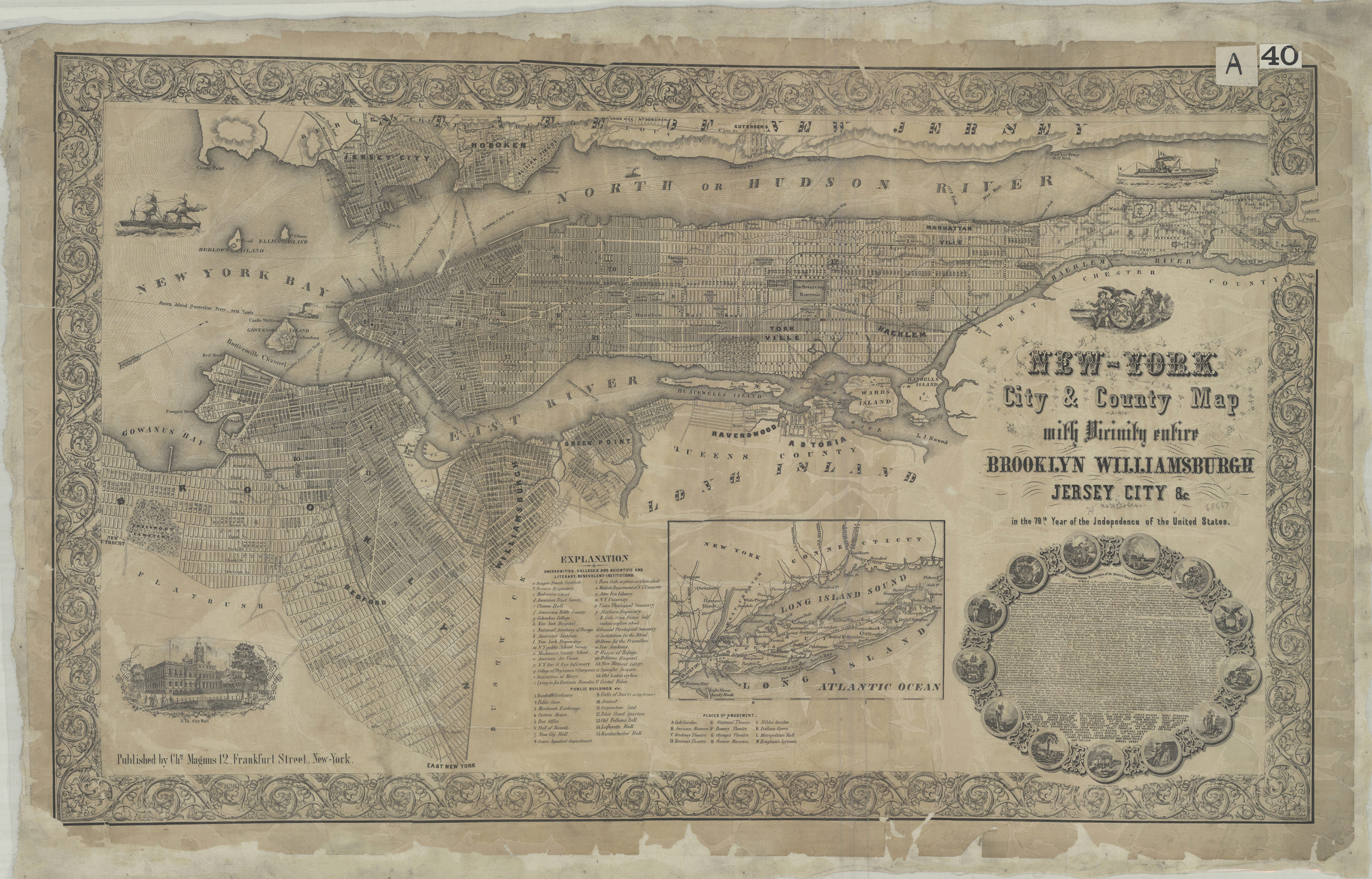
Creator
Magnus, Charles,Publisher
Brooklyn Historical SocietyCitation
New-York City & County map: with vicinity entire, Brooklyn, Williamsburgh, Jersey City &c. in the 79th year of the independence of the United States; [1855], Map Collection, NYC-[1855].Fl; Brooklyn Historical Society.Scale
Scale not givenLoading zoom image...