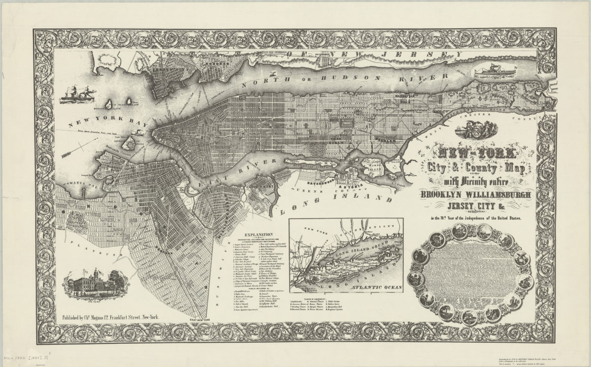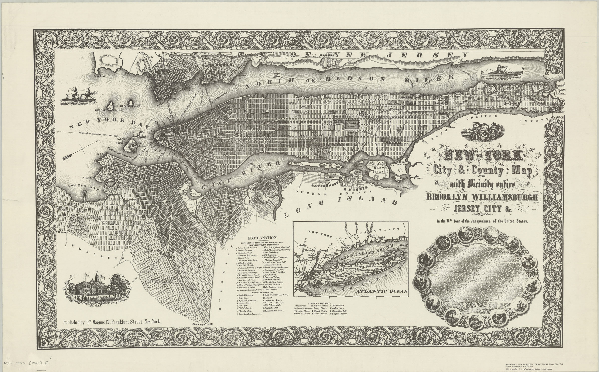
New-York City & County map with vicinity entire: Brooklyn, Williamsburgh, Jersey City &c. in the 79th year of the independence of the United States 1974
Facsimile covering the entirety of Manhattan also covers Brooklyn north from approximately 42nd St. to Green Point and east to East New York. Covers portions of Queens and Long Island, as well as Jersey City, Hoboken, Blackwells Island, Wards Island, Randell’s Island, Sunken Meadow, Ellis’s Island, Bedlow’s Island, and Governors Island. Shows railroads, universities, colleges, scientific and literary benevolent institutions, public buildings, places of amusement, and ferry lines. Relief shown by hachures. Oriented with north toward the upper right. Includes index, ill., text of Declaration of Independence, and inset map of Long Island. BHS copy: This is number 36 of an edition limited to 500 copies. (The number 36 written in pencil).
Map area shown
Genre
Historical mapsRelation
Full catalog recordSize
51 × 84 cmDownload
Low Resolution Image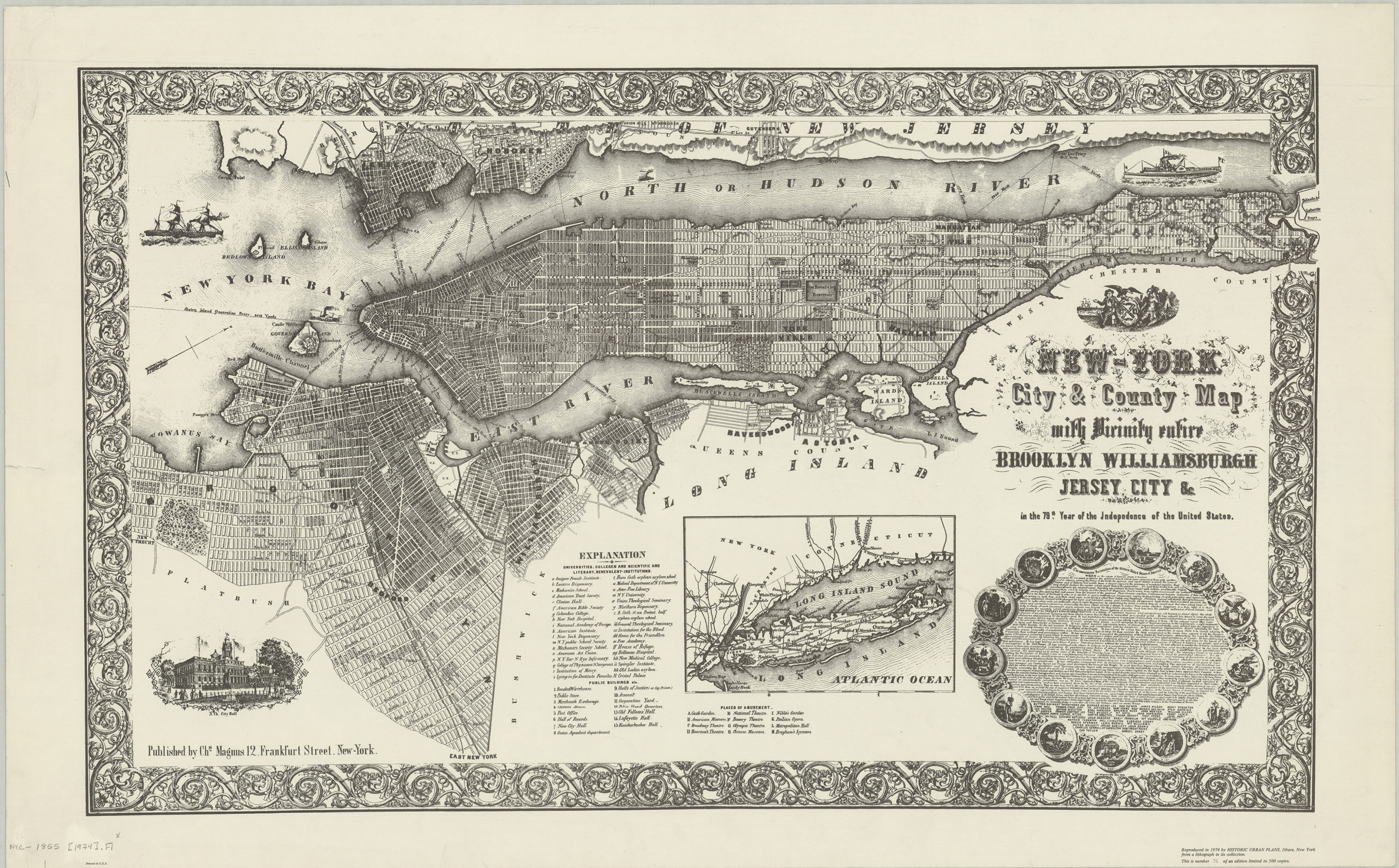
Creator
Magnus, Charles,Publisher
Brooklyn Historical SocietyCitation
New-York City & County map with vicinity entire: Brooklyn, Williamsburgh, Jersey City &c. in the 79th year of the independence of the United States; 1974, Map Collection, NYC-1855 (1974).Fl; Brooklyn Historical Society.Scale
Scale not given