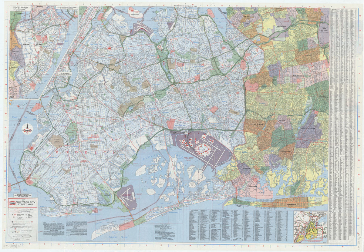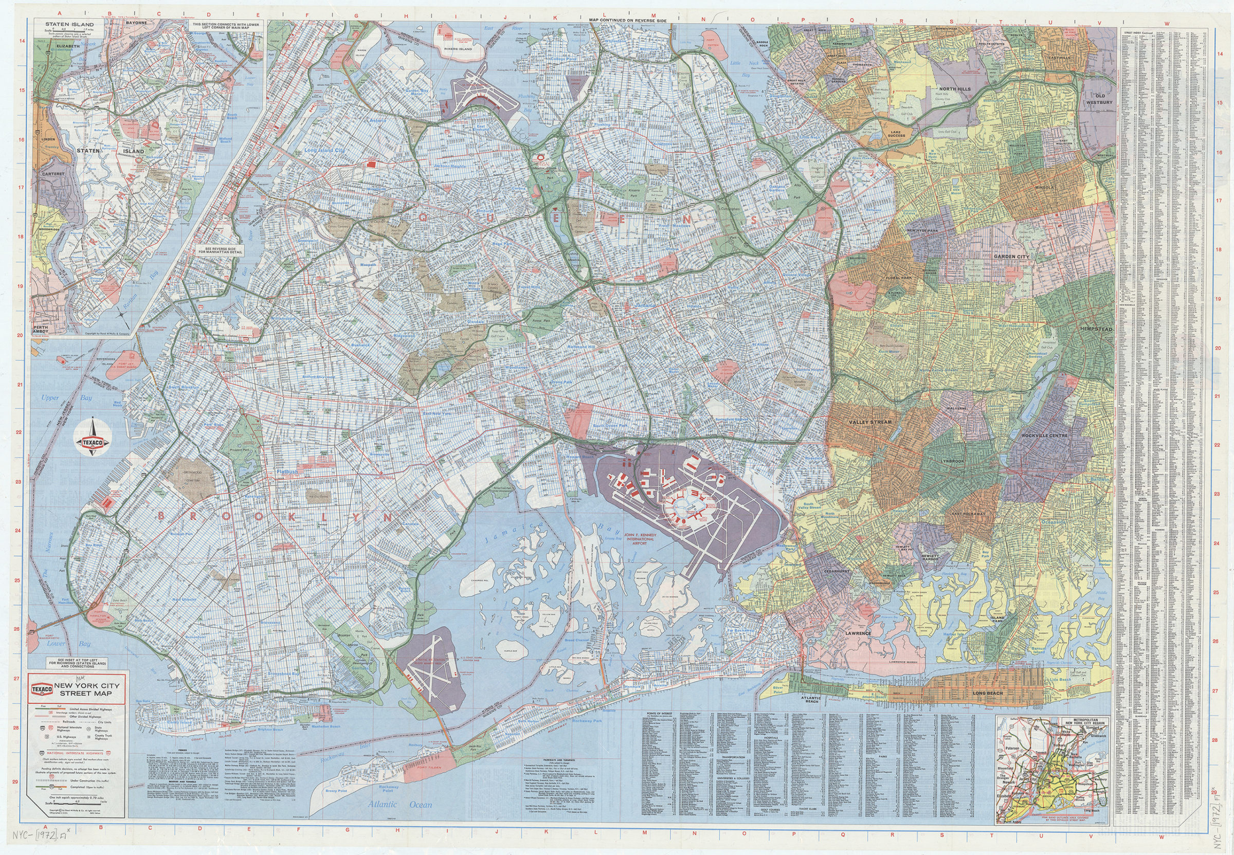
New York City street map: [prepared for] Texaco [1972]
Map No. NYC-[1972].Fl
Also covers portions of Nassau County and Westchester County. Shows county boundaries, neighborhoods, and some structures. Includes text, key, indexes, tables, coverage map, and inset continuation map. Inset continuation map: Staten Island (Scale ca. 1:95,040). “726213-10.” “726212-9.”
Map area shown
Genre
Road mapsRelation
Full catalog recordSize
66 × 94 cmDownload
Low Resolution Image
Creator
Rand McNally and Company,Publisher
Brooklyn Historical SocietyCitation
New York City street map: [prepared for] Texaco; [1972], Map Collection, NYC-[1972].Fl; Brooklyn Historical Society.Scale
Scale [ca. 1:37,352] 1 inLoading zoom image...