
New York City Transit subway map: multilingual : English, Français, Español, Deutsch, Italiano, Nihongo, Chung wen/: MTA-New York City Transit [ca. 1996]
Map No. NYC-1996.Fl
Schematic map showing subway lines in Manhattan, the Bronx, Queens, and Brooklyn. Panel title. Includes text, notes, and route and schedule tables, and table of wheelchair-accessible stations. On verso: text, color illustrations, and advertisement. “22-30-1216.”
Map area shown
Genre
Transportation mapsRelation
Full catalog recordSize
55 × 45 cmDownload
Low Resolution Image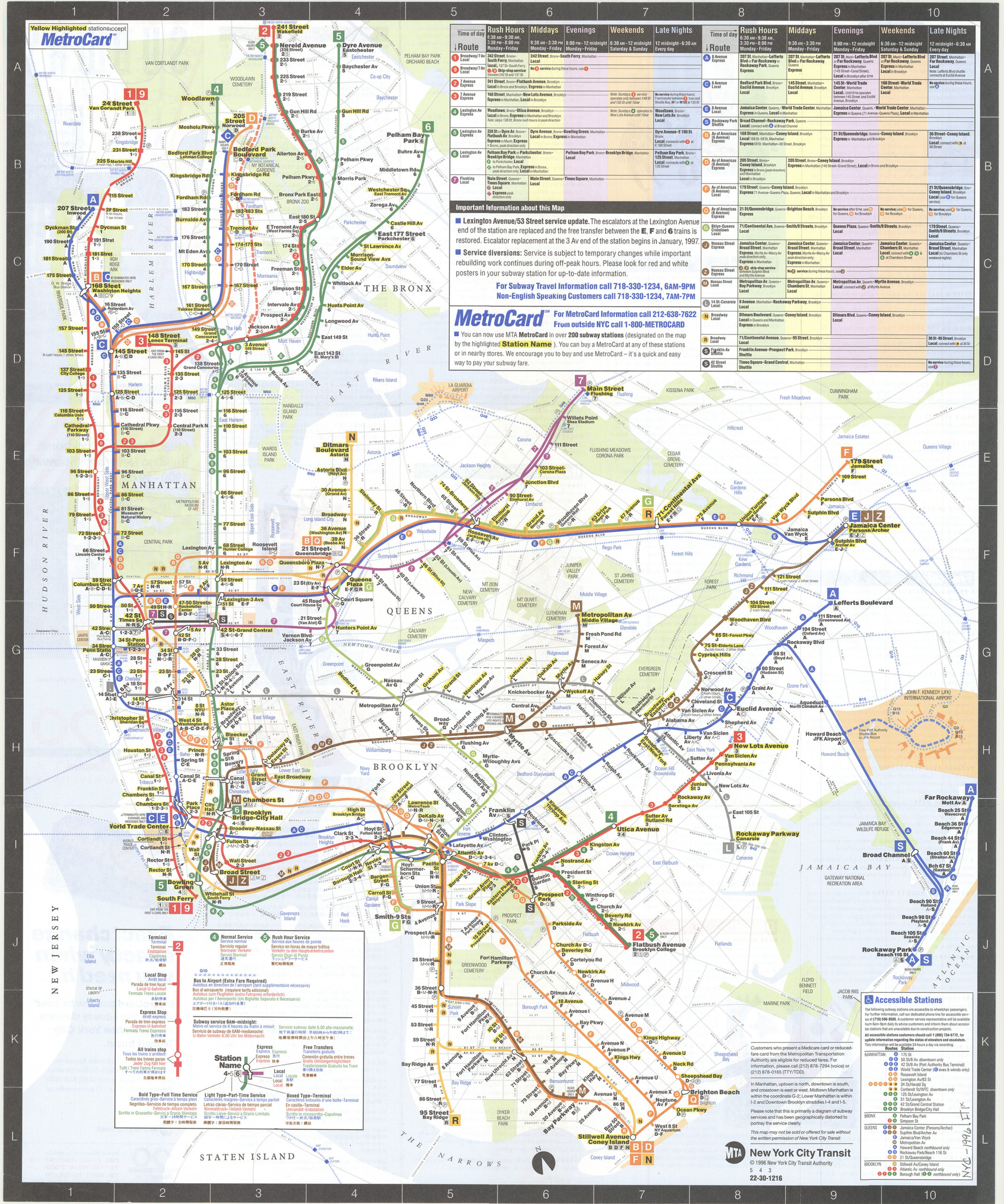
Creator
New York City Transit Authority,Publisher
Brooklyn Historical SocietyCitation
New York City Transit subway map: multilingual : English, Français, Español, Deutsch, Italiano, Nihongo, Chung wen/: MTA-New York City Transit; [ca. 1996], Map Collection, NYC-1996.Fl; Brooklyn Historical Society.Scale
Not drawn to scaleLoading zoom image... 