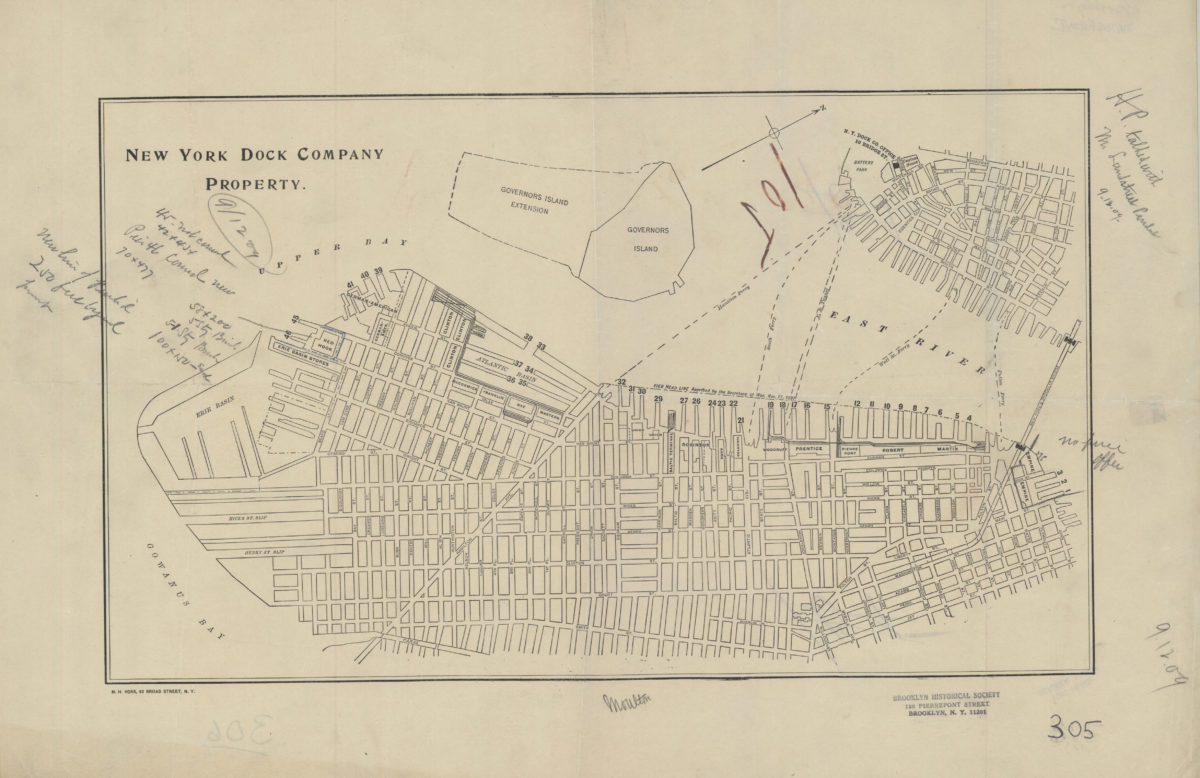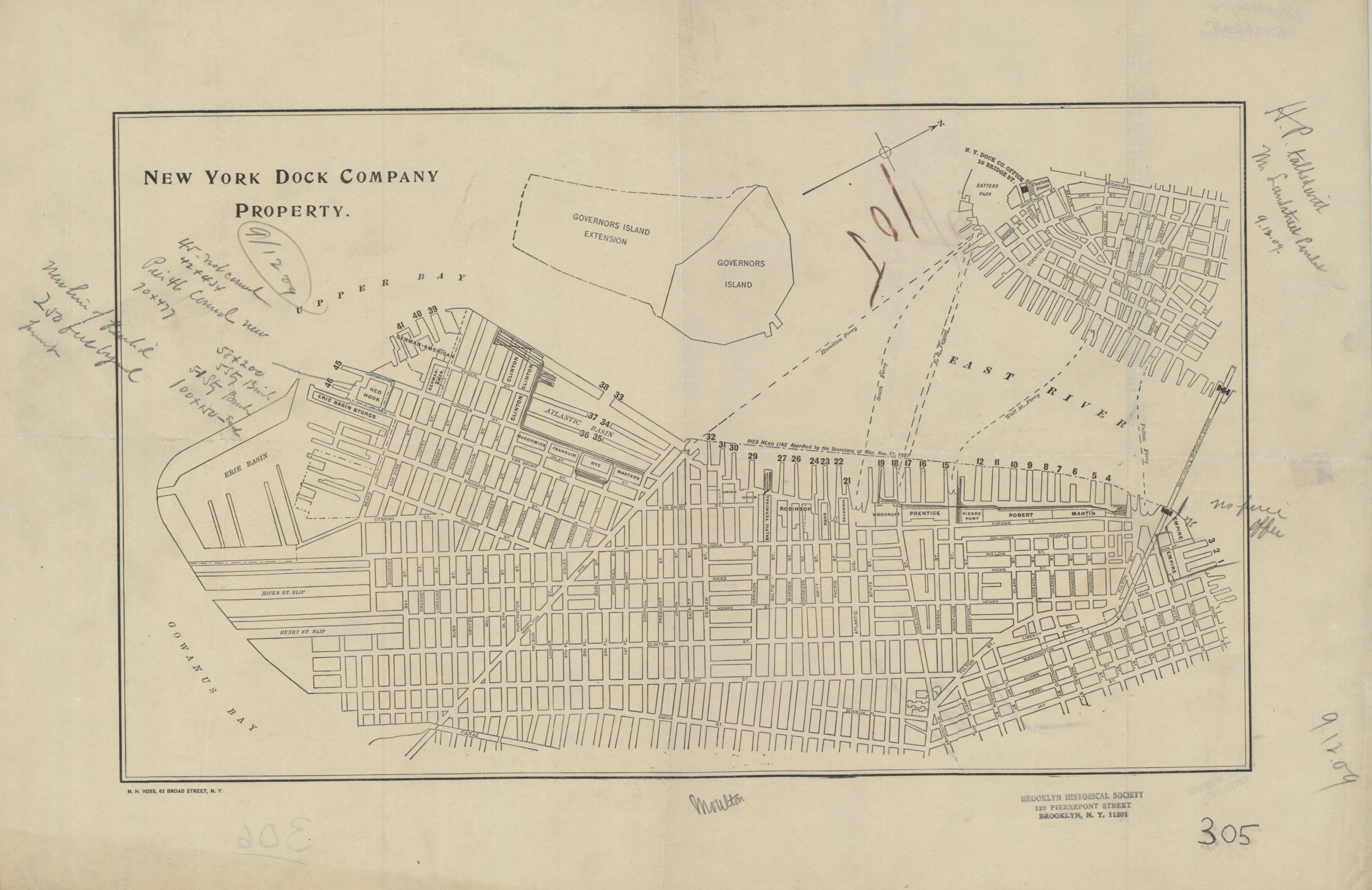
New York Dock Company property [1897]
Map No. B P-[1897?]c.Fl
Cadastral map covering Brooklyn north from the Gowanus Bay to John St. and east to the Gowanus Canal. Also covers Governors Island and a portion of Lower Manhattan. Shows piers, slips, and buildings owned by the New York Dock Company. Also shows the names of property owners near the Brooklyn waterfront, ferry lines, pierhead lines, and the Governors Island extension. Oriented with north to the upper right. Watermark: Crescent Bond. BHS copy annotated in blue, gray, and brown pencil.
Map area shown
Genre
Cadastral mapsRelation
Full catalog recordSize
30 × 50 cmDownload
Low Resolution Image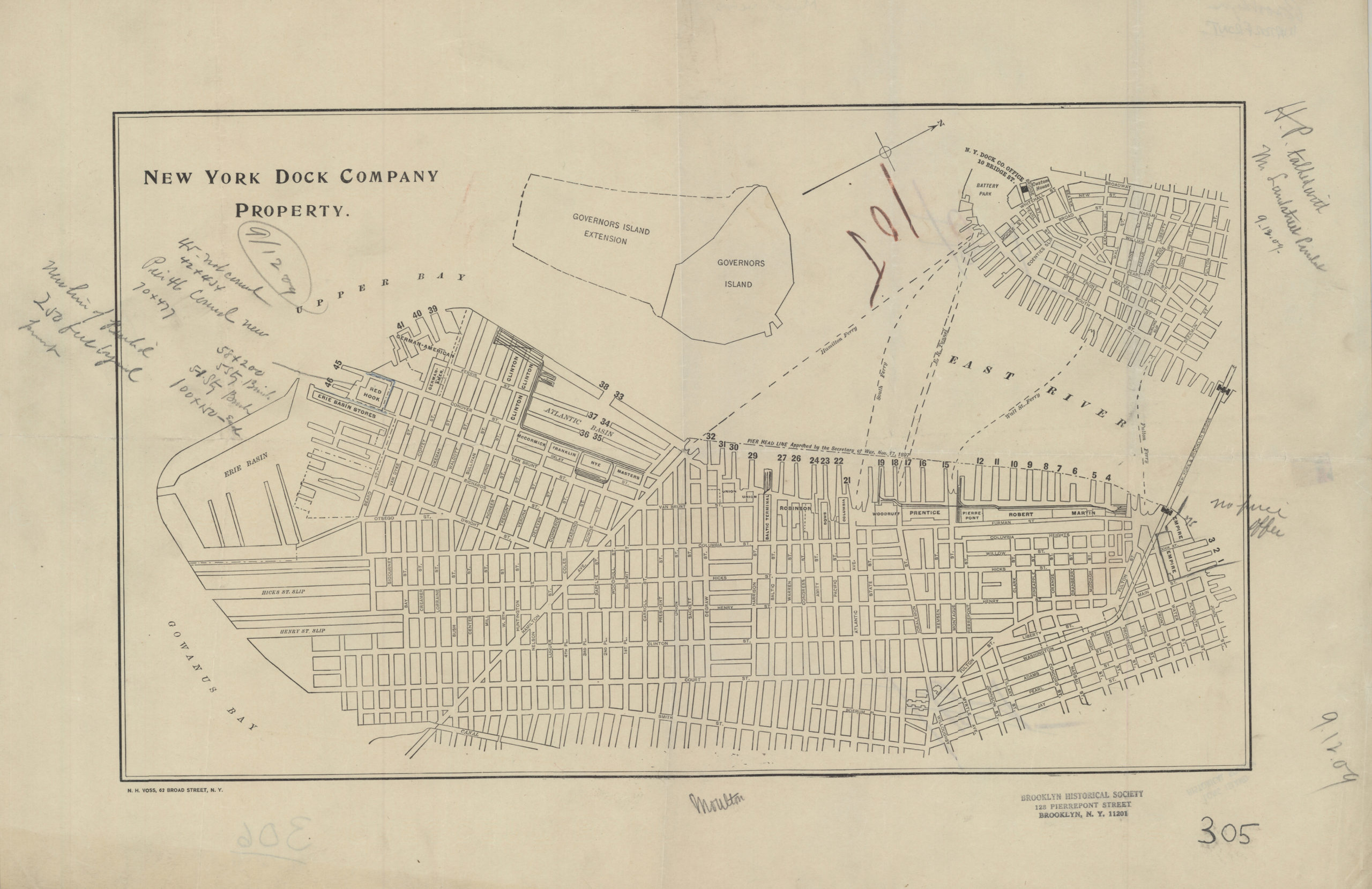
Creator
Voss, N. H.,Publisher
Brooklyn Historical SocietyCitation
New York Dock Company property; [1897], Map Collection, B P-[1897?]c.Fl; Brooklyn Historical Society.Scale
Scale not givenLoading zoom image...