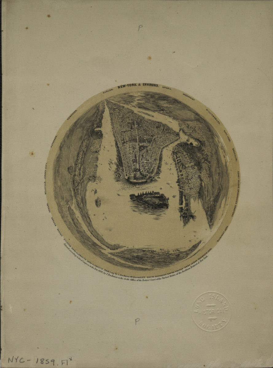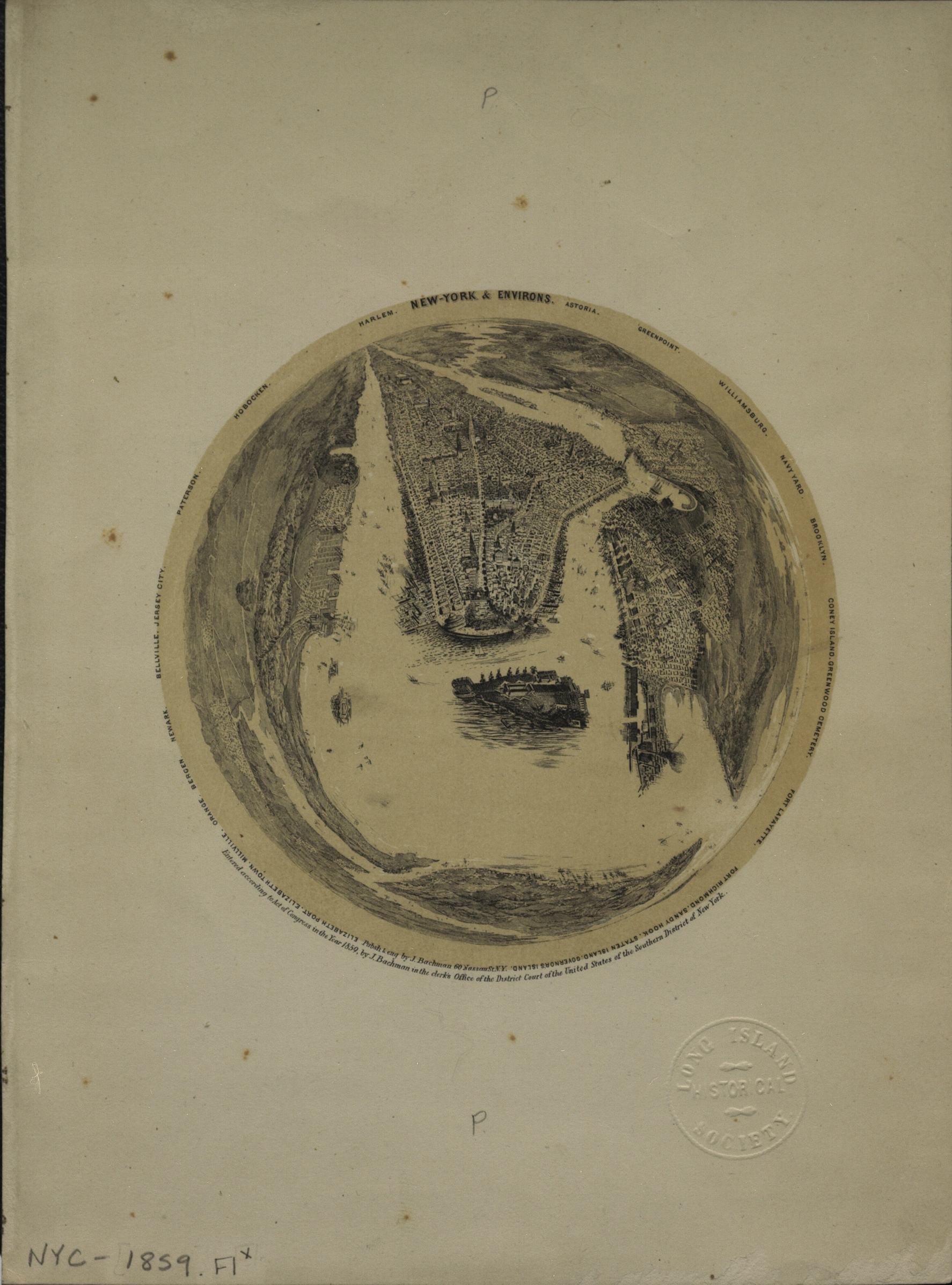
New York & environs: Astoria, Williamsburg, Navy Yard, Brooklyn, Coney Island, Greenwood Cemetery, Fort Lafayette, Fort Richmond, Sandy Hook, Staten Island, Governor’s Island, Elizabeth Port, Elizabeth Town, Millville, Orange, Newark, Bellville, [ca. 1859]
Map No. NYC-1859.Fl
Circular bird’s-eye view looking northeast from Staten Island. Shows Manhattan, Governor’s Island, and portions of Brooklyn, Queens, eastern New Jersey, and Staten Island. Relief shown pictorially. “Entered according to Act of Congress in the Year 1859, by J. Bachman in the clerk’s Office of the District Court of the United States of the Southern District of New York.”
Places
Map area shown
Genre
Aerial viewsRelation
Full catalog recordSize
28 × 21 cmDownload
Low Resolution ImageCreator
Bachman, J.,Publisher
Brooklyn Historical SocietyCitation
New York & environs: Astoria, Williamsburg, Navy Yard, Brooklyn, Coney Island, Greenwood Cemetery, Fort Lafayette, Fort Richmond, Sandy Hook, Staten Island, Governor’s Island, Elizabeth Port, Elizabeth Town, Millville, Orange, Newark, Bellville,; [ca. 1859], Map Collection, NYC-1859.Fl; Brooklyn Historical Society.Scale
Not drawn to scaleLoading zoom image...