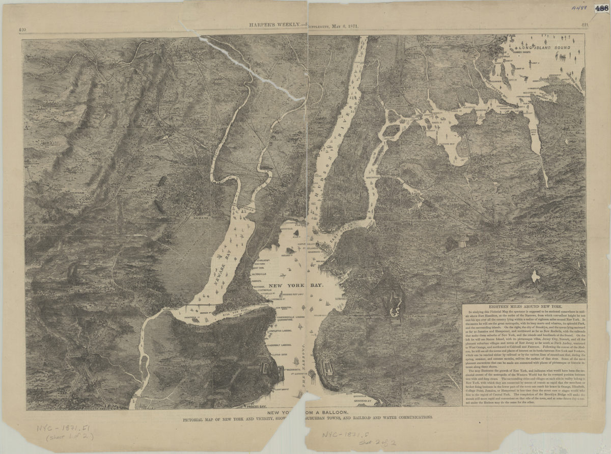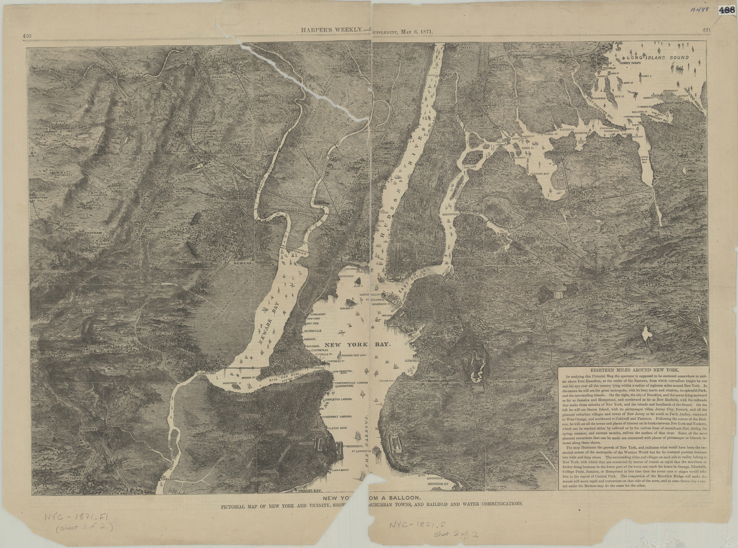
New Yo[rk fr]om a balloon: pictorial map of New York and vicinity, show[ing … ] suburban towns, and railroad and water communications [1871]
Map No. NYC-[1871].Fl
Bird’s-eye view of the New York Metropolian Area shown as if the viewer is in mid-air above Fort Hamilton, at the outlet of the Narrows. Covers a radius of 18 miles around New York City. Relief shown pictorially. “Harper’s Weekly–Supplement, May 6, 1871”–Upper center margin. Includes text. On verso: Text unrelated to main view. “420”–Upper left margin of recto. “421”–Upper right margin of recto. “422”–Upper left margin of verso. “419”–Upper right margin of verso. Item is imperfect missing portion of lower center margin containing some title information.
Map area shown
Genre
Aerial viewsRelation
Full catalog recordSize
35 × 52 cmDownload
Low Resolution Image
Creator
Publisher
Brooklyn Historical SocietyCitation
New Yo[rk fr]om a balloon: pictorial map of New York and vicinity, show[ing … ] suburban towns, and railroad and water communications; [1871], Map Collection, NYC-[1871].Fl; Brooklyn Historical Society.Scale
Not drawn to scaleLoading zoom image...