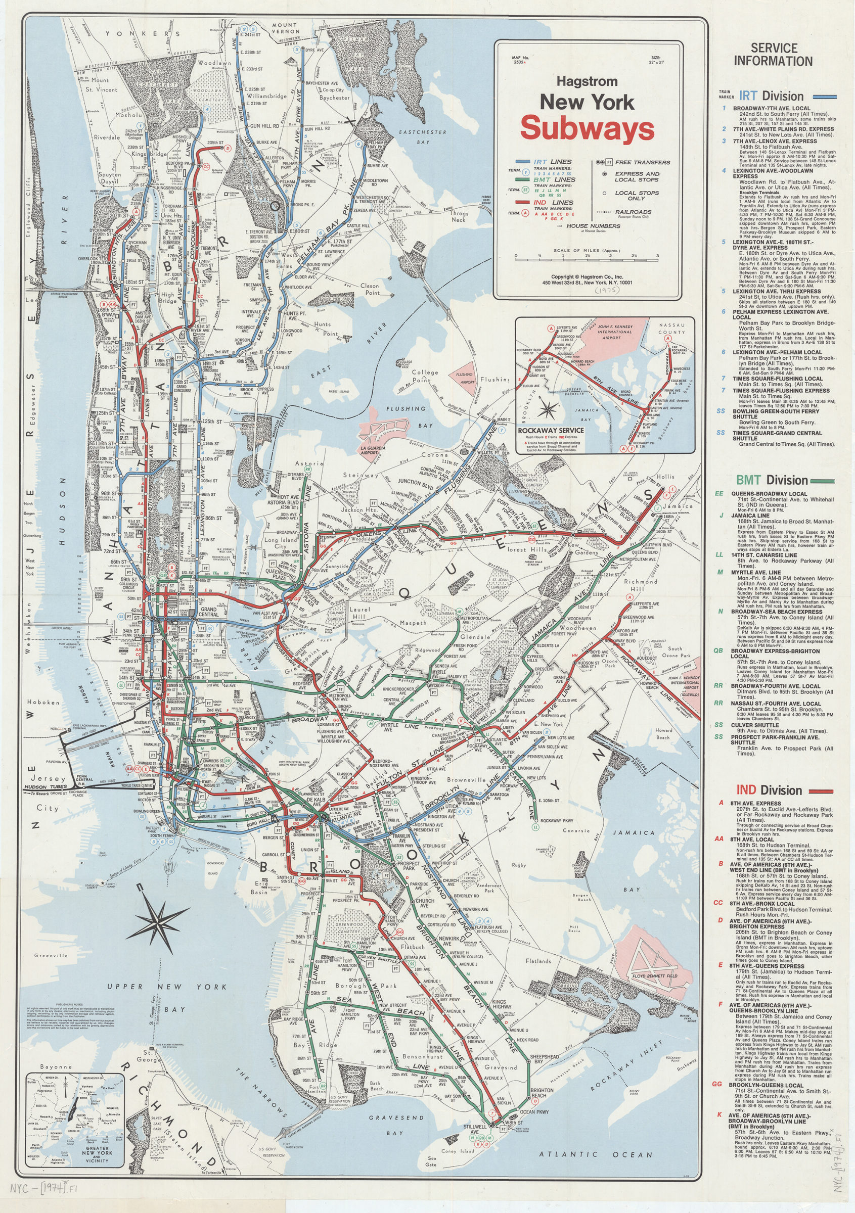
New York subways: Hagstrom [1974]
Map No. NYC-[1974].Fl
Covers the Bronx, Manhattan, Queens, and Brooklyn. Shows parks, airports, cemeteries, ferry lines and railroads. Bridges shown pictorially. Oriented with north to the upper left. Publication date derived from code: S-OS. Includes publisher’s notes, service information on IRT, BMT, and IND divisions, inset, and location map of “Greater New York and vicinity.” Inset: Rockaway service. Cover includes publisher’s map list and ill. “Map no. 2535A.”
Map area shown
Genre
Transportation mapsRelation
Full catalog recordSize
79 × 56 cmDownload
Low Resolution Image
Creator
Hagstrom Company,Publisher
Brooklyn Historical SocietyCitation
New York subways: Hagstrom; [1974], Map Collection, NYC-[1974].Fl; Brooklyn Historical Society.Scale
Scale [ca. 1:52,000]Loading zoom image... 