New York: the plan drawn & engraved by J. Rapkin ; the illustrations drawn & engraved by H. Winkles [185?]
Map No. NYC-[185-?]b.Fl
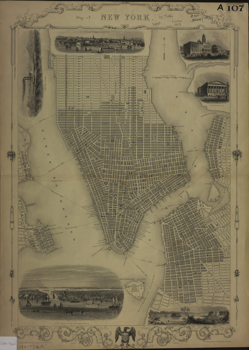
Covers Brooklyn north from the Atlantic Dock to N. 13th St. and east to the interior of Wallabout Bay. Covers Manhattan north to 42nd St., Governor’s Island, and portions of Hoboken and Jersey City. Shows Manhattan wards, ferry lines, docks, and slips. Includes decorative border and titled ill. Titled ill.: New York from Williamsburgh — The Narrows from Fort Hamilton — Custom House — City Hall — Brooklyn — A New York steamer.
Map area shown
Genre
MapRelation
Full catalog recordSize
45 × 32 cmDownload
Low Resolution Image
Creator
Rapkin, J.,Publisher
Brooklyn Historical SocietyCitation
New York: the plan drawn & engraved by J. Rapkin ; the illustrations drawn & engraved by H. Winkles; [185?], Map Collection, NYC-[185-?]b.Fl; Brooklyn Historical Society.Scale
Scale [ca. 1:15,840]Loading zoom image...