New York World’s Fair 1964-1965: [prepared for] Carey Transportation, Inc. ; published by City Street Directory, Inc [1964; 1964]
Map No. Q-1964-1965.Fl
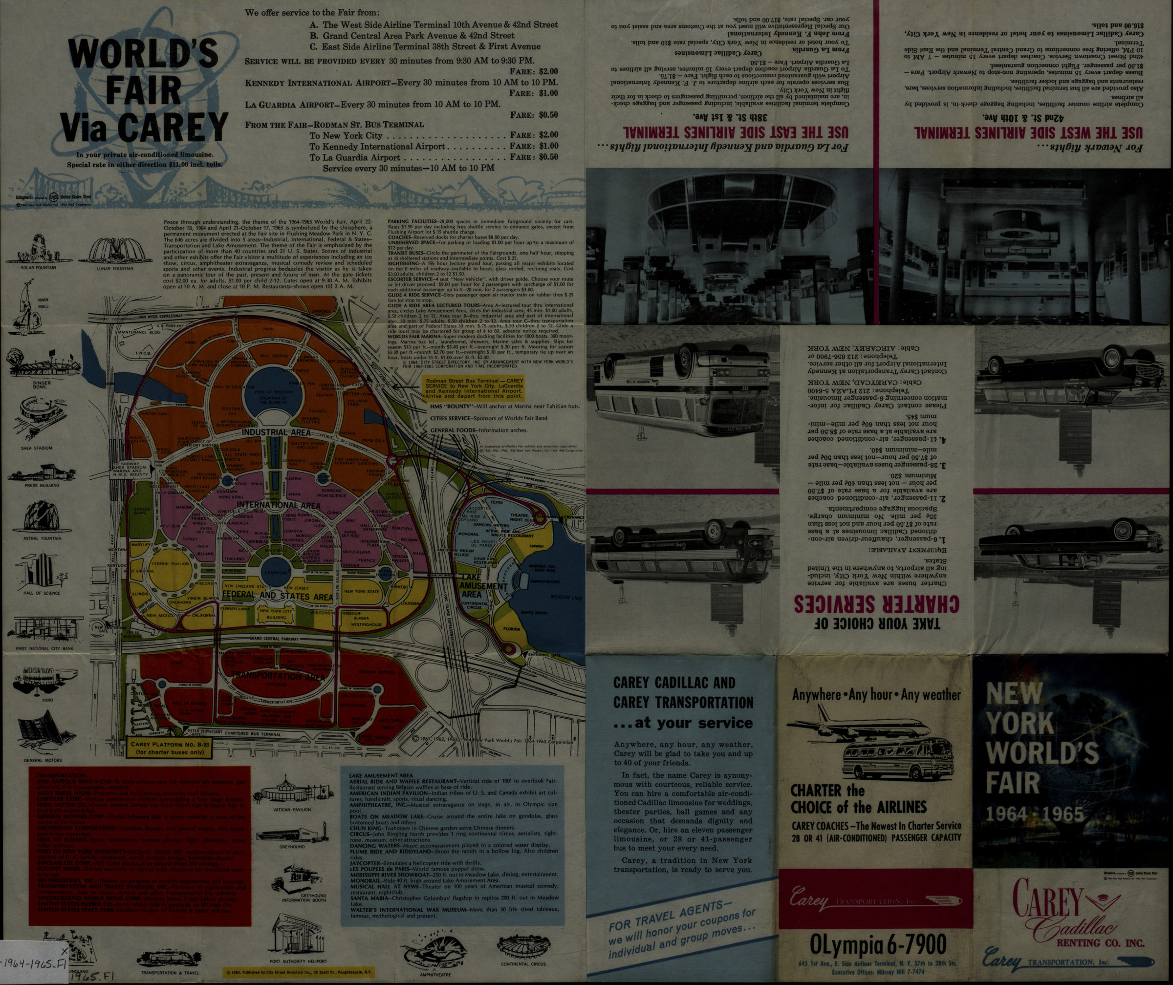
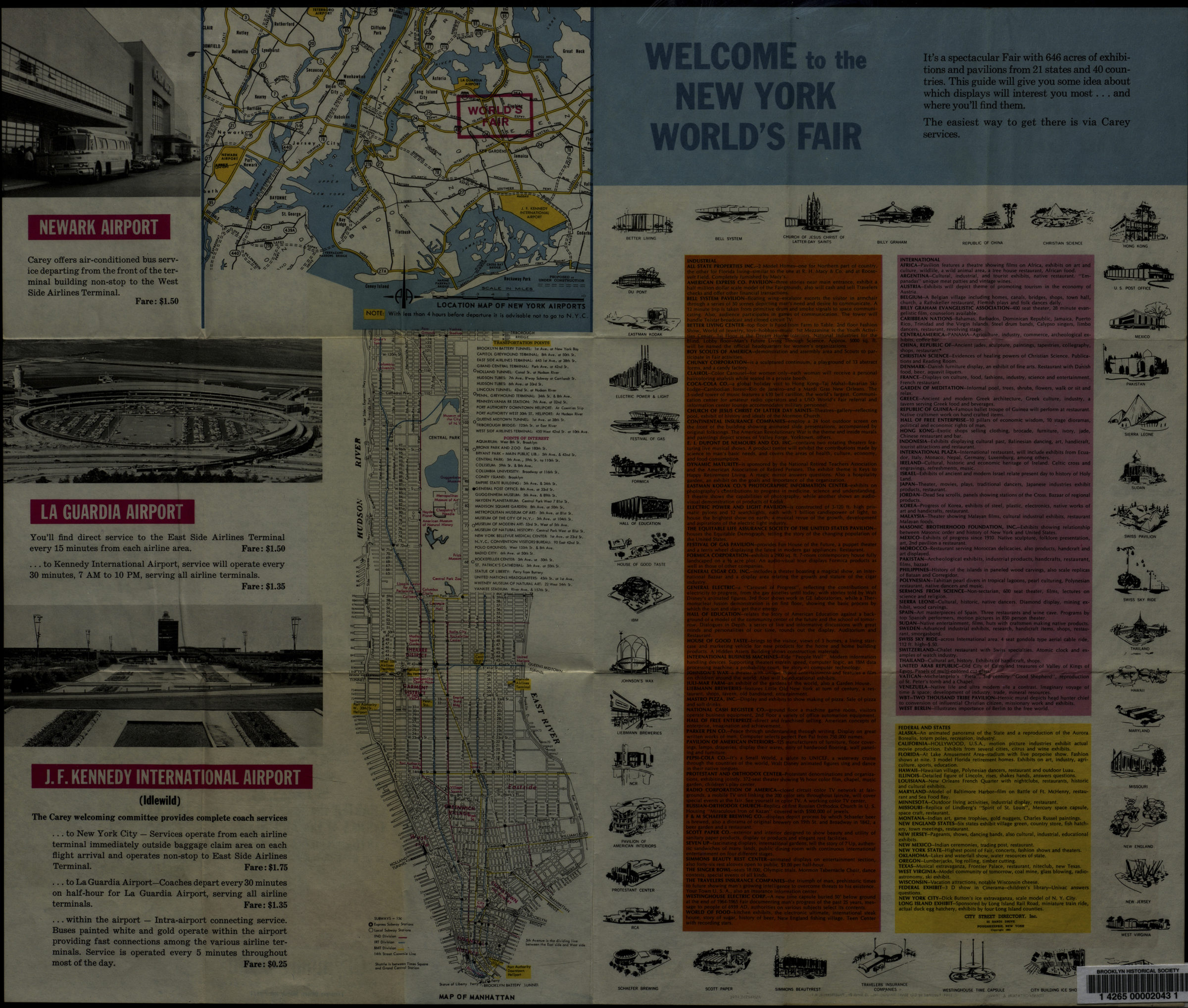
Panel title. Includes text, tourist information, illustrations and advertising. Map of Manhattan includes subway lines, indexes to transportation points and points of interest. New York World’s Fair via Carey. Location map of New York airports. Map of Manhattan.
Map area shown
Genre
Tourist mapsRelation
Full catalog recordSize
42 × 50 cmDownload
Low Resolution Image
Creator
City Street Directory, inc.,Publisher
Brooklyn Historical SocietyCitation
New York World’s Fair 1964-1965: [prepared for] Carey Transportation, Inc. ; published by City Street Directory, Inc; [1964; 1964], Map Collection, Q-1964-1965.Fl; Brooklyn Historical Society.Scale
Scale not givenLoading zoom image... 