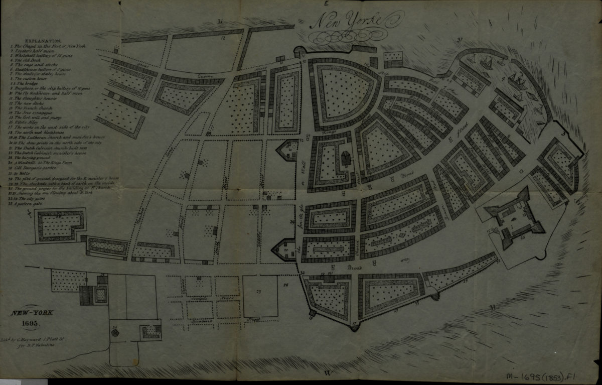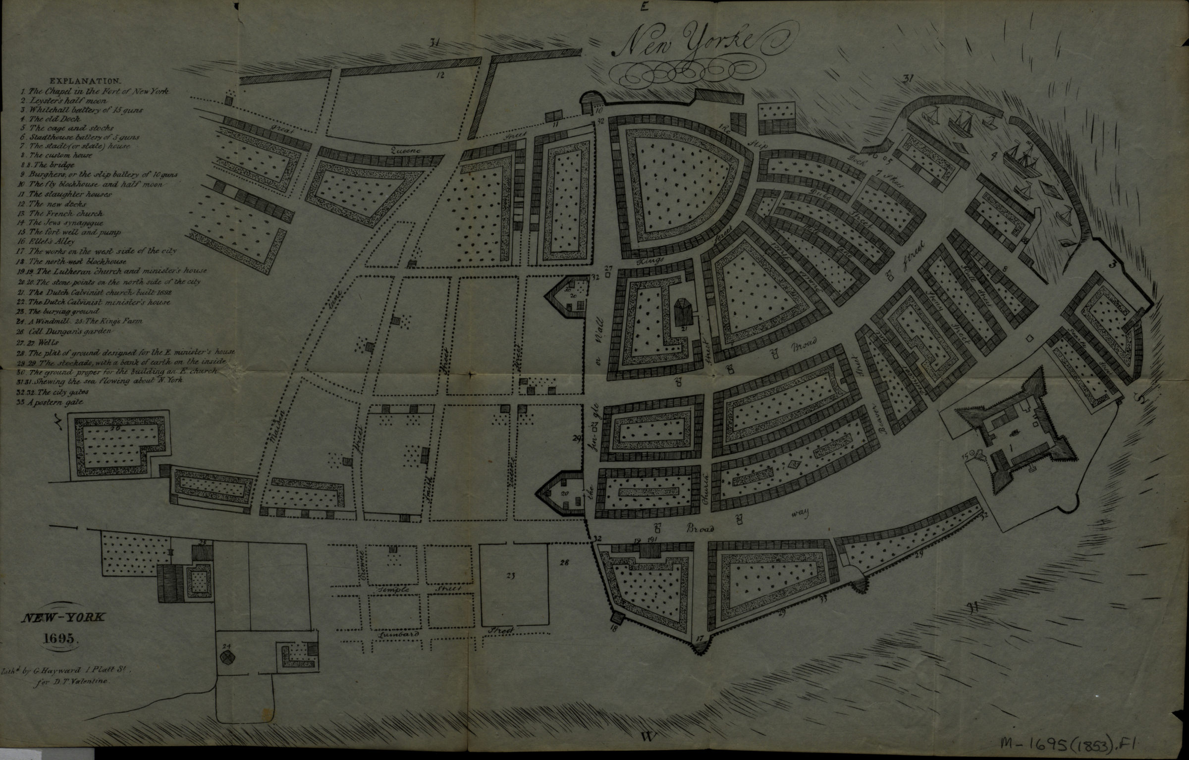
New Yorke, 1695 [1853]
Map No. M-1695 (1853).Fl
Covers Lower Manhattan. Shows buildings, streets, fort, and piers. Facsimile of ms. map. Cartography attributed to John Miller by Cohen. Appears in: D.T. Valentine’s History of the city of New York, 1853. Oriented with north toward the lower left. Includes index to points of interest.
Map area shown
Genre
MapRelation
Full catalog recordSize
24 × 37 cmDownload
Low Resolution Image
Creator
Miller, John,Publisher
Brooklyn Historical SocietyCitation
New Yorke, 1695; [1853], Map Collection, M-1695 (1853).Fl; Brooklyn Historical Society.Scale
Scale not givenLoading zoom image...