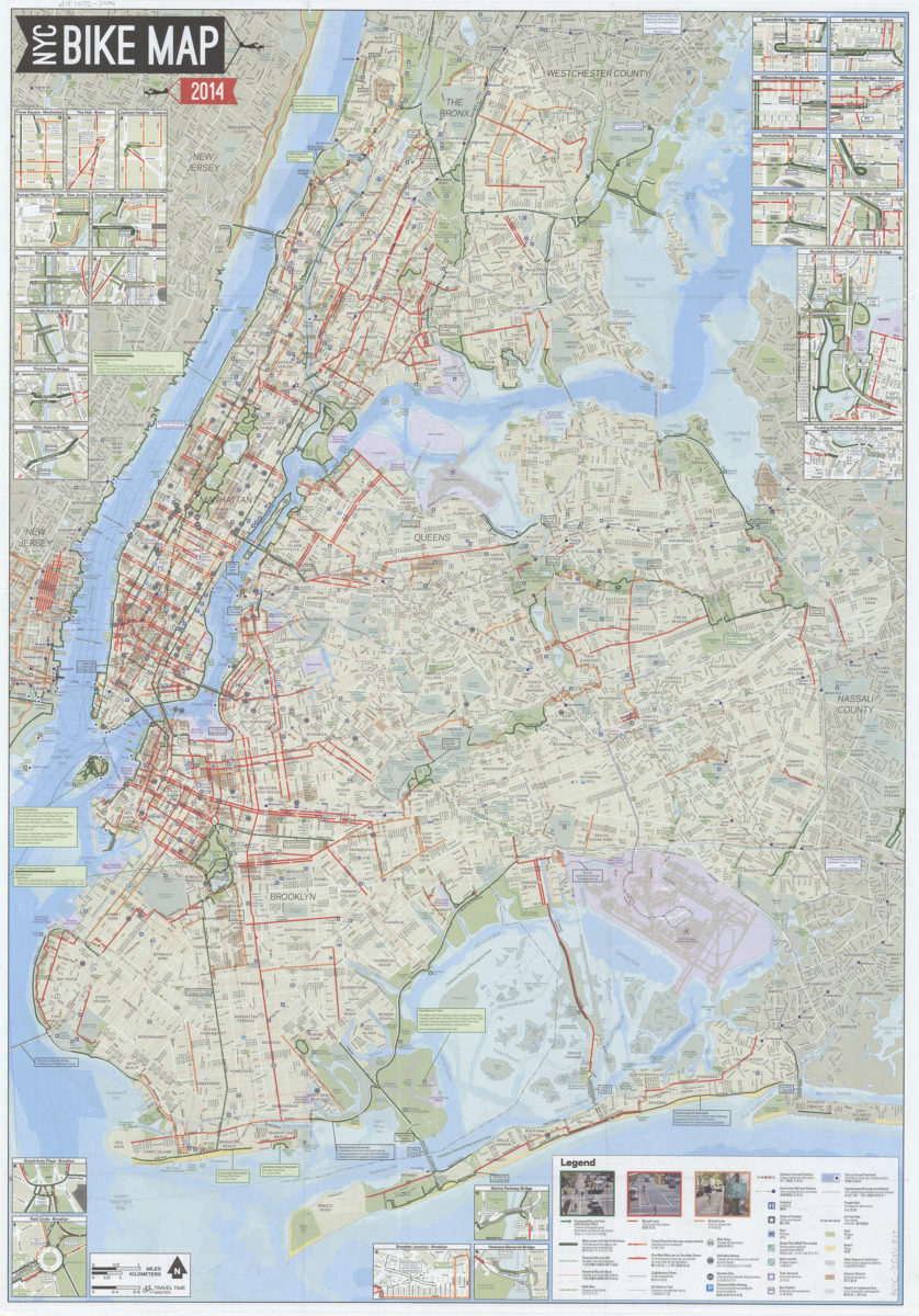
NYC bike map 2014: NYC Department of Transportation, Department of Parks & Recreation, Department of City Planning [2014]
Map No. NYC-2014.Fl
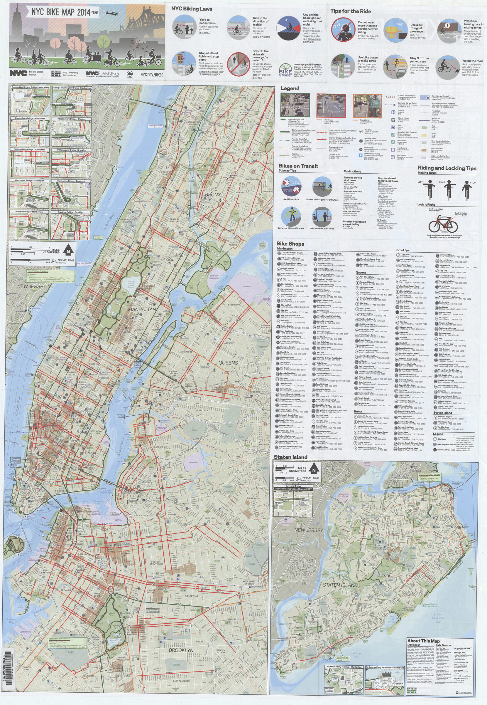
Panel title. Shows bike paths, lanes, and routes, existing and proposed. Also shows bike shops, parks, transit facilities, hospitals, and other places of interest. Includes notes, color illustations, 25 insets and a legend in English, Spanish and Chinese. Also includes larger scale map of Manhattan with adjacent parts of Bronx, Queens, and Brooklyn (approximately 1:32,000) map of Staten Island (approximately 1:68,000) 14 insets color illustrations diagrams, and text regarding bike laws and safety information about taking bikes on mass transit and index/directory to bike shops on verso.
Map area shown
Genre
Road mapsRelation
Full catalog recordSize
87 × 61 cmDownload
Low Resolution Image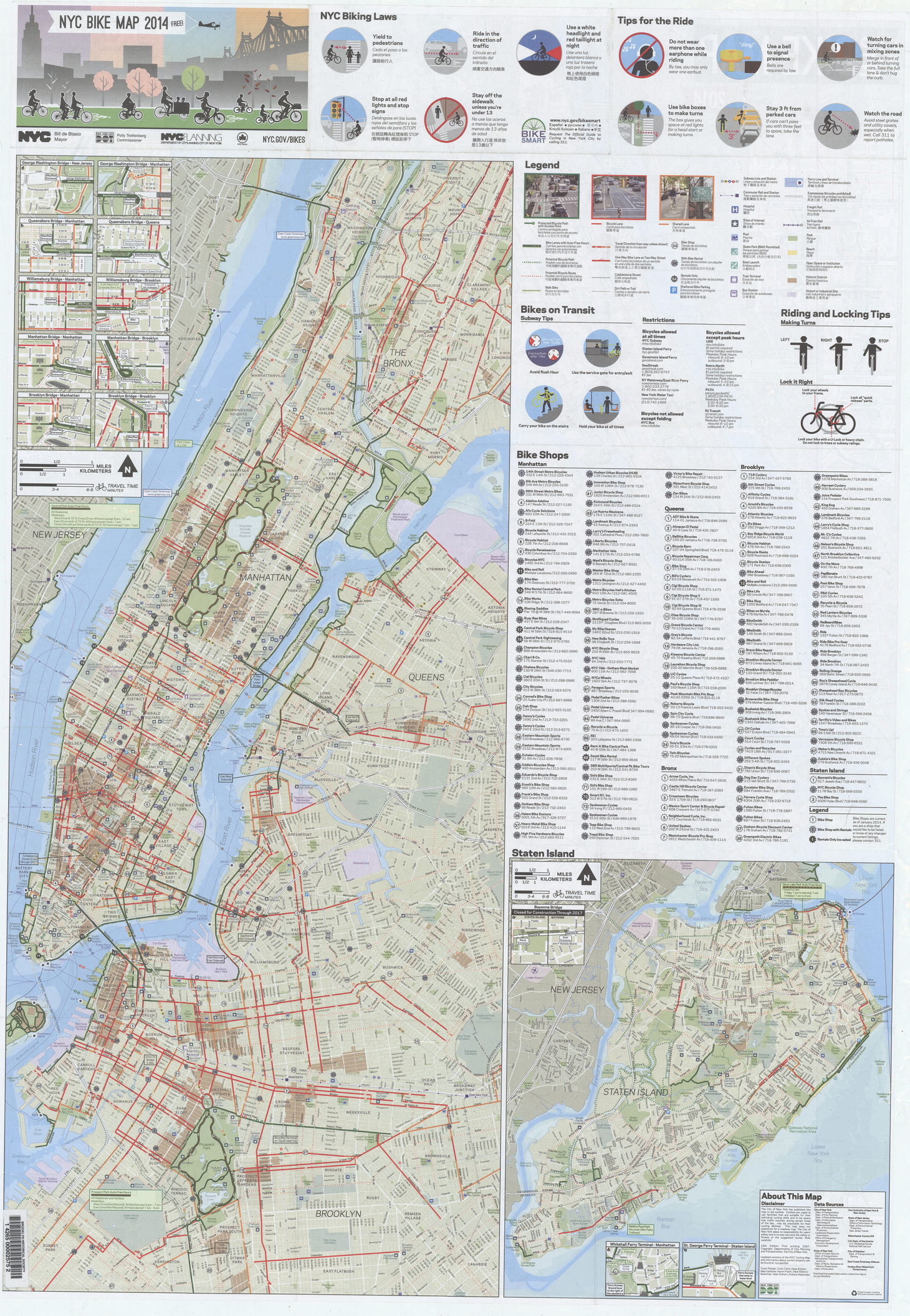
Creator
New York (N.Y.).; Department of Transportation,Publisher
Brooklyn Historical SocietyCitation
NYC bike map 2014: NYC Department of Transportation, Department of Parks & Recreation, Department of City Planning; [2014], Map Collection, NYC-2014.Fl; Brooklyn Historical Society.Scale
Scale approximately 1:49,Loading zoom image...