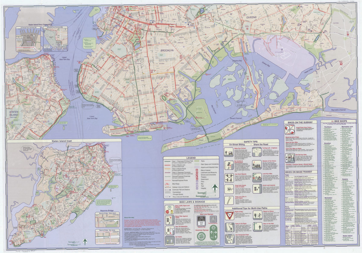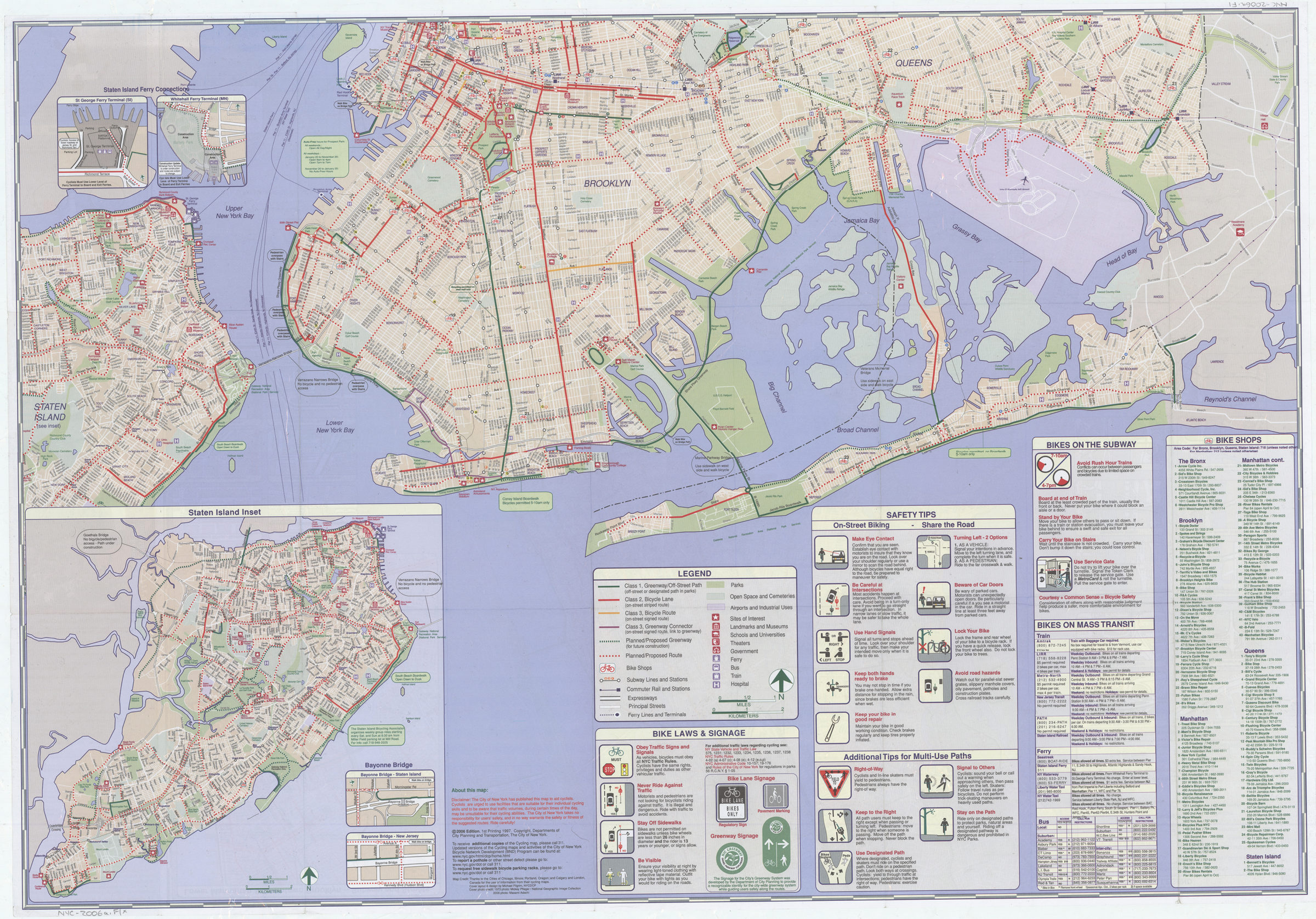

NYC cycling map, 2006: the Bronx, Brooklyn, Manhattan, Queens, Staten Island : timeless fun! : five boroughs, one map!: the New York Cycling Map was designed by in-agency staff at the New York City Department of City Planning [ca. 2006]
Map No. NYC-2006a.Fl
Shows on-street bike lanes and routes as well as off-street paths and greenways, existing and proposed. Also shows bike shops, parks, transit facilities, hospitals, and other places of interest. Panel title. Includes directory to cycling organizations, notes, col. ill., 23 insets of bridges and bridge approaches, 2 insets of ferry connections, insets of Staten Island and lower Manhattan with downtown Brooklyn, col. diagrams and text regarding bike laws, signage, and safety, information about taking bikes on mass transit, and index/directory to bike shops.
Map area shown
Genre
Road mapsRelation
Full catalog recordSize
119 × 87 cmDownload
Low Resolution Image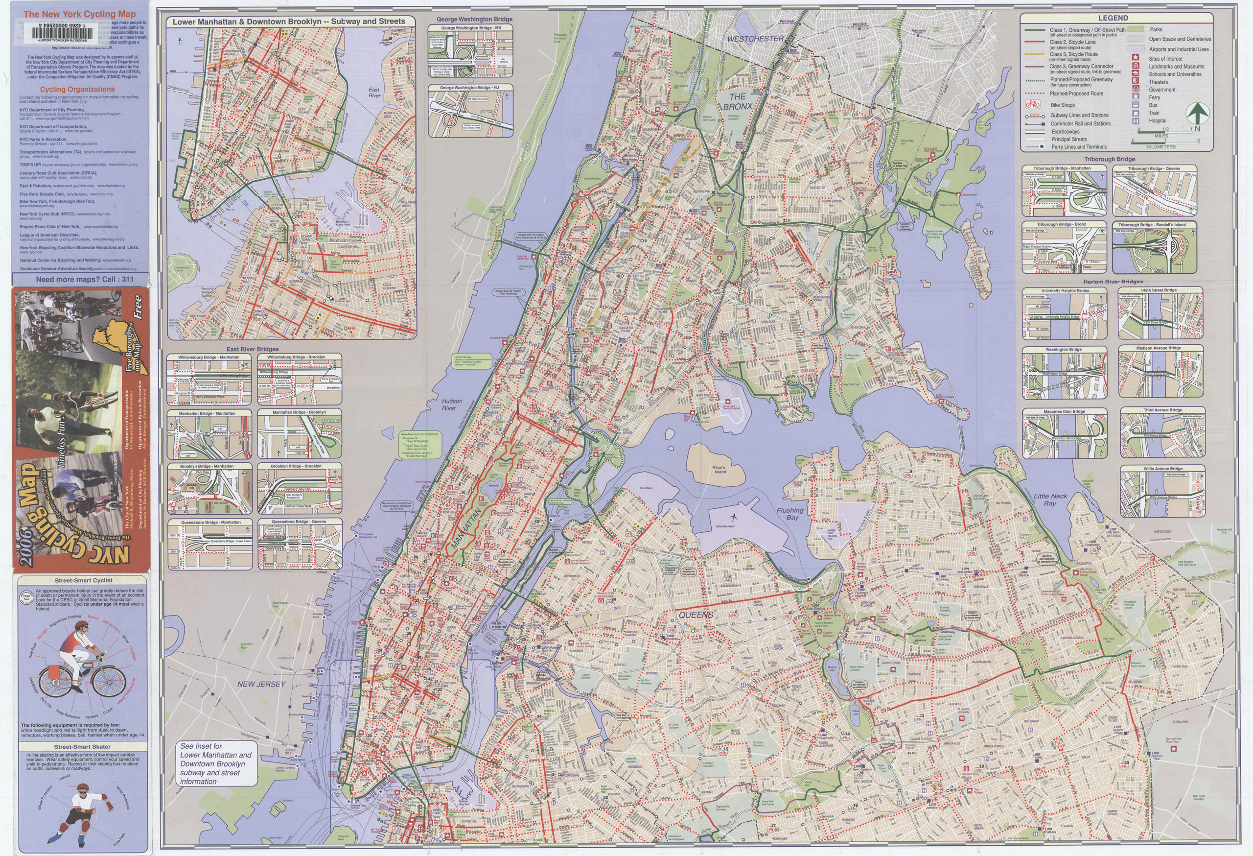
Creator
New York (N.Y.).; Department of Transportation,Publisher
Brooklyn Historical SocietyCitation
NYC cycling map, 2006: the Bronx, Brooklyn, Manhattan, Queens, Staten Island : timeless fun! : five boroughs, one map!: the New York Cycling Map was designed by in-agency staff at the New York City Department of City Planning; [ca. 2006], Map Collection, NYC-2006a.Fl; Brooklyn Historical Society.Scale
Scale [ca. 1:41,500]Loading zoom image...