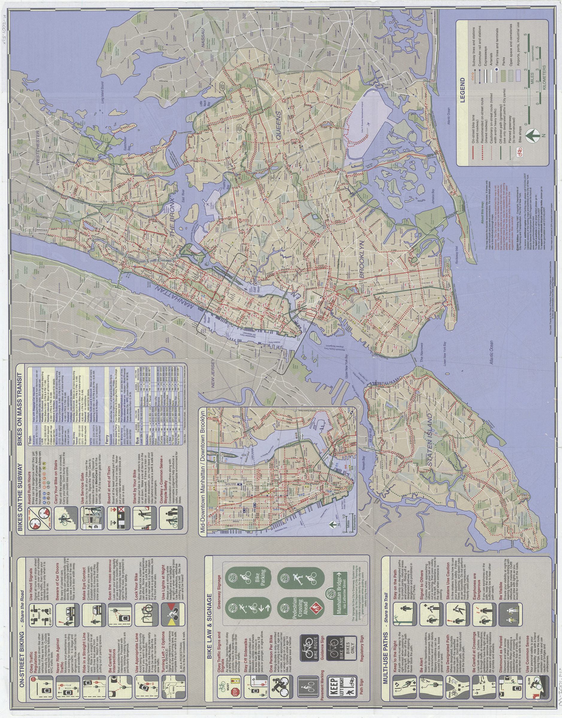

NYC cycling map, Manhattan, 2001: double-sided map featuring Manhattan bicycle routes and major citywide bicycle routes: … designed by in-agency staff at the New York City Department of City Planning and Department of Transportation Bicycle Program [2001]
Shows on-street bike lanes, recommended on-street routes, and off-street paths. Also shows bike shops, parks, transit facilities, hospitals, and other places of interest. Panel title. “1st printing 1997.” “Updated versions of the Cycling maps and activities of the City of New York Bicycle Network Development (BND) Program can be found at www.nyc.gov/html/dcp/home.html.” Includes directory to cycling organizations, notes, col. ill., 22 insets of bridges and bridge approaches, 2 insets of ferry connections, inset of lower Manhattan, index/directory to bike shops, inset of midtown and downtown Manhattan with downtown Brooklyn, col. diagrams and text regarding bike laws, signage, and safety, and information about taking bikes on mass transit. [Manhattan]. [New York City].
Map area shown
Genre
Road mapsRelation
Full catalog recordSize
62 × 79 cmDownload
Low Resolution Image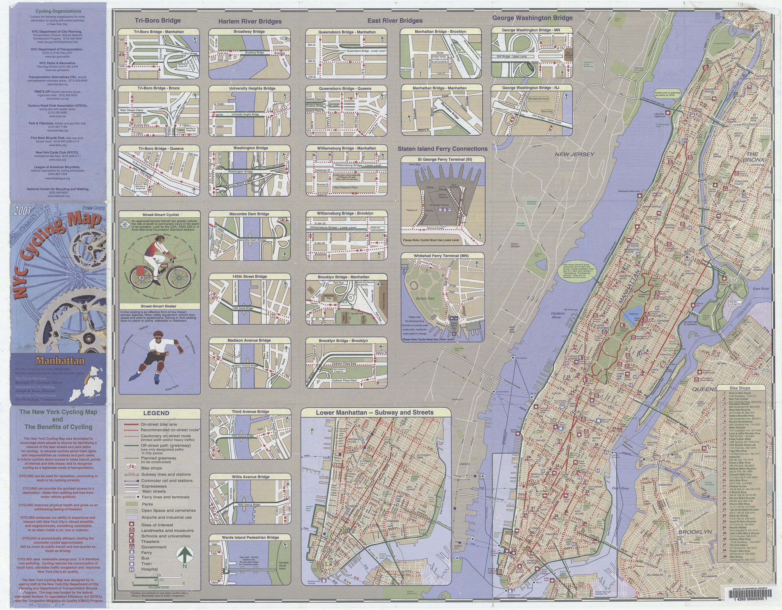
Creator
New York (N.Y.).; Department of Transportation,Publisher
Brooklyn Historical SocietyCitation
NYC cycling map, Manhattan, 2001: double-sided map featuring Manhattan bicycle routes and major citywide bicycle routes: … designed by in-agency staff at the New York City Department of City Planning and Department of Transportation Bicycle Program; [2001], Map Collection, M-2001.Fl; Brooklyn Historical Society.Scale
Scales differ