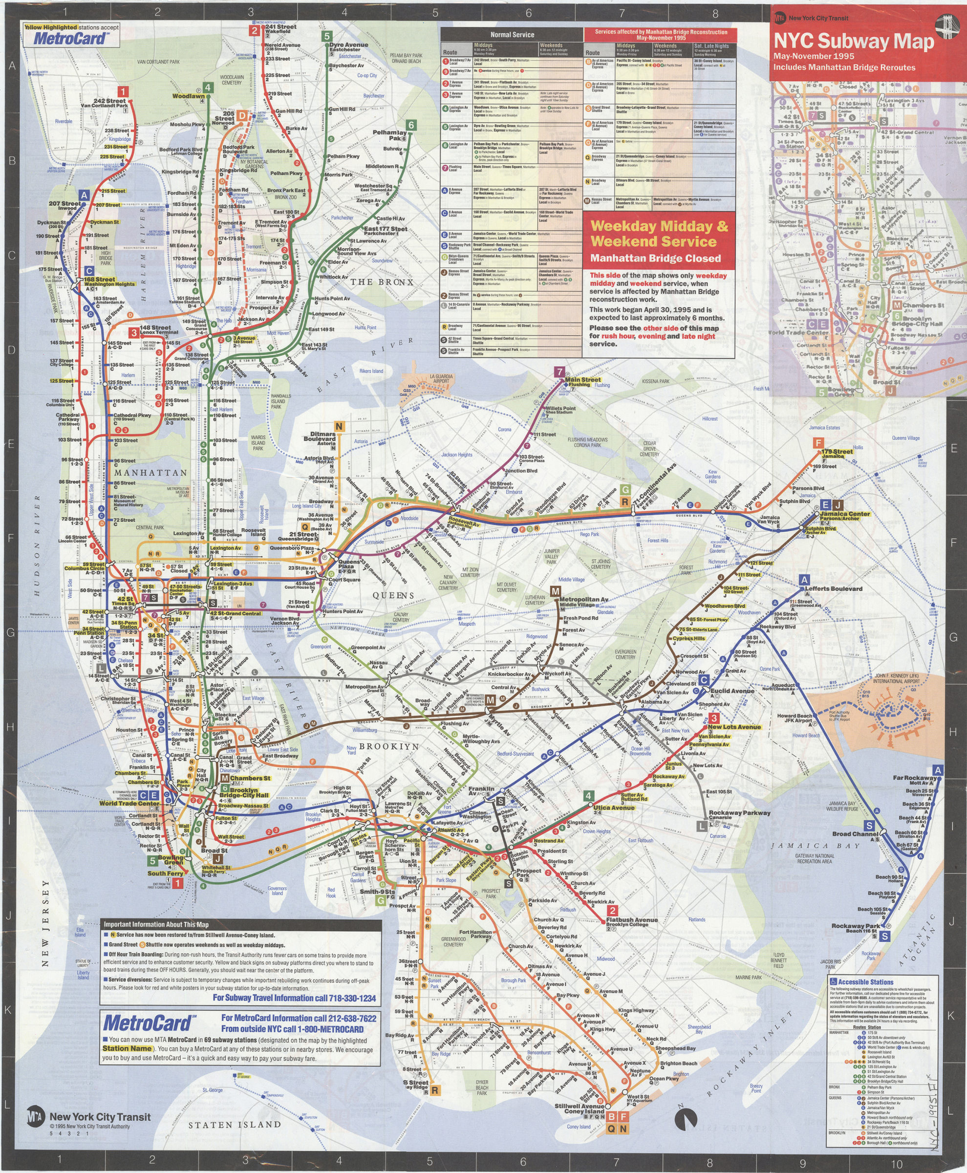
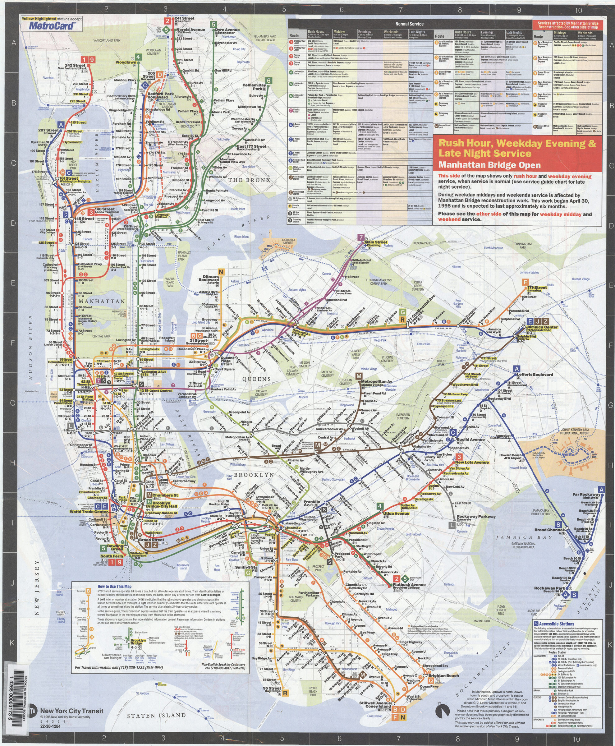
NYC subway map, May-November 1995: includes Manhattan Bridge reroutes: MTA New York City Transit Authority [ca. 1995]
Map No. NYC-1995.Fl
Schematic map showing subway lines in Manhattan, the Bronx, Queens, and Brooklyn. Panel title. Includes notes, route and schedule tables, and tables of wheelchair-accessible stations. Center point longitude: -73.8956. Center point latitude: 40.7291. Manhattan Bridge open : rush hour, weekday evening and late night service. Manhattan Bridge closed : weekday midday and weekend service.
Map area shown
Genre
Transportation mapsRelation
Full catalog recordSize
56 × 47 cmDownload
Low Resolution Image
Creator
New York City Transit Authority,Publisher
Brooklyn Historical SocietyCitation
NYC subway map, May-November 1995: includes Manhattan Bridge reroutes: MTA New York City Transit Authority; [ca. 1995], Map Collection, NYC-1995.Fl; Brooklyn Historical Society.Scale
Not drawn to scaleLoading zoom image... 