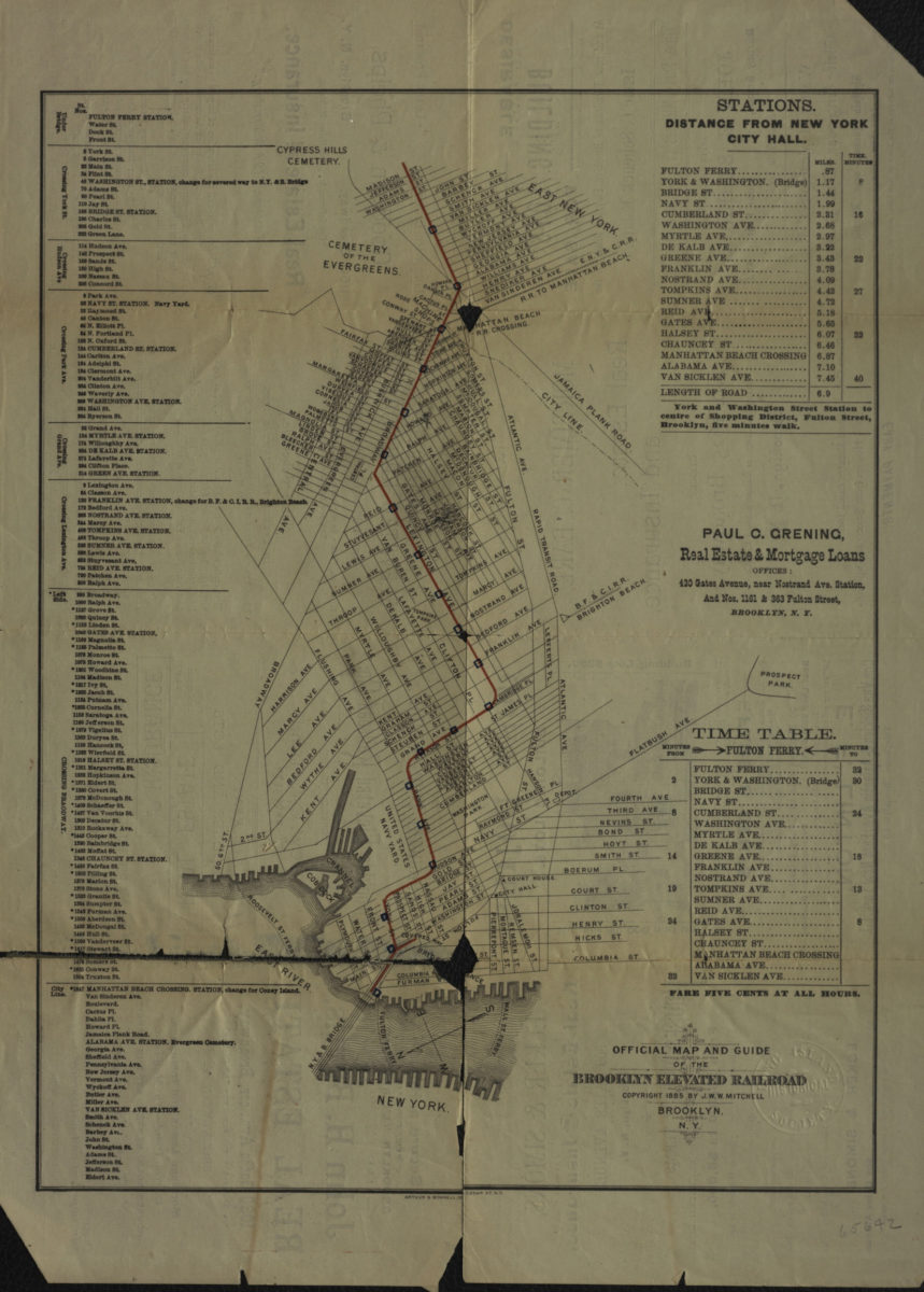
Official map and guide of the Brooklyn Elevated Railroad [ca. 1885]
Map No. B C-1885a.Fl
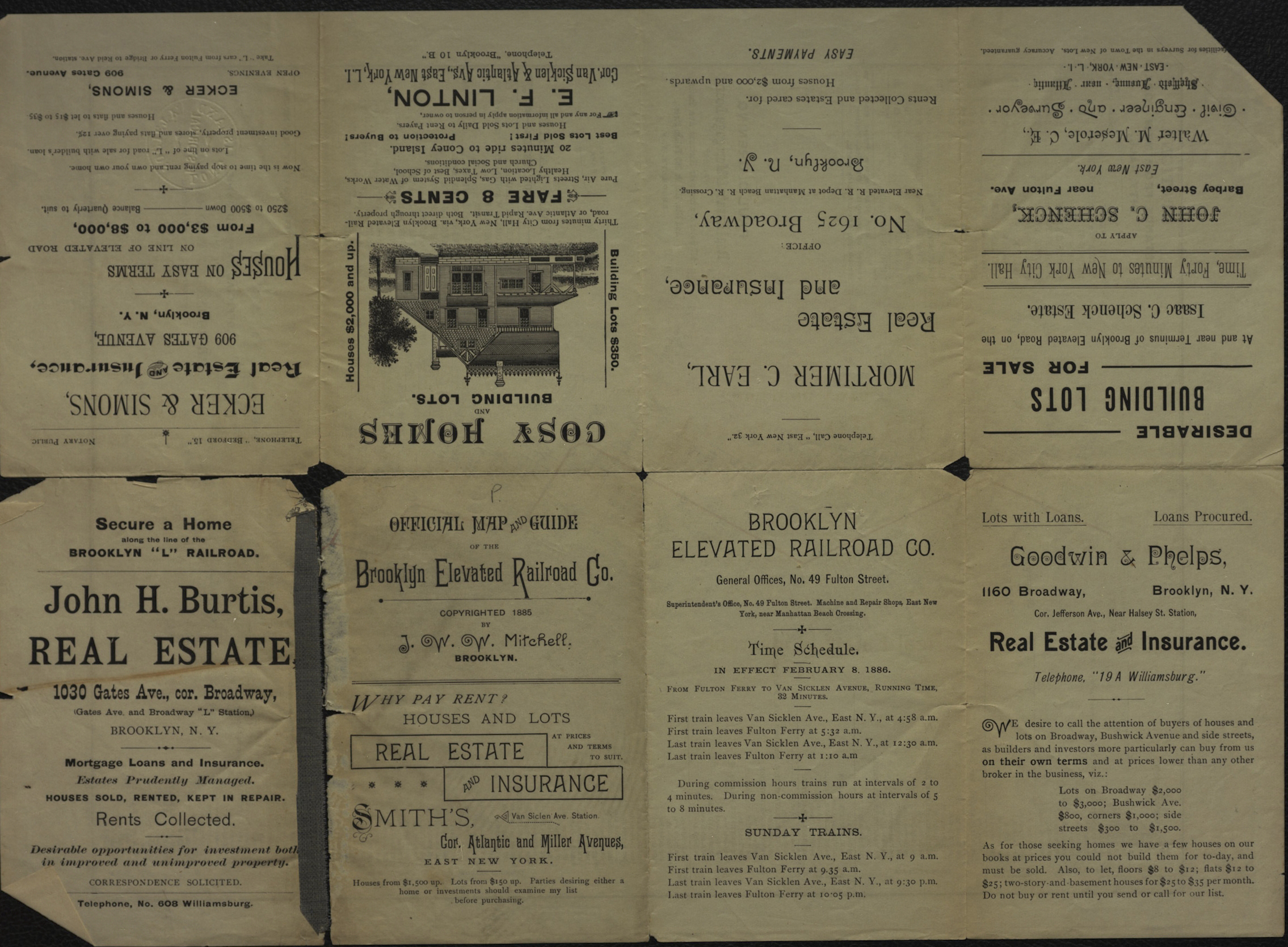
Covers area north from approximately Atlantic Ave. to Broadway Ave. and east from the East River to East New York. Shows ferry lines, buildings, and station distances from New York City Hall. Oriented with north to the lower left. “Copyright 1885 by J.W.W. Mitchell.” Includes tables and advertisement. On verso: Advertisements.
Map area shown
Genre
Transportation mapsRelation
Full catalog recordSize
36 × 27 cmDownload
Low Resolution ImageCreator
Mitchell, J. W. W.,Publisher
Brooklyn Historical SocietyCitation
Official map and guide of the Brooklyn Elevated Railroad; [ca. 1885], Map Collection, B C-1885a.Fl; Brooklyn Historical Society.Scale
Scale not givenLoading zoom image...