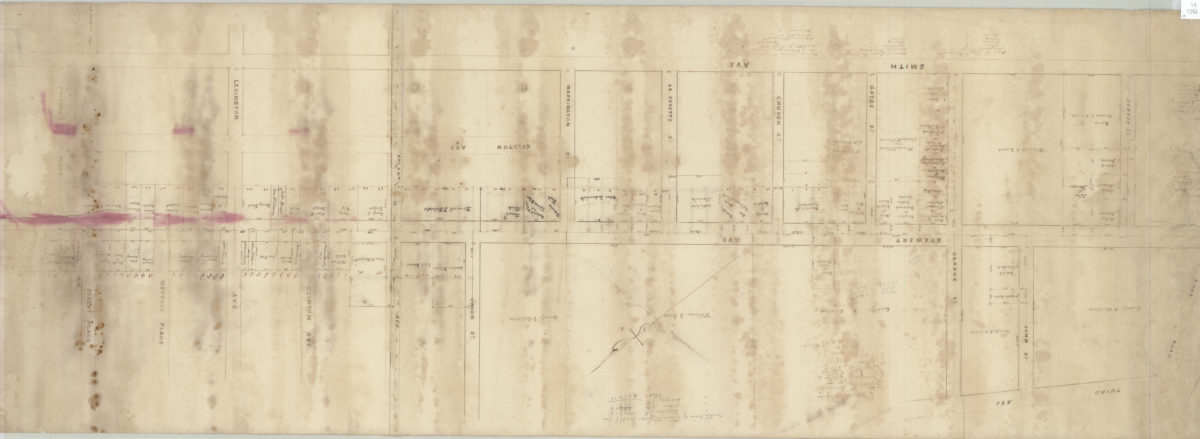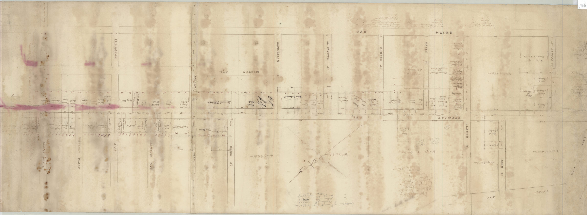
Opening map of Stewart Avenue, Denyse Street, Clarke Street, & John Street: as surveyed by T.G. Bergen June 1861
Map No. Bergen-1861.Fl
Cadastral map covering area bounded by Third Avenue, Forest Place, Smith Avenue, and Denyse Street. Shows property (including dimensions) and names of landowners in modern-day Fort Hamilton section of Bay Ridge. Oriented with north to the upper right. Includes notes and calculations.
Subjects
Places
Map area shown
Relation
Full catalog recordSize
38 × 110 cmDownload
Low Resolution Image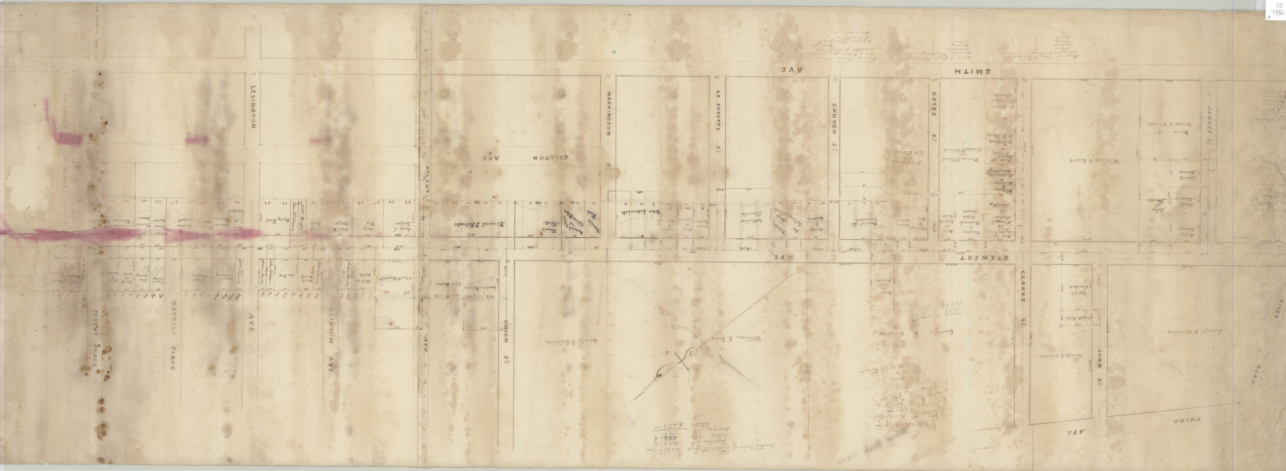
Creator
Bergen, Teunis G.,Publisher
Brooklyn Historical SocietyCitation
Opening map of Stewart Avenue, Denyse Street, Clarke Street, & John Street: as surveyed by T.G. Bergen; June 1861, Map Collection, Bergen-1861.Fl; Brooklyn Historical Society.Scale
Scale [1:1200] 1 in to 10Loading zoom image...