Oyster Bay and Huntington: Huntingon Bay [ca. 1968]
Map No. L.I.-1778 (1968).Fl
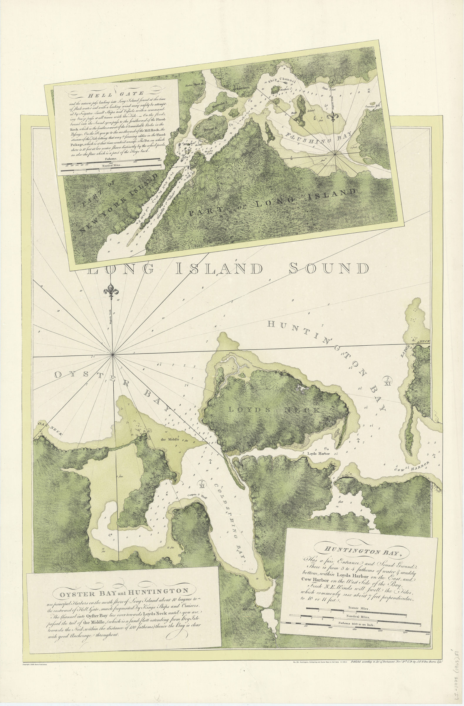
Nautical chart also showing Flushing Bay and Loyds Neck. Relief shown by hachures and shading. Depths shown by soundings. Includes text and inset “Hell Gate” Scale ca 1:25 250. Includes text and inset of Hell Gate. “No. 30” “S155-1”
Places
Map area shown
Relation
Full catalog recordSize
90 × 59 cmDownload
Low Resolution Image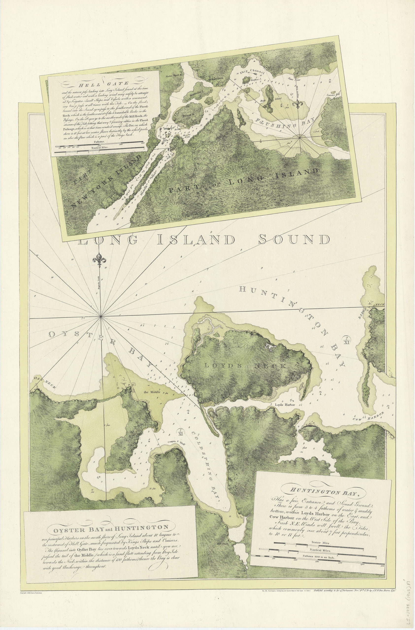
Creator
Des Barres, Joseph F. W.,Publisher
Brooklyn Historical SocietyCitation
Oyster Bay and Huntington: Huntingon Bay; [ca. 1968], Map Collection, L.I.-1778 (1968).Fl; Brooklyn Historical Society.Scale
Scale [ca. 1:25,250]Loading zoom image... 