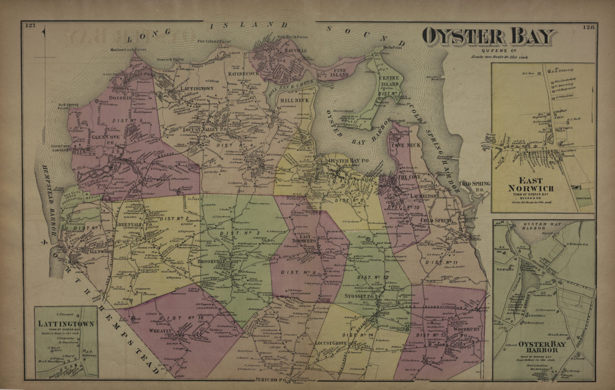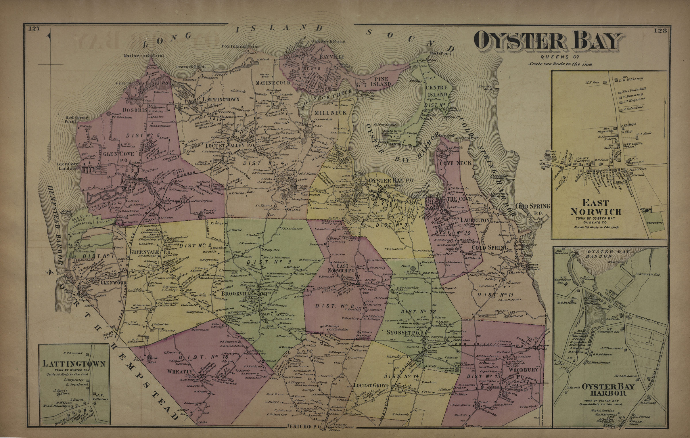
Oyster Bay, Queens Co [1873]
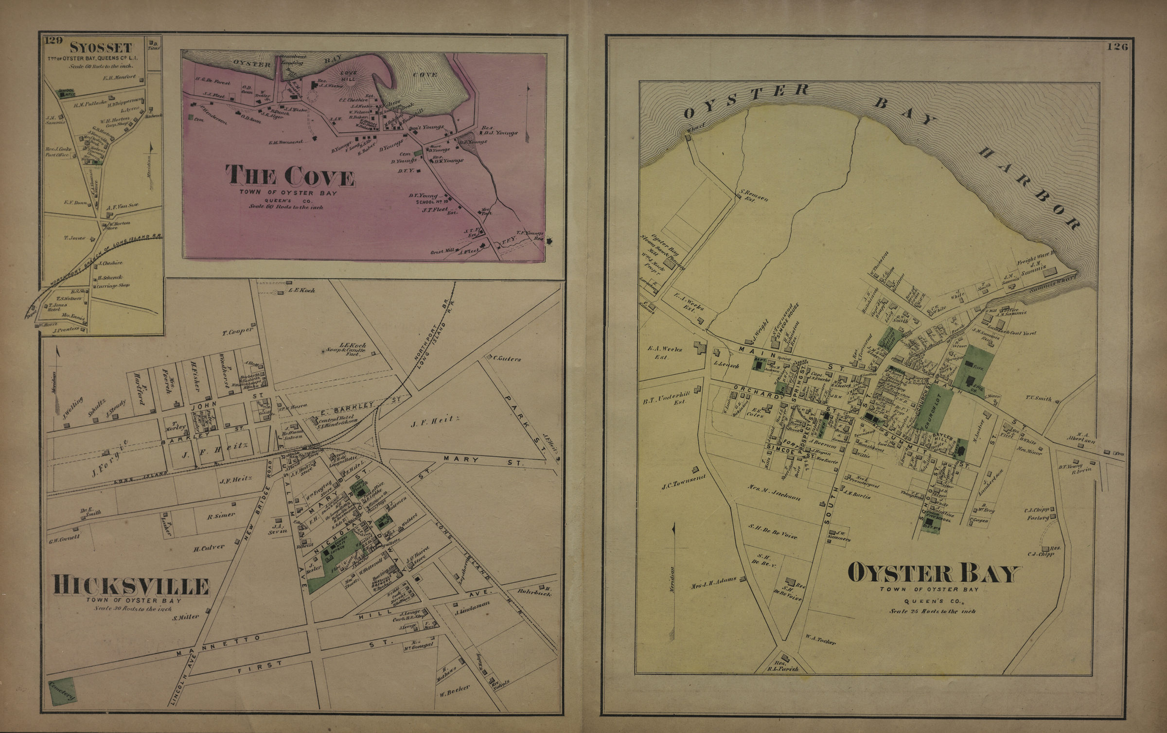
Cadastral map. Shows property (including buildings), names of landowners, administrative divisions, and railroads. Extracted from: Atlas of Long Island, New York. New York : Beers, Comstock & Cline, 1873, p. 126-128. Includes 3 insets. Insets: Lattington, town of Oyster Bay (Scale [1:5,940]. 30 rods to the in.) — East Norwich, town of Oyster Bay, Queen’s Co. (Scale [1:5,940]. 30 rods to the in.) — Oyster Bay Harbor, town of Oyster Bay (Scale [1:11,880]. 60 rods to the in.). On verso: 4 ancillary maps. Ancillary maps: Syosset, twn. of Oyster Bay, Queens Co., L.I. (Scale [1:11,880]. 60 rods to the in.) — The Cove, town of Oyster Bay, Queen’s Co. (Scale [1:11,880]. 60 rods to the in.) — Hicksville, town of Oyster Bay (Scale [1:5,940]. 30 rods to the in.) — Oyster Bay, town of Oyster Bay, Queen’s Co. (Scale [1:4,950]. 25 rods to the in.).
Map area shown
Genre
Cadastral mapsRelation
Full catalog recordSize
37 × 56 cmDownload
Low Resolution Image
Creator
Beers, F. W.; Beers, Comstock & Cline,Publisher
Brooklyn Historical SocietyCitation
Oyster Bay, Queens Co; [1873], Map Collection, L.I.-[1873]a.Fl; Brooklyn Historical Society.Scale
Scale [1:39,600] 1 in to