Panorama of the great metropolis [185?]
Map No. NYC-[185-?].Fl
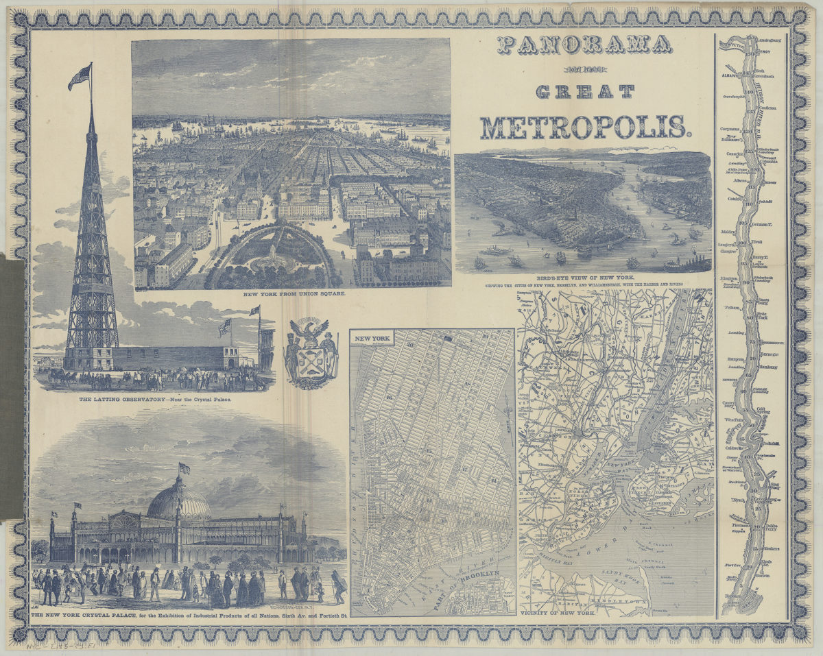
Covers Manhattan, the metropolitan New York region, and the Hudson River. Relief shown by hachures, depths shown by isolines. Title for Hudson River map supplied by cataloger. Includes 2 titled ill., seal of New York City. The Latting Observatory, near the Crystal Palace. New York from Union Square. Bird’s-eye view of New York, showing the cities of New York, Brooklyn, and Williamsburgh, with the harbor and rivers. [Map of the Hudson River]. The New York Crystal Palace, for the exhibition of industrial products of all nations, Sixth Av. and Fortieth St.. New York. Vicinity of New York. BHS copy missing front cover.
Map area shown
Genre
Bathymetric mapsRelation
Full catalog recordSize
45 × 57 cmDownload
Low Resolution Image
Creator
Phelps, Fanning & Co.,Publisher
Brooklyn Historical SocietyCitation
Panorama of the great metropolis; [185?], Map Collection, NYC-[185-?].Fl; Brooklyn Historical Society.Scale
Scales differLoading zoom image...