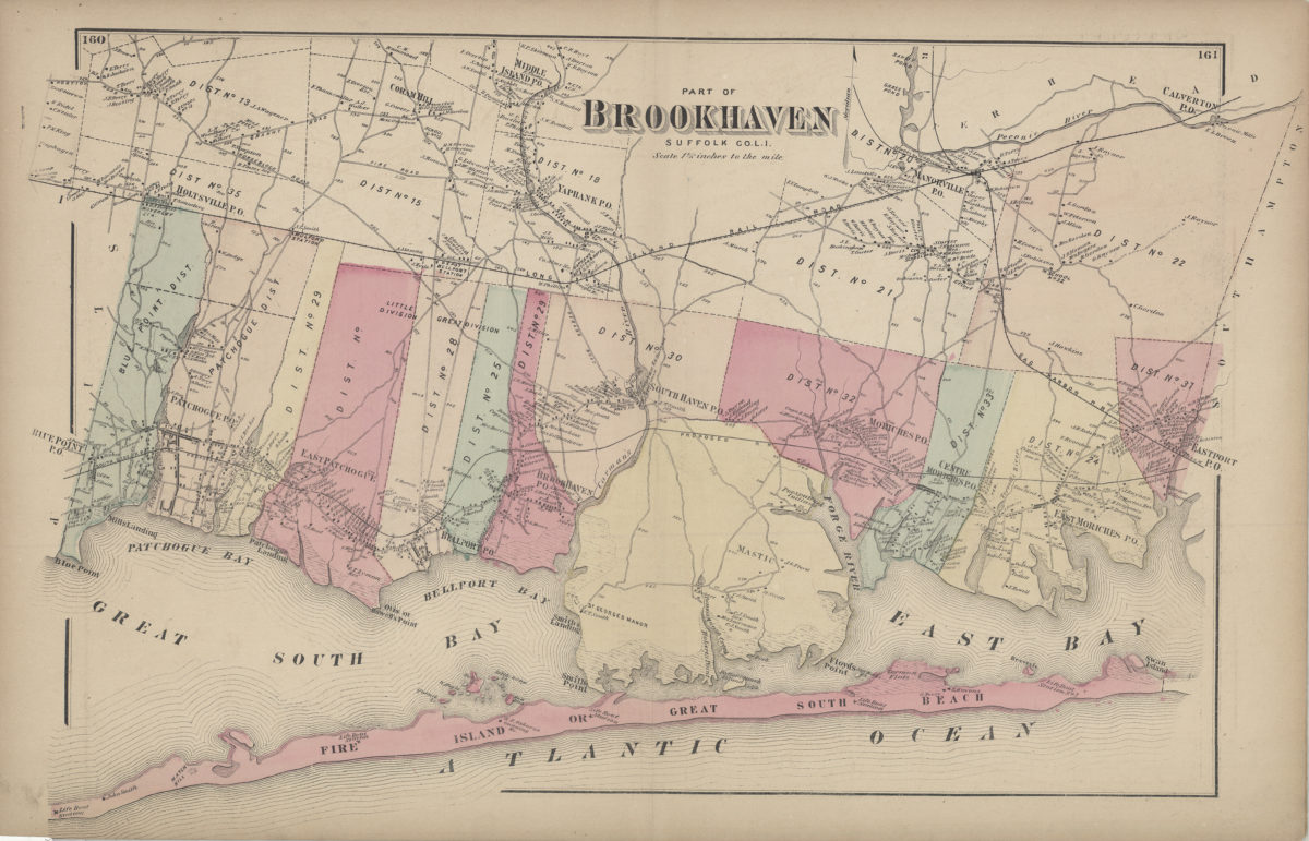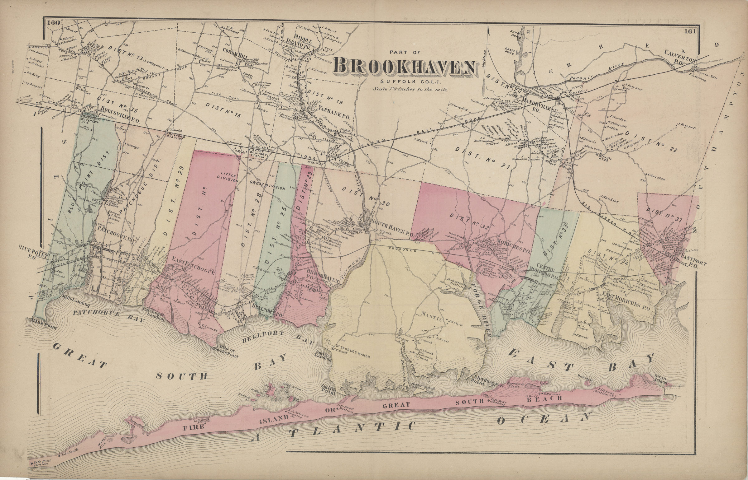
Part of Brookhaven, Suffolk Co., L.I. [1873]
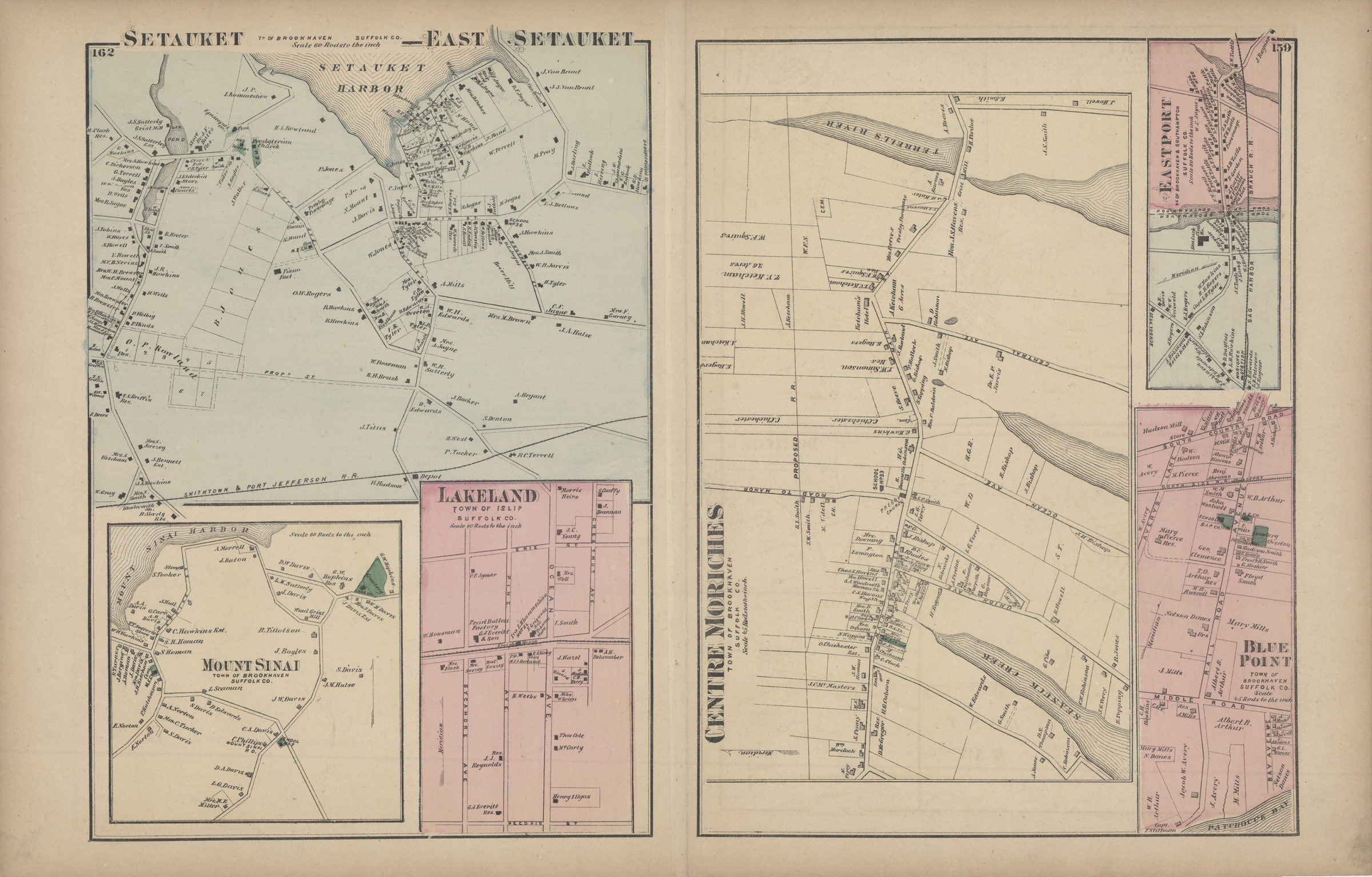
Cadastral map covering area north from Fire Island to Middle Island and east from Blue Point to Eastport. Shows property (including buildings), names of landowners, administrative divisions, and railroads. Extracted from: Atlas of Long Island, New York. New York : Beers, Comstock & Cline, 1873, p. 159-162. On verso: 6 ancillary maps. Ancillary maps: Setauket, East Setauket, tn. of Brookhaven, Suffolk Co. (Scale [1:11,880]. 60 rods to the in.) — Mount Sinai, town of Brookhaven, Suffolk Co. (Scale [1:11,880]. 60 rods to the in.) — Lakeland, town of Islip, Suffolk Co. (Scale [1:7,920]. 40 rods to the in.) — Centre Moriches, town of Brookhaven, Suffolk Co. (Scale [1:8,910]. 45 rods to the in.) — Eastport, tns. of Brookhaven & Southampton, Suffolk Co. (Scale [1:15,840]. 80 rods to the in.) — Blue Point, town of Brookhaven, Suffolk Co. (Scale [1:8,910]. 45 rods to the in.).
Map area shown
Genre
Cadastral mapsRelation
Full catalog recordSize
36 × 60 cmDownload
Low Resolution Image
Creator
Beers, F. W.; Beers, Comstock & Cline,Publisher
Brooklyn Historical SocietyCitation
Part of Brookhaven, Suffolk Co., L.I.; [1873], Map Collection, L.I.-[1873]q.Fl; Brooklyn Historical Society.Scale
Scale [1:52,800] 1 1/5 in