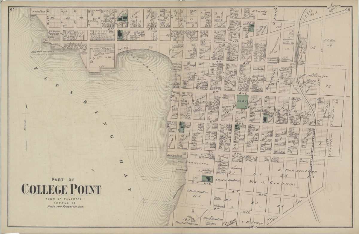
Part of College Point, town of Flushing, Queens Co [1873]
Map No. Q-[1873]l.Fl
Cadastral map. Covers area north from 9th Ave. to approximately 2nd Ave. and east from River St. to 21st St. Shows property (including lots and buildings), names of landowners, churches, schools, and railroads. Extracted from: Atlas of Long Island, New York. New York : Beers, Comstock & Cline, 1873, p. 64-67. On verso: Queens County business notices.
Subjects
Places
Map area shown
Genre
Cadastral mapsRelation
Full catalog recordSize
35 × 54 cmDownload
Low Resolution Image
Creator
Beers, F. W.; Beers, Comstock & Cline,Publisher
Brooklyn Historical SocietyCitation
Part of College Point, town of Flushing, Queens Co; [1873], Map Collection, Q-[1873]l.Fl; Brooklyn Historical Society.Scale
Scale [1:3,600] 1 in to 3Loading zoom image...