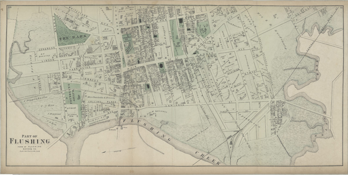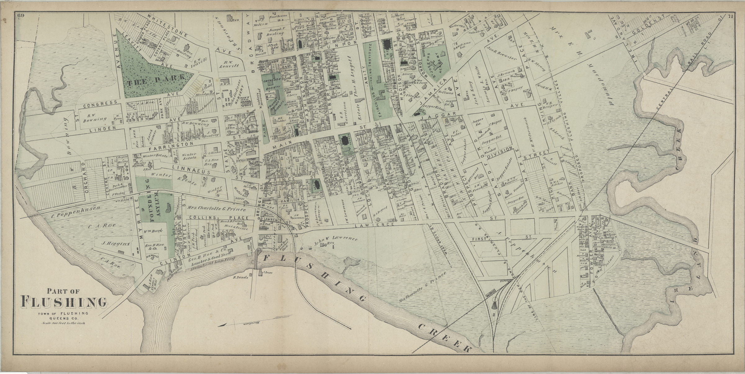
Part of Flushing, town of Flushing, Queens Co [1873]
Map No. Q-[1873]j.Fl
Cadastral map. Covers area north from Ireland Creek to approximately Orchard St. and east from Flushing Creek to Union St. Shows buildings, names of landowners, and railroads. Extracted from: Atlas of Long Island, New York. New York : Beers, Comstock & Cline, 1873. Oriented with north to the lower left. “69”–Upper left corner. “71”–Upper right corner.
Map area shown
Genre
Cadastral mapsRelation
Full catalog recordSize
36 × 75 cmDownload
Low Resolution Image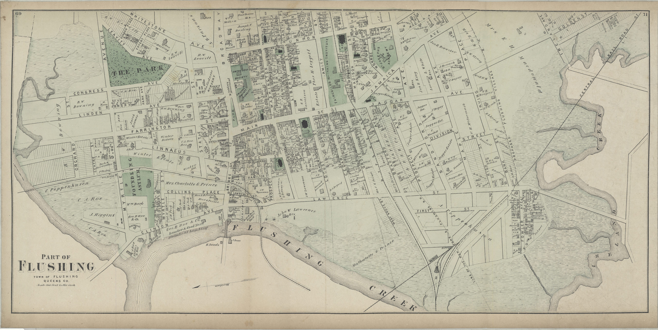
Creator
Beers, F. W.; Beers, Comstock & Cline,Publisher
Brooklyn Historical SocietyCitation
Part of Flushing, town of Flushing, Queens Co; [1873], Map Collection, Q-[1873]j.Fl; Brooklyn Historical Society.Scale
Scale [1:3,600] 1 in to 3Loading zoom image...