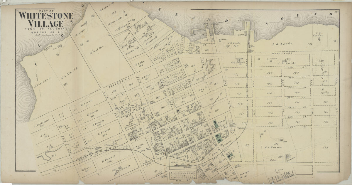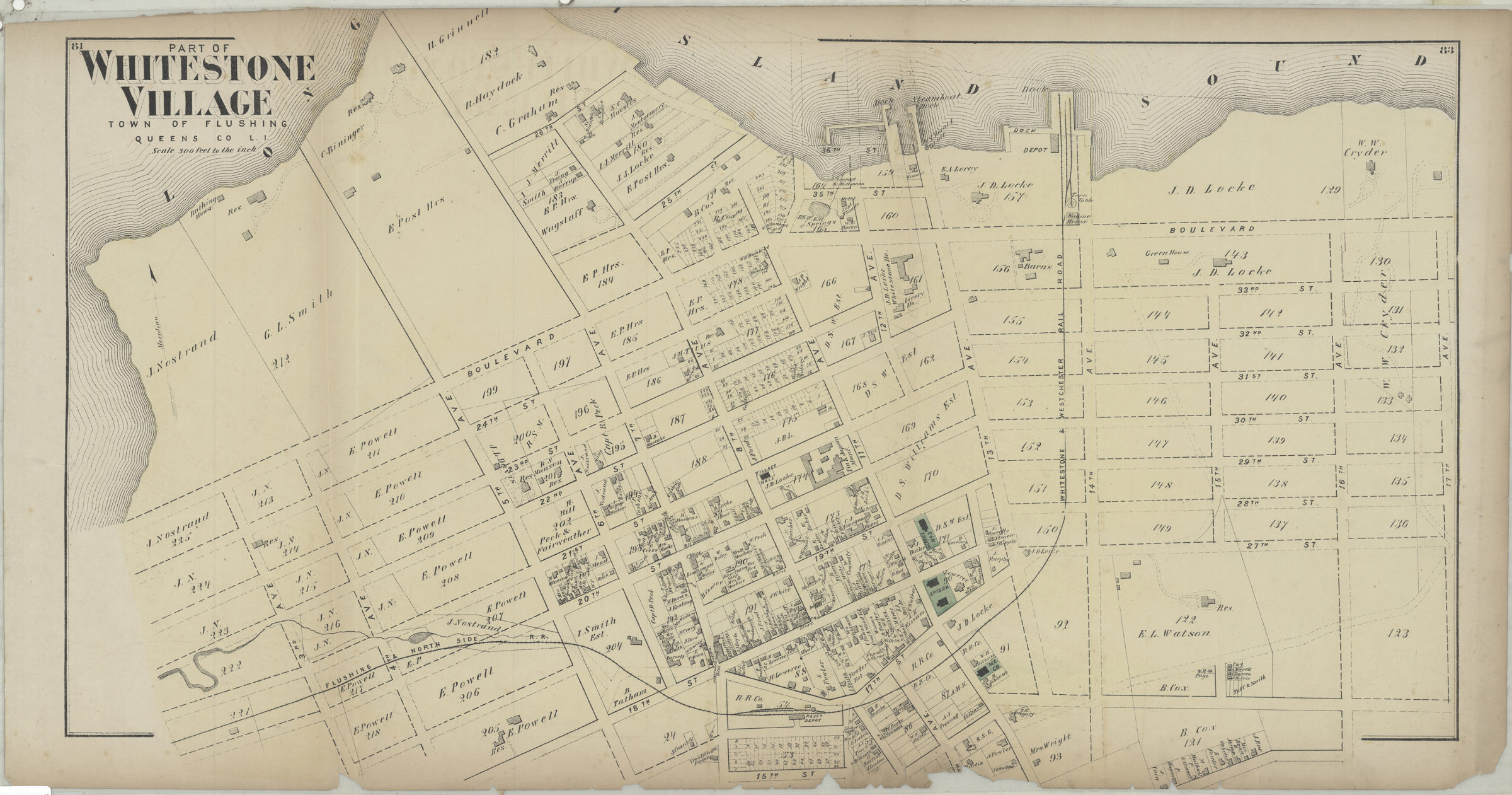
Part of Whitestone Village, town of Flushing, Queens Co., L.I. [1873]
Map No. Q-[1873]d.Fl
Cadastral map. Shows property (including lots and buildings), and names of landowners. Extracted from: Atlas of Long Island, New York. New York : Beers, Comstock & Cline, 1873. “81”–Upper left corner. “83”–Upper right corner.
Subjects
Places
Map area shown
Genre
Cadastral mapsRelation
Full catalog recordSize
40 × 71 cmDownload
Low Resolution Image
Creator
Beers, F. W.; Beers, Comstock & Cline,Publisher
Brooklyn Historical SocietyCitation
Part of Whitestone Village, town of Flushing, Queens Co., L.I.; [1873], Map Collection, Q-[1873]d.Fl; Brooklyn Historical Society.Scale
Scale [1:3,600] 1 in to 3Loading zoom image...